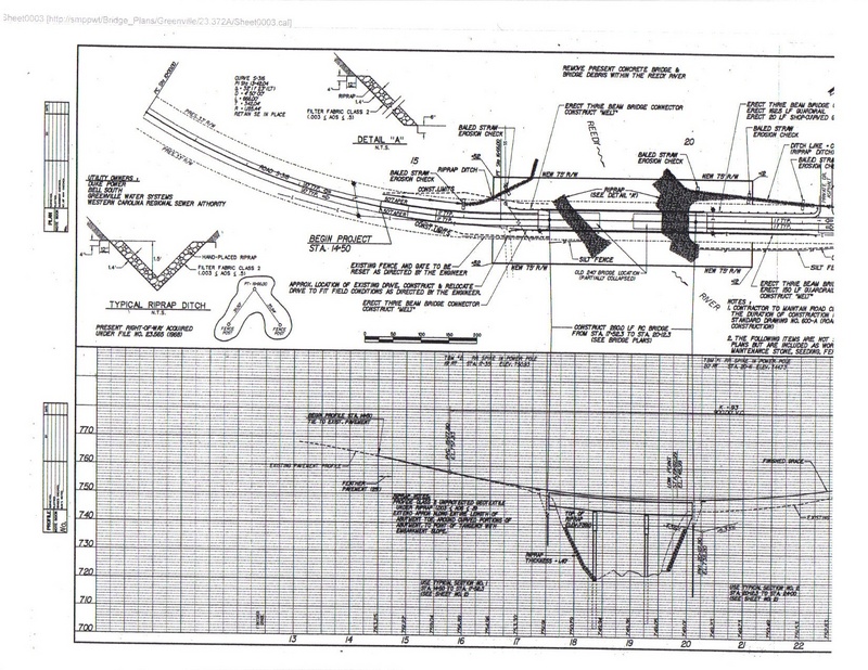
Reedy River
4 - Log Shoals Rd to West Georgia Rd
| Difficulty | II+(III) |
| Length | 2.4 mi |
| Avg Gradient | 19 fpm |
| Gauge | Reedy River Above Fork Shoals, Sc |
| Flow Rate as of 1 hour | 4.37 ftbelow recommended |
| Reach Info Last Updated | May 11, 2011 |
Put in downstream of the Log Shoals bridge on river right. Parking is available on downstream on river right. Please be kind and do not block the private property entrance. DO NOT access the river upstream on river right from the property with the large brick house.
Take out just upstream of the West Georgia Rd bridge on river left. There is a narrow access road but if you don't have 4WD you might be better served to park along the road.
Shuttle Directions: From the put-in, go west on Log Shoals Rd. Turn left (at the blinking yellow light) onto Standing Springs Rd. Continue straight when Standing Springs Rd becomes Holcombe Rd (you probably won't notice this change). The road will end at a stop sign. Turn left onto West Georgia Rd. Parking for the take-out is at the bottom of the hill on the far side of the bridge, right side of the road.
Water Quality: Poor--The Reedy's poor reputation is due to the Colonial Pipeline oil spill many years ago. Despite significant cleanup efforts from this spill, it still suffers as a river which runs through a city just begining to gain an environmental respect for it. During rain, the river will spike with storm water. A sewage line also runs along the river.
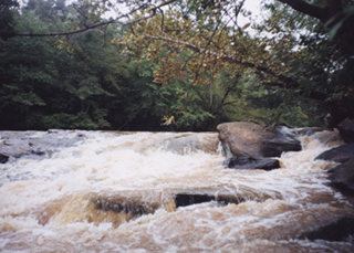
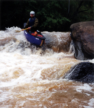
A rock sticks up in the river about 10 feet off the left bank. Run about 10 feet right of this rock to follow the tongue down the slide, or run closer to the rock to go over a drop. Make a slight S-turn through the rapid, first pointing left, then right, then left. The total drop is about 7 feet.
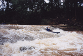
Run roughly river center down this 4-foot slide. The hole at the bottom makes an excellent 360 play spot.
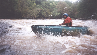
Start this series of small (roughly 1-foot) ledges in river center and work toward river right at the bottom.
Jun 8, 2025
My friend and I paddled this little stretch on Sunday afternoon. The put-in was freshly weed-whacked and easy to spot on the side of the road. Definitely be sure to not block the gate, but it is easy to avoid.
The take-out looks like it's had some rocks put in recently to block the main parking area, but there's still plenty of space to park between the road and the rocks. I don't think it's possible to get any closer with a 4WD as the description suggests, but it's a short walk from the river to the parking.
The run itself feels surprisingly secluded and has just enough little features to keep things entertaining. The highlight for sure is the slide about 0.1 miles in, but there's other spots that were also nice to keep us entertained. Anything below 5' though and you're doing a LOT of scraping.
There's several trees that are down, but all but one are pretty clearly avoidable. There is one tree down at mile 1.5 that you may have to get out of the boat to get over, but that might not be a problem at higher levels. The river is reasonably clean thanks to the work of locals taking out dozens of tires, but I still wouldn't want to spend all day swimming in the water.
Overall a very logistically easy, beginner-friendly (at least at this lower flow) run super close to town.
May 9, 2006
I found out the proper way to enter here the hard way. Myself and two of my friends received trespassing tickets this afternoon. The improper way to access the river is to park on the road next to the new house and walk down. The proper way is to park across the road where there is a gate with a No Trespassing sign. DO NOT block this gate and you will not have a problem. Be sure to pull your car down and out of the way so that the landowners (who live in Michigan) can access the gate if they are in town. If you have any questions, ASK FIRST. My friends and I made an assumption and it is going to cost is a nice chunk of change.