Eastatoe Creek -2, Lower Gorge
Mill Creek to Dug Mountain Access(Lower Eastatoe)
| Difficulty | II-III(V) |
| Length | 2.8 mi |
| Avg Gradient | 60 fpm |
| Gauge | Eighteenmile Creek Above Pendleton, Sc |
| Flow Rate as of 7594 days | 35 cfsstale data |
| Reach Info Last Updated | June 11, 2012 |
Directions: From Keowee Toxaway State Park, go north on SC11. In about 3.5 miles, turn left on Roy F Jones Hwy. The take-out is about 1.2 miles down this road at the Dug Mountain Access Area, after passing over the bridge over Eastatoee Creek.
Shuttle Directions: Continue down Roy F Jones Hwy until it ends. Turn right on Cleo Chapman Hwy. Eventually, Cleo Chapman Hwy will parallel the river. After passing over Mill Creek, Mill Creek Rd enters from the left. Park in the road right-of-way between Cleo Chapman Hwy and Eastatoe Creek.
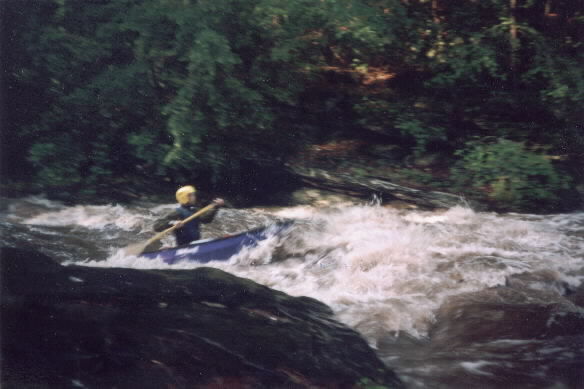
Local boater Brett Dalton has this to say 'At the end of the valley 'proper' (about 1/2 mile below Mill Creek and Mill Creek Road on Cleo Chapman Highway), the river enters the lower gorge. It begins with a pretty good bang when the water is up. There is one very constricted undercut slide that could be a killer in a kayak. Higher water is much better at this rapid. However at very high levels the water constricts against an undercut rock wall and shoots straight up in the air for 15 or 20 feet. At high water there are very few boulders or technical maneuvers required. Of course it is narrow and requires frequent maneuvering, just no must make ferries or anything. (After the first rapid this run is a nonstop flush of class III whitewater. There is one large slide but the remainder of the run is wave trains and big holes. Will Reeves describing a high water run).
This excitement continues for several miles until you come to Dug Mountain Bridge on Roy F. Jones Highway. This is the best takeout as there is a designated parking area.
Below Dug Mountain Bridge there are a few more minor slides and good currents for 1/2 mile or so. Following this initial 1/2 mile, the river becomes very gentle again as it approaches Lake Keowee. Near where the river enters Lake Keowee, Little Eastatoee Creek comes in from the left. The river never really 'dumps' in the lake, it almost
...
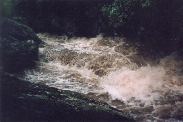
At high water this rapid is a real class V drop with almost half the river going up into a big undercut on river left and then flowing into a huge hole.
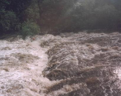
After the big rapid the river picks up speed and slowly builds up to a ledge, which at high water forms a big hole. The hole looks much more dangerous than it really is.
Feb 25, 2007
Parking at the fishermen's access at the second power line going north on Granny Gear Rd. beats the heck out of paddling the first .8 or so of tree infested flat water (in Jan. of 06 I had to portage about 6 trees before the gorge). Its around a .4 mi hike in from the road. In Feb of 07 I portaged 1 tree in the gorge, which was passable if you were really determined.
May 6, 2003
Notice the kayaer on river right.
Jan 1, 1900
Make a late right turn in to the first eddie, theres a rock just underwater that blocks the entrance, ferry in front of the minor sieve, get some speed going down the first drop, thread the needle between the rake of branches on right and the ugly undercut on left on the second drop, get a lil' more speed for the last sticky hole and your done with a Kayak Killer. A good medium low lvl. I would say.