Saluda, Middle
1: <b>(Jones Gap) </b>Jones Gap Trail bridge to bridge at park HQ(Gap Section)

| Difficulty | III-V |
| Length | 1.2 mi |
| Avg Gradient | 240 fpm |
| Gauge | Middle Saluda River Near Cleveland, Sc |
| Flow Rate as of 42 minutes | 1.36 ftbelow recommended |
| Reach Info Last Updated | January 8, 2013 |
You must complete a permit to paddle the Middle Saluda within the state park. Permit requires your driver's license and car tag number. Includes intsructions on approved put-in and takeout points and applicable rules. This is a state trout stream and removal of wood is prohibited. The highest approved put-in is approximately a one mile walk above the park headquarters.
WARNING!!! There is lots of wood - some easy to see and some waiting just below the surface on this stream. This is a tight, very busy little creek that commands your attention.
Directions: Take 276 N out of Greenville, and a few miles after Hwy 11 joins in, turn Right at the F-Mart (small brown country store with a Pepsi Sign--'Best Hotdogs In Town', and they're telling the truth), and follow this road straight a nubmer of miles all the way into the park.
Description: This is all out tight, technical, boney, boulder infested continuous creeking. DON'T GET SIDEWAYS. It is far from hair, lacks anything huge and of Tao's enjoyment, but is still enough to get the blood pumping.
Park at the parking lot or in 'camper' parking if it's during the week, and be sure to register at the park office after checking the flow. If there's enough water in the park, there should be enough upstream for a ways. Try to catch it during a serious downpour or after a number of days of rain.
After you've started up the trail, start scouting, because eddies are going to be few and small. Be sure to check out the stream falling off the mountain on Hiker's Left about a mile up the trail. The river leaves and rejoins the trail several times. Once you're in the water, keep it pointed downstream, and catch whatever eddies you can find.
The only drops I can note are both near the end of the run. One is a huge boulder clog (Razorback), which looks runnable on the far right side down 2 or 3 steps, and then picking your way through the runnout. Stay out of th
...
This is the put in for the hike up run.
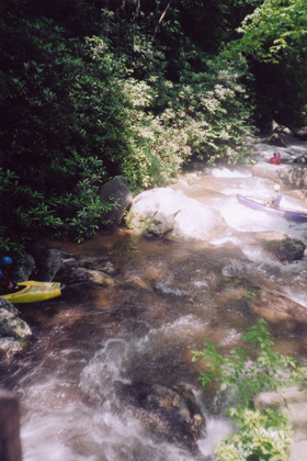
After the put in bridge rapid the action starts right away.
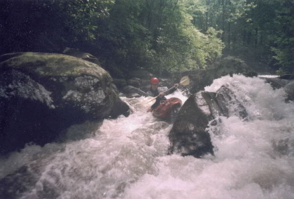
About 100 yards from the put in is your first typical rock garden rapid. The easy line is on the left around the rocks and over a few drops.

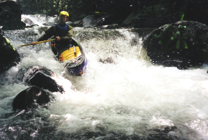
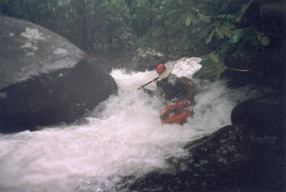
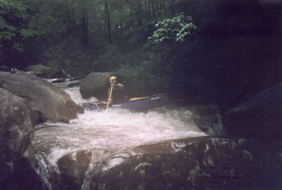
A serious boof with some undercut rocks and pinning potnetial.
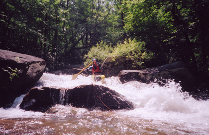
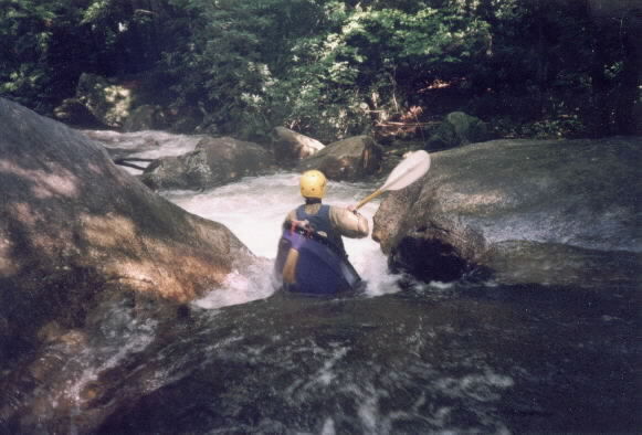
Razorback is by far the most serious rapid on the river. Scout this one on the hike since you might not notice and stop until it is too late.
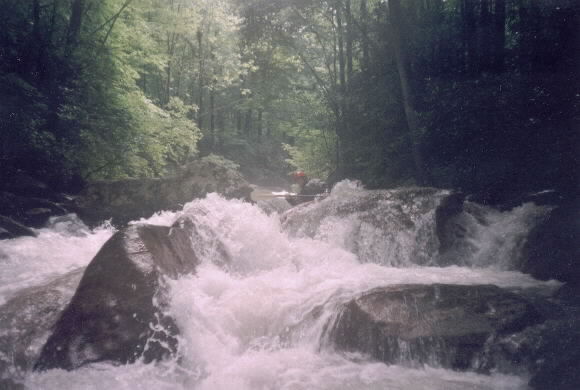
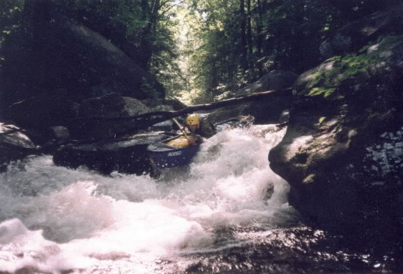
Perhaps one of the more visable birg drops on the river. A good boof on river right.
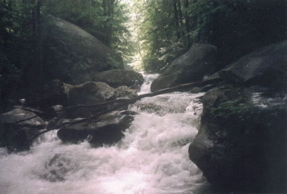
After the slot the river keep going with some tight slots.
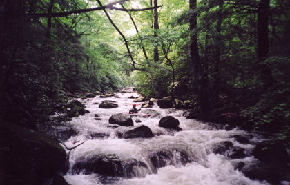
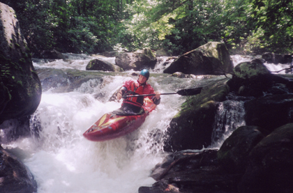
The final shoals before the first takeout bridge. Most people will continue downstream for a few more good rapids.
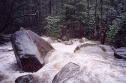
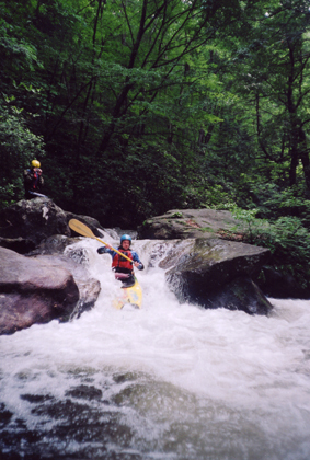
View of the rapid a good flows
Final plunge of State Park Rapid
One of the larger drops on the river is right across teh path from the Park HQ. This drop has everything: wood, no eddies, tight slots, and undercuts.
View from below
Aug 3, 2012
Ran most of this section this spring. It does still require a permit and you will need your car tag info and your driver's license number for the permit. Can take a little while to get it all filled out and the run drops out super fast.
Super tight little creek run. Lots of wood to be avoided and portaged - stop to scout when on your way up. I would recommend at least 3 in the group. Have a couple of folks paddle down while 1 is on shore for support. Boat down a short distance and rotate spots while the shore support boats on down.
We didn't finish due to a pin on some hidden wood in a drop. Wasn't a bad situation but it could have been.
High quality run that I can't wait to hit again with a slightly larger crew.
Mar 26, 2011
The Middle Saluda is now open to paddlers. Be sure to sign in at the Ranger station.
Feb 28, 2009
Are you using the french broad gage to correlate the levels in cfs or does the french broad have to be going huge.