| Difficulty | I-II(III) |
| Length | 6.6 mi |
| Avg Gradient | 30 fpm |
| Gauge | Chestatee River Near Dahlonega, Ga |
| Flow Rate as of 17 minutes | 168 cfsbelow recommended |
| Reach Info Last Updated | January 23, 2006 |
River Description
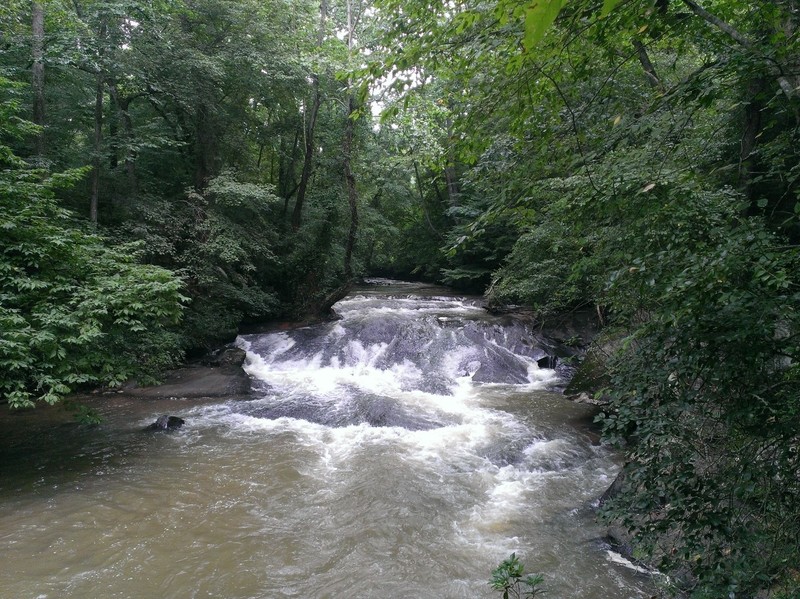
The largest rapids are the slides below the US 19 river access point. There are some small holes and surfing spots at higher water levels. The lower sections of this run flatten out as the creek approaches the Chestatee River.
River Features
Put In
Access PointDistance: 0 mi
Take Out
Access PointDistance: 6 mi
Trip Reports
Log in to add a reportJT
Jim Tebbel
Aug 13, 2013
PFD today at 600 cfs, very scrapey and lots of wood/deadfall, but passible. This run is very narrow in spots. 1000 cfs probably a much more comfortable level.
?
Untitled
May 29, 2009
There is a undercut and a decent sized pothole on the left side of the slide...a good(4-5ft) haystack followed by a nice sized hole and two large diagonal curlers appears when the dam is overflowing significantly
KB
Kyle Bergner
Jan 30, 2006
Level? Look for the Yahoola Resevoir Dam to be actively overflowing at the saw teeth.
Put In: Park at the public lot at the resevoir, and put in at base of the dam.
Baptismal Slides (II) This is the first real rapid you'll come to. Run it just about any way you want-no real hazards.
7-10 Split (II) This is a gnarly drop split by a boulder clog and a dead tree. The River Right line could be run at higher levels, but the river left line is your best bet. Its a two tiered drop of about 4 feet.
After that is nothing more than boogie water and flats until you reach the 'mighty' chestatee.
Could have fome potential for fun during flood levels, or if Lumpkin county ever needs to do a release on the resevoir.
RB
Rick Bellows
Jan 11, 2006
New Streamkeeper: Rick Bellows, chestateer@yahoo.com.