Newfound River
Newfound lake to Bristol
| Difficulty | II-III+ |
| Length | 2 mi |
| Avg Gradient | 62 fpm |
| Reach Info Last Updated | October 24, 2022 |
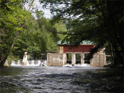
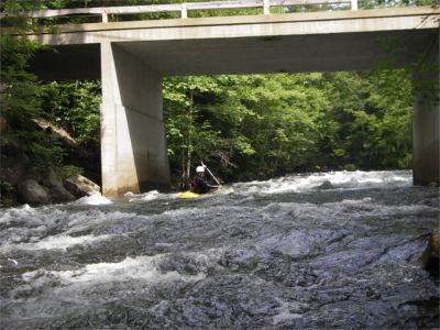
The Newfound is a seldom run river located near the more popular Pemi. This is a medium size river about 45' wide on average. It is broken up into three sections separated by two dams. The first mile is easier (class 2). You may portage the partially washed out dam on river right or scout this drop to run through on river right, perhaps 6 to 8 ft from the right wall. Below the first dam the river passes under the NH Rt 3A bridge then quickly increases in difficulty to class 3 at medium levels. There is a short breather where the rapids decrease in difficulty. Just above the bicycle path footbridge the main event starts. Old Mill rapid starts just upstream of the bridge then increases in difficulty up to class 3+ at medium levels. Be prepared to strike hard for shore if you find yourself separated from your boat since another dam awaits just downstream. The rapids calm to class 2 just before it takes a sharp turn back under the NH Rt 3A bridge then tumbles over another dam. Easiest take out is on river right just before the sharp right turn. This is the upper take out at the Newfound Lake Watershed parking area. If you should choose to continue downstream carry your boat across NH Rt 3A then behind the building adjacent to the dam. Mild class 2 rapids continue up to Bristol Hill Road take out on the right. Just above the take out bridge there is a river wide hole formed by a lowhead dam. This is not noticeable until you are right on top of it. There is good play here by good boaters with escape lines on either side of the hole.
Technical info
Put in elevation........587'
Take out elevation......463'
Total drop..............124'
Average drop/mile.......62'
Distance................2.0 miles
River width average.....45'
1st mile drop...........47' (includes ~6’ of portaged dam)
2nd mile drop...........77' (includes ~7’ of portaged dam)
River geology...........schists, small to medium bould
...
Put in at the outflow dam for Newfound Lake located on the bicycle path on the south end of the lake. There is a visual gage located river left just downstream of the dam.
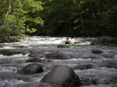
First significant rapid you will encounter. Riverdale road bridge is a good visual marker for the start of this rapid. Just run down the middle.
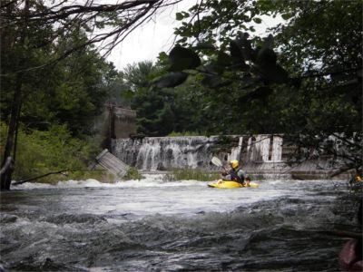
This dam is an optional portage. The top half of the dam washed out in the flood of May 2006. The bottom section awaits removal at a later date. For now the easiest portage is on river right between the dam and a strainer choked spillway. If the water is high paddlers should take out and portage on river left. The dam is best run on far river right or left, maintaining 6 to 8 ft from the corresponding edge.
Yup, you guessed right, a paddler broke his paddle here once. Shortly after the first dam the river passes under NH rt 3A. Rapids immediately pick up to class III with much boulder dodging at low water. The rapid calms down to class II just below a chute with good surf.
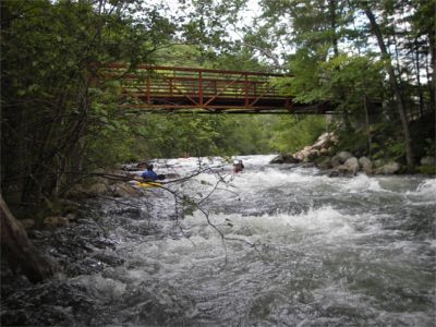
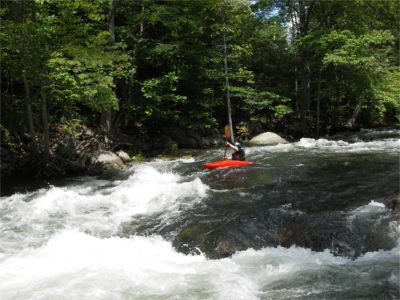
It is advised to scout this rapid before entry from above on the footbridge during the shuttle process. When the footbridge comes into view shortly below Broken Paddle, prepare yourself for the longest and most difficult section on this river. The top of the rapid requires some maneuvering around boulders and chutes to stay on line. A few yards below the footbridge the river splits around an island. Decide before passing the footbridge which lane you will run and strongly commit to that direction ASAP. There are boulders to avoid on the right and left passage. When the channels come back together a short way downstream the river passes steeply through white and violent curlers that require good bracing skills to remain upright. Once through this mayhem the water eases out to class II difficulty just before it passes under NH rt 3A and over another dam. Take out river right just before the bridge and portage across the road and put back in behind the building on the dam's right flank. For those just wanting to run the toughest whitewater this is an optional take out since the river below is much calmer.
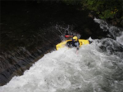
Old Nate is a hole formed by a low head dam just upstream of the take out. It is rather hard to see from above until you are right up upon it. You will be able to recognize its location by the take out bridge located on Bristol Hill Road. At low to medium levels it is a fairly good playhole. There is good escape out of the hole on eather side of it.
Jul 11, 2023
Ran today with Tom Currier at approx. 7.35 ft. Seemed like a medium-high flow.
My first time on the river, overall it was a fast and exciting run - there were few grabby holes but plenty of sizeable wavetrains. Some islands to pick a direction around, it was obvious if one was more fluid than the other. Low and overhanging branches at the start of the run especially. Very few rocks were exposed anywhere on the river, almost all of them were below water level.
I ran the first dam (before crossing under 3A the first time) left center and got caught up on a rock at the bottom - Tom went a bit more river center and didn't hit anything. The second dam (just after crossing 3A the second time) seemed very spooky to run at this level. We took out right before it.
There is poison ivy on the bank below the dam where you'd put in after a short portage, fyi if you were to do the bottom section down to Old Nate during leafy months.
Regarding Old Mill, I thought it was solid 3+ (maybe pushing 4?). Tom said at 6.5 Old Mill has more rocks to get caught up on, but it's much less pushy. In a lower volume boat I was still scraping and having to avoid rocks more than I'd have thought in the area around the footbridge.
Apr 10, 2017
As of 4/9/2017 both dams are runnable. At the first dam about a 1/4 way down river, run about 15' from the left shore and slide over a smooth hump and paddle through the washout at the bottom.
This may be easily scouted from shore or from the road. I recommend doing so as this one has changed over the years. We used to run it river right until this season.
The second dam is after the walking bridge crosses the river. After going through a mini Kennebec like series of rough whitewater, paddle fast and hard and run the dam about 10 - 15' from the right shore. Again, paddle hard through the washout at the end. There's a slight hydraulic here but with any speed you'll blast right through