Salt
01. Fort Apache to US 60
| Difficulty | III-IV+(V+) |
| Length | 52 mi |
| Avg Gradient | 40 fpm |
| Gauge | Salt River Near Chrysotile, Az |
| Flow Rate as of 1 hour | 68 cfsbelow recommended |
| Reach Info Last Updated | March 1, 2022 |
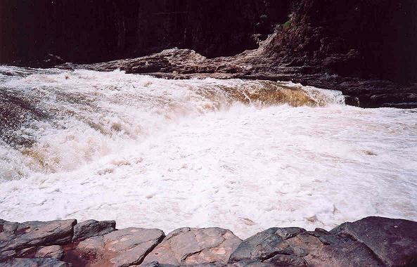
This run is on the reservation and not open to the public. We ask that boaters respect the wishes of the Apache Nation. We know that the river canyon has breathtaking scenery and whitewater.
You need a hiking permit from the White Mountain Apache Tribe to visit the falls which can be accessed as a 1-mile roundtrip hike from the Highway 60 bridge.
Access on river right downstream of the bridge.