Black, East Fork

Johnson's Shut Ins (2 miles)
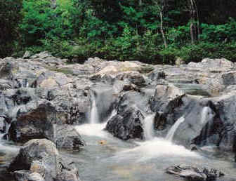
Reach banner
DifficultyII-III
Length2 mi
Avg Gradientn/a
GaugeEast Fork Black River Near Lesterville, Mo
Flow Rate as of 49 minutes
1.08 ftbelow recommended
Reach Info Last UpdatedDecember 5, 2006

River Description

This run is NOT RECOMMENDED (and is probably ILLEGAL) due to devastation caused by collapse of upper reservoir at AmerenUE Taum Sauk Hydroelectric Pumped-Storage Project. For more info, click on the links below

Johnson’s Shut-Ins State Park Damage

USGS-UMR Research Team Investigate Impoundment Failure


River Features

Put In

Distance: 0 mi

Take Out

Distance: 2 mi
Take Out

Rob Smage
Rob Smage

Jul 13, 2009


Is there any update on the status of this run? I see that the park is now open, and in fact, has a 'scour trail'.

http://www.mostateparks.com/jshutins/trails.htm

Any info on suggested water levels (if/when the run is open)?