Big Hungry River
Big Hungry Road to Green(Hungry River)
| Difficulty | III-IV |
| Length | 1.4 mi |
| Avg Gradient | 130 fpm |
| Reach Info Last Updated | May 8, 2025 |
In September 2011, The NC Department of Environment and Natural Resources, Wildlife Resources Commission (NC DENR WRC) announced plans to remove both dams on Big Hungry River, a tributary to the Green River Narrows. American Whitewater and the paddling community weighed in to support funding and implementation of this [...]Read More
To reach the put in for Big Hungry drive up Big Hungry Road to the bridge where the dam is. There should be a few parking spaces on either side of the road. From here look for the painted gauge on the bridge to check the level.
Ideally look for 2in+ of rain the day before. 7in is probably the minimal level. 9-11in is ideal. Anything over 18in will be on the spicy side.
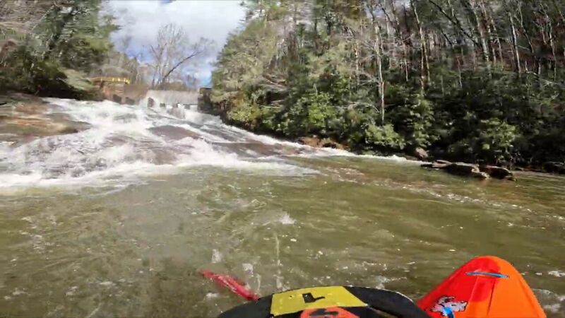
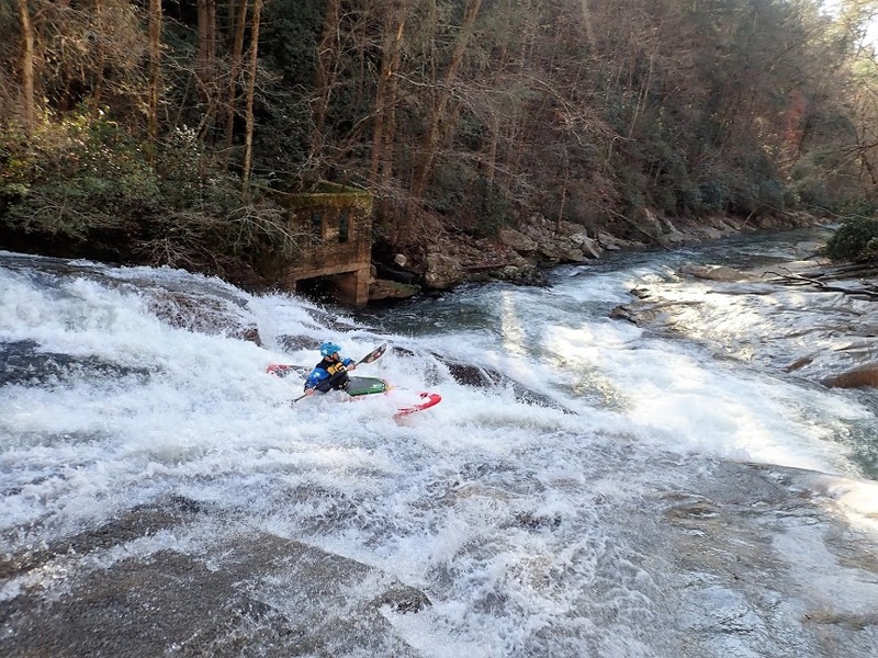
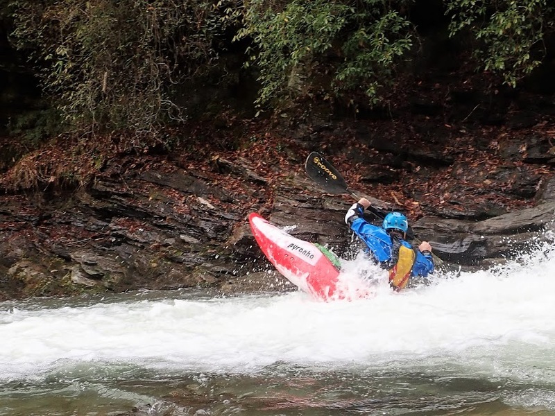
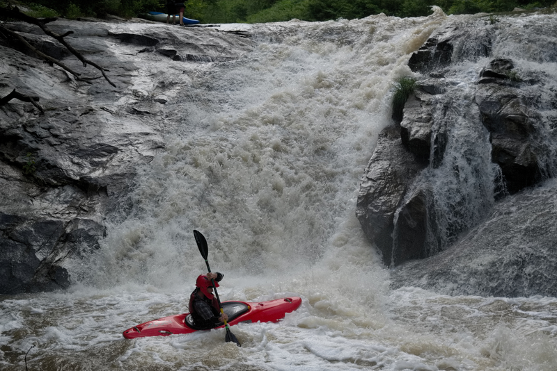
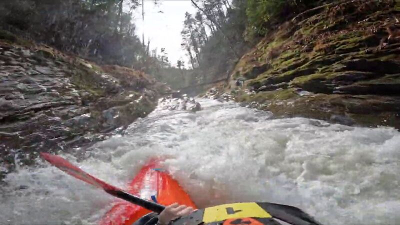
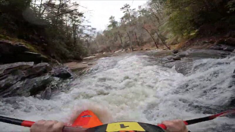
You can hike up river left to the dam & put in or just under the bridge. The run is mostly class III+ read & run with some nice class IV rapids like Lower Big Hungry Falls (Twin Cheeks) Duck Duck Boof & Mini Gorge. Goes without saying watch for wood & scout any drops you can't see. The river will eventually join the Green just below the put in for the Narrows. Keep in mind if Big Hungry is running the Narrows are most likely running at a high level.
You have two options for take outs. First is to run the length of The Narrows down to Fishtop. The other option is to reach the confluence with the Green & hike approximatly .6mi back up the Narrows put in trail to the parking lot at Gallimore Road. Make sure you have a key to the gate. It is a short shuttle which is always a plus & is a neat run with just enough to get you ready for the Green.
It is a good step below the Narrows in terms of difficulty.
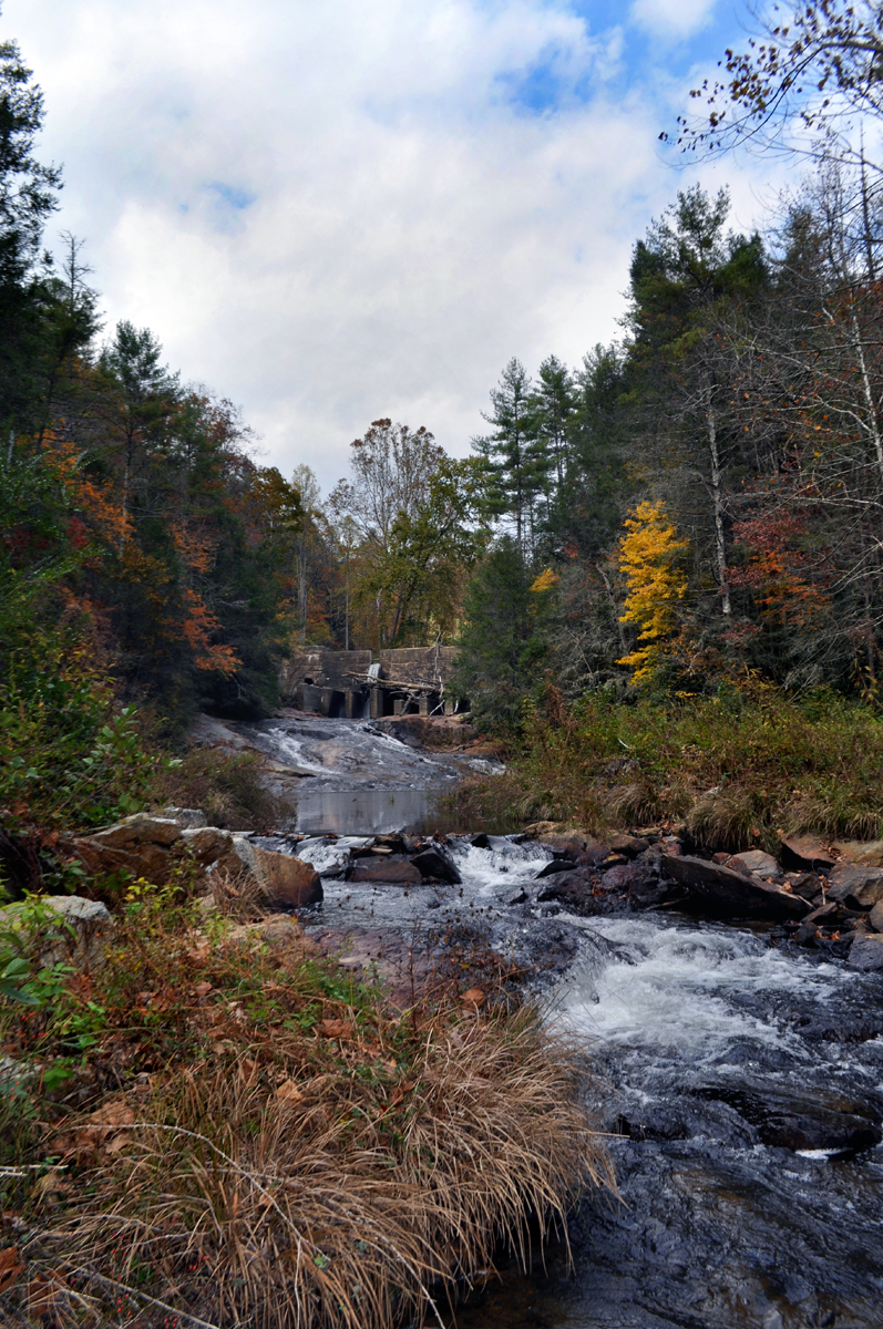
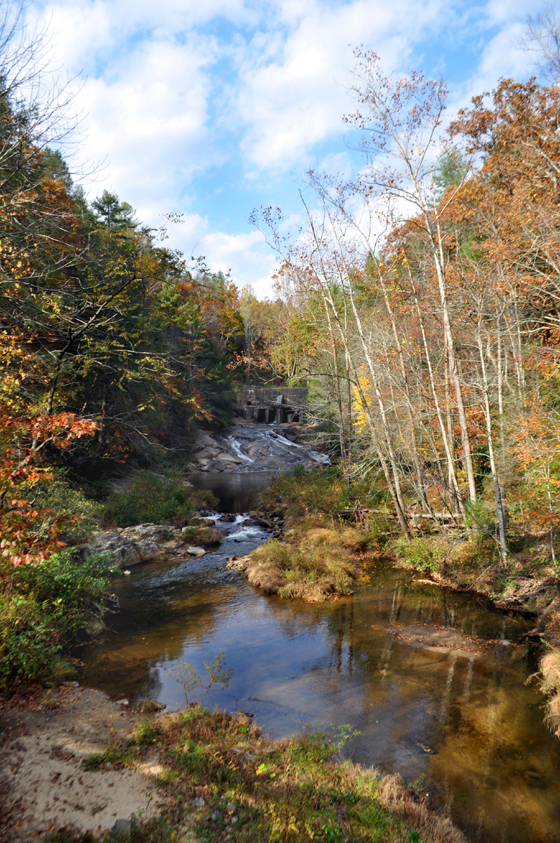
NOTE: Hurricane Helene did extensive damage to this area. The bridge has been washed out (with the painted gauge) & part of the upper dam as well.
Can either put in at the Upper Falls or Lower Falls depending on where you parked
Can either put in just below the dam & run the slide or below it. Pretty straight forward.
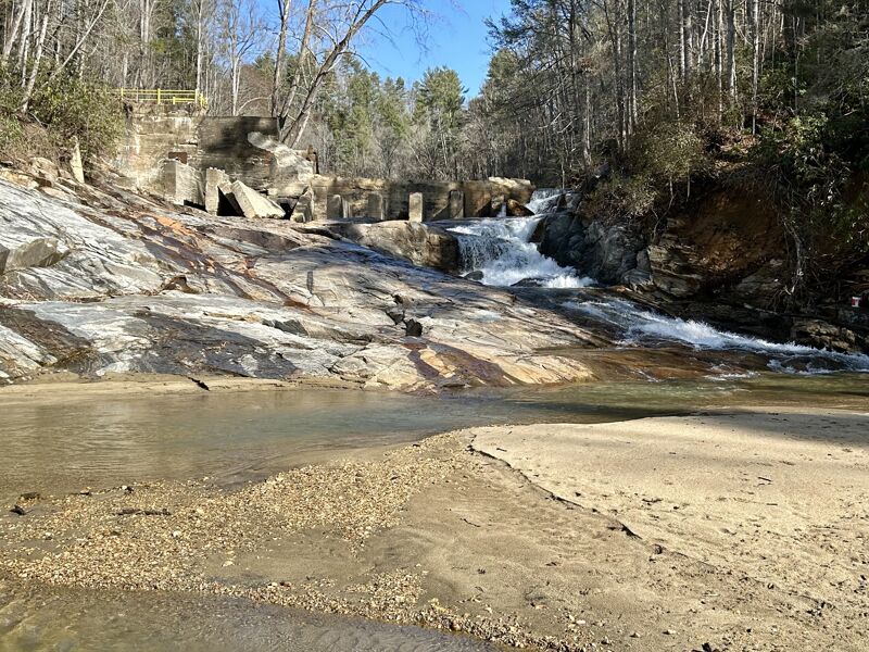
NOTE: Hurricane Helene wiped out a chunk of the dam & now most of the flow goes river left it seems.

After some boogie water you'll see an obvious horizon line. Scout river right. Best ran on the right & trying to drive right. If you get pushed left it shouldn't be a huge deal if you boof. Hole has flipped boats before but doesn't seem to hold them. Can also put on here if you hiked in from Gallimore Rd.
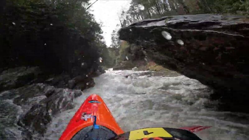
After a stretch of some class III+/IV- rapids you should be able to spot a large boulder. Tricky rapid next to an undercut rock with a nice 6ft boof at the bottom. Scout for wood here as it is a bit of a blind turn once you drop in. Just don't get too close to the undercut unless you want to know how the rapid got it's name. Easy to scout & set safety on river right.
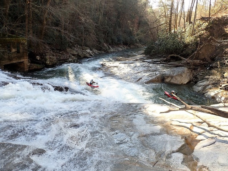
The river will narrow into a neat mini gorge. Try to drive up on the shoulder on the left wall to avoid the hole here. Probably not a bad idea to scout this section in the event wood blocks it. Below is a really fast but small slide rapid to add to the fun.
The last rapid on the Big Hungry River. Another slide with a small S turn that drops into a hole. At high levels the hole could be nasty. A large calm pool is at the bottom so get your roll right. The confluence with the Green River is just downstream.
Either hike up the trail to the Narrows parking lot or continue on towards the Narrows. If Big Hungry is running the Narrows will most likley be high flow.
Dec 28, 2023
First time down Big Hungry. Painted bridge gauge was right at 7in after 2in of rain the night before. I think 9-11in would've been the sweet spot. A log was stuck in the lower falls but everything else goes.
Dec 28, 2023
6 or 7 inchs on the painted gauge on the bridge.
Enough flow for everything to go. There was wood in the immediate runout of the big slide, just after the removed dam, which made that a portage. All and all it was a fun level but would be better around 10-12'
Dec 23, 2018
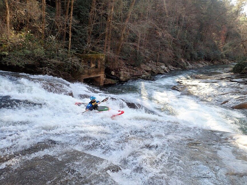
Dwight dropping the slide
Sep 22, 2011
Both Dams On Big Hungry To Be Removed!
September 2011: The NC Dept. of Environment and Natural Resources Wildlife Resources Commission (NC DENR WRC) plans to remove both dams on Big Hungry and put out a request for proposals to do the work. The closing date for the 'letters of interest' was Oct. 7th, and several engineering firms responded. These will get whittled down to a few and then one of the firms will be selected. The actual work itself will depend on final (likely federal) funding, and will perhaps cost on the order of $700,000, a number that was mentioned in the NCDENR WRC request. The timeline mentioned recently puts this next phase around 6 months to a 1 year out.
The earliest mention of the Big Hungry dams being considered for removal (that I could find) is from a 2008 NC Ecosystem Enhancement Program power-point presentation on dam removal. Here is the pdf file. The EEP is a DENR initiative.
Although it will be a mess whenever the project gets going, this is GREAT news for Big Hungry and for fans of free-flowing rivers everywhere. Untold tons of sediment will be removed from behind the dams, including the log-jam behind the lower dam, and everybody's a winner.....the aquatic ecosytem, the fishermen, hikers, and paddlers alike. Sediment issues in the Green River watershed are discussed a bit further on this AW page.
November 2012 article in Blue Ridge Now. Febuary 2015 article in Blue Ridge Now.
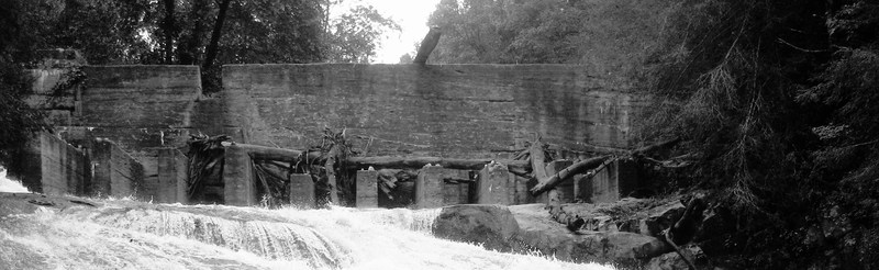
Seen above is a photo of the upper dam. There are a few photos of the lower dam on the AW Big Hungry page. Here is a one minute video from atop the upper dam.
Following the early failure of a steam-powered generator, the next effort at a public electric supply in Henderson County was in 1904 at the upper dam location on Big Hungry. It washed away and was replaced in 1910. Then that dam also washed away and in 1911 the current upper dam was built, followed by the lower dam in 1913. Apparently, after the devastating 1916 floods Henderson County was the only place in Western North Carolina to still have electricity -- because of these two Big Hungry hydro projects. This timeline and information comes from a folk history of the area called ' The Banks of the Oklawaha' (Fitzsimmons, 1976, in three volumes). The two dams are essentially abandoned; they are not in use and haven't generated power in many decades most likely, but I'm not sure when it stopped. Both dams are on Green River Gamelands property, which is managed by the Wildlife Resources Commission.
The Lake Summit dam (Tuxedo Hydro) was built just a bit later, around 1916-1921, depending which newspaper account you believe. And as a side-note, those 1916 floods were truly epic (see here, here, here) and the French Broad River in Asheville averaged 66,000 cfs one day that July (and may have peaked near 110,000 cfs). This compares to 'only' 35,000 cfs or so during the 2004 hurricanes, and is staggering.
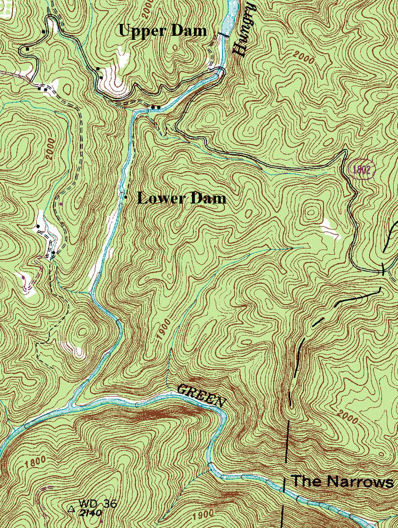
Below is a blown-up portion of a topo map showing Big Hungry River from the upper dam to the confluence with the Green Narrows. The upper dam is just north of Big Hungry Road and can be seen drawn on the map. The lower dam is not drawn on the map but is located downstream about where the 'house' is along the creek on river left (eastern side), and before the confluence with the Narrows. From where the road crosses the creek to the Narrows is said to be 1.3 miles. This map is just an out-of-scale little snippit. To view the entire map, go to this Libre Map Project page and open the 'Cliffield Mountain' quad map. The Pulliam Creek Trail is not shown on the map below, but the county line does. The Pulliam Creek Trail begins a bit out of frame and further to the right.
Kevin Colburn (American Whitwater's National Stewardship Director) has made an AW Project Page that is following the dam removal. American Whitewater has long been an advocate nationwide for free-flowing rivers. Read more about AW's work in dam removal here________(get linkie).
Below is a pic from Summer 2011 showing the upper dam. Info on this pic here.
===============================================================
September 2011: I'm just tossing up this page to start collecting information about what will likely be a multi-year process, with photos/articles/documents, etc. Please send things along if you find them. Some other Green River maps can be found here. If you are a new visitor to this site and are curious about the Green Narrows, go to American Whitewater's Green Narrows page. Thanks,,,,,John Pilson,,,,johnpilson at the gmail