Dolores
06. Bedrock to Gateway(Paradox and Mesa Canyon)
| Difficulty | II+ |
| Length | 45 mi |
| Avg Gradient | 10 fpm |
| Gauge | Dolores River Near Bedrock, Co. |
| Flow Rate as of 58 minutes | 16 cfsbelow recommended |
| Reach Info Last Updated | June 20, 2018 |
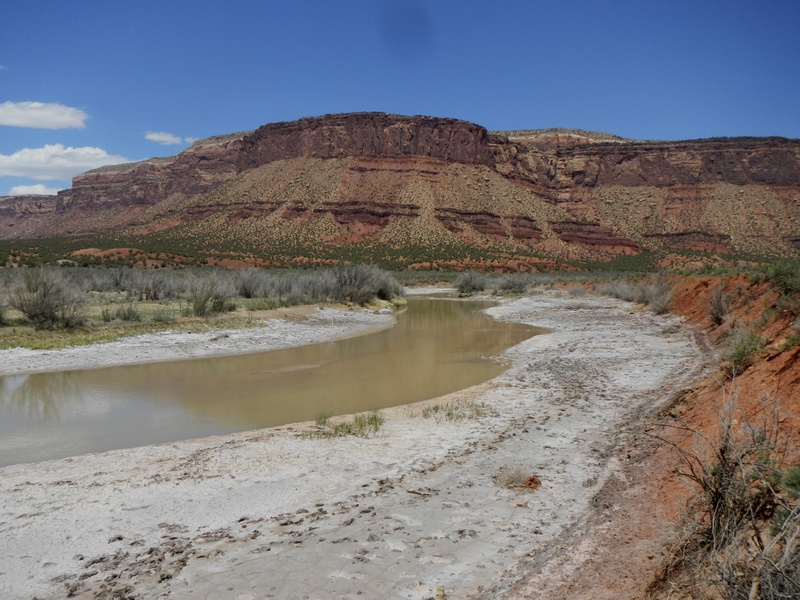
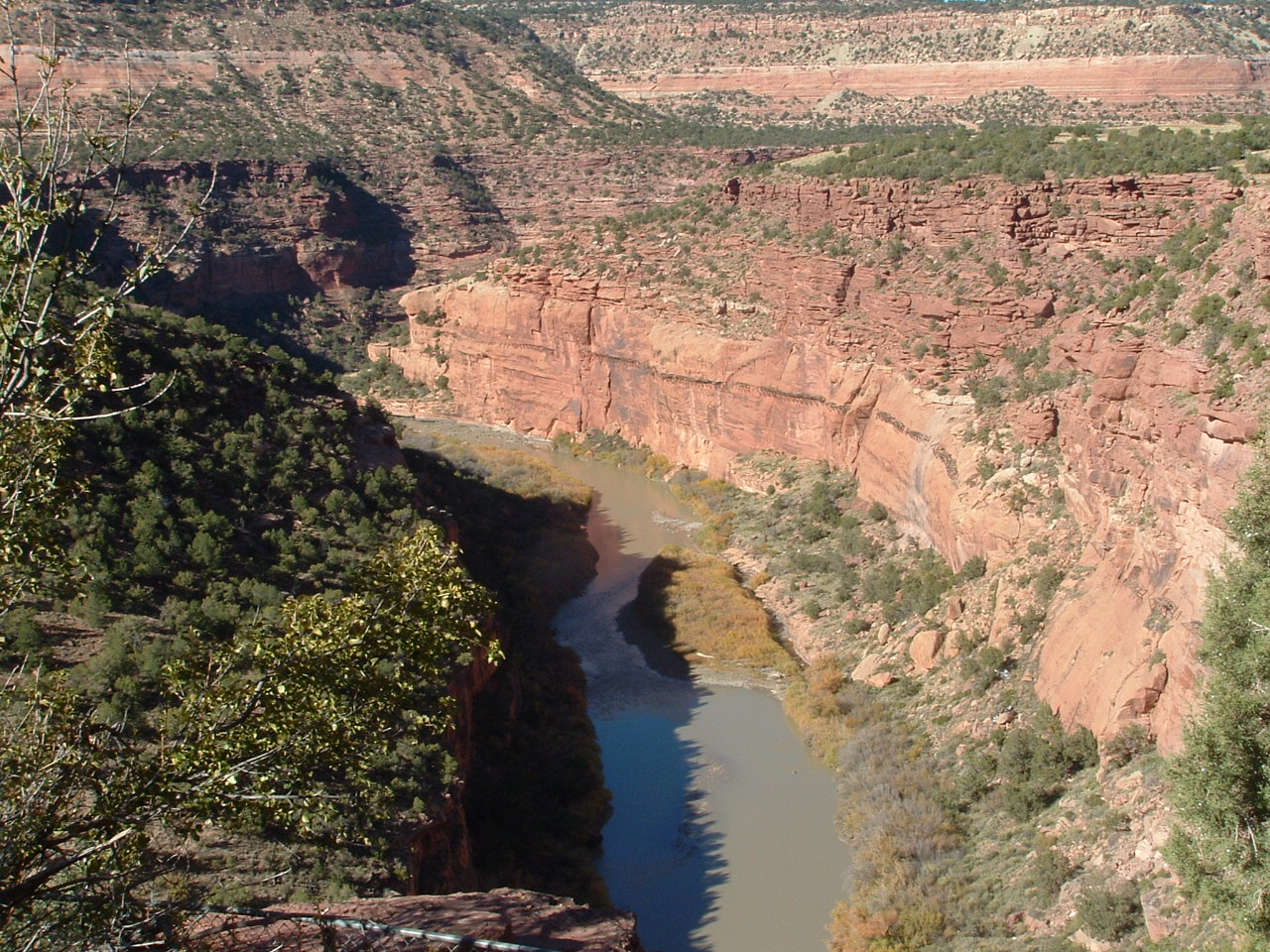
The Dolores River contains an impressive diversity of landscapes, from its pristine high-altitude headwaters in the Lizard Head Wilderness to the red sandstone canyons at the confluence with the Colorado River 230 miles downstream. The basin sustains rare riverside habitats, plant communities, and native fish and wildlife. Historically, the [...]Read More
SEASON: April to early June depending on snowpack and release from McPhee Dam and inflow from the San Miguel River.
ISSUES: Recreational users have traditionally been the last to be considered in the management plan for McPhee Dam. A proposal to construct additional diversions designed to capture even more of the spring melt will only make the situation worse. Check with the San Juan Citizen's Alliance for the latest information on this issue.
LOGISTICS: The put-in at Bedrock is on river left just upstream of the Highway 90 Bridge. There have been reports of car vandalism at this access site. From the put-in take Highway 90 east and turn north onto Y11 Road as it parrallels the river. Once you reach the confluence with the San Miguel River the road turns east and up the San Miguel along river left where it crosses the river and joins Highway 141. You may be able to find an alternate launch site here when the Dolores is too low. Follow Highway 141 back downstream along the San Miguel on river right. This road follows the river all the way to the take-out at Gateway. Access from Highway 141 to the river is limited by the steep canyon walls, but there are a couple potential spots (obtain permission from land owners).
DESCRIPTION: This section is the Paradox and Mesa Canyon section of the Dolores and for the most part you're here for the scenery. This section is most often paddled as part of a longer trip on the Dolores. Evidence of past mining activity can be seen from the river and there is a road along much of the run.
While McPhee dam upstream limits the days the San Miguel River joins the Dolores providing supplemental flows in the spring. In some years your only opportunity for paddling the Dolores is to launch below the confluence of the San Miguel. The Dolores is managed by the BLM and they maintain a web page with
...Access on river left that serves as a put-in for this section.
Stay right of the island as the left side can be a trap exposing you to nasty rocks.
Private access point requiring permission but the only easy access between Bedrock and Gateway.