Yadkin
1. SR 1372 to US 321
| Difficulty | IV+ |
| Length | 6.4 mi |
| Avg Gradient | 62 fpm |
| Reach Info Last Updated | December 27, 2023 |
The Upper Yadkin is located north of Lenior about 30 or 40 minutes past Wilson Creek. The book Carolina Whitewater says there is a gauge on a wood plank bridge 1/2 mile downstream of the take-out; however, it appears the bridge has been replaced but not the gauge.
An easy shuttle brought us to a little farm drainage-ditch-type creek at the putin. We got permission to park from a nice woman at a nearby farmhouse and started downstream at 3:30 p.m. on the seven-mile run.
Like the
, the Yadkin starts flat, then you come to five-foot ledge. Things gradually start to pick up from there. The farmland recedes and big boulders start appearing in the stream, making for a very intimate feeling little creek.
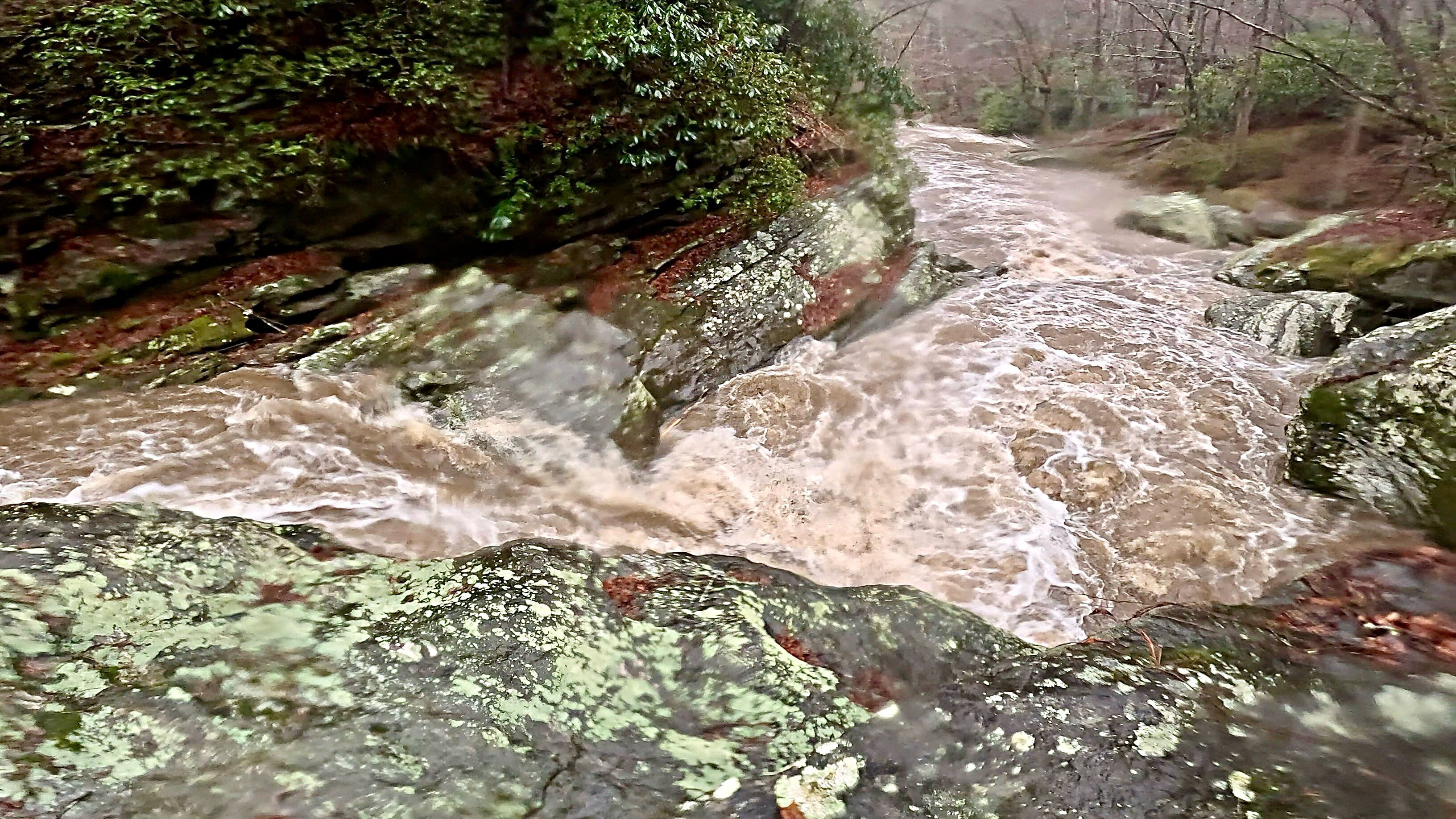
About the time you come to the start of the Gorge is an ugly sight. The owner of all land in the gorge, something called Yadkin Partners, has strung 'no trespassing' signs across the river at the top and bottom of the gorge. It appears they are doing some kind of development all through there. They have cut a road along the river which constantly crosses fords between rapids. This along with some ag runoff from upstream has really messed up the water quality.
The flow was quite minimal, definitely ELF boating. There are logs down everywhere which we wriggled under, over and around. One of the bigger drops of about 6-7 feet has a log down in a boiling cauldron of foam at the bottom. Three of us were able to avoid pinning, by boofing slightly to the left, but one boater in a very long kayak pinned under the log. Fortunately, with the low flow he was able to get out and recovering his boat was a simple matter.
Not far downstream the whole river pours about 4 feet through a slot about 6 feet wide. The kayakers all got stern-squirted there. It turned out to be the one of the best ender spots I have ever seen. It was so powerful even at
...
I don't know how accurate the distance is from the put-in in terms of the location for this rapid. I gave an estimate of where I thought it might be as a placeholder. [THIS WILL NEED TO BE UPDATED]
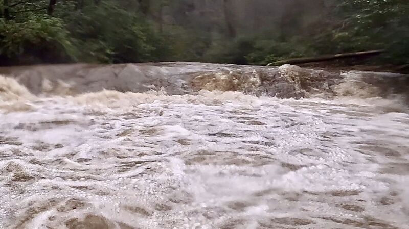
A riverwide ledge that drops about 5 feet. Things gradually start to pick up from here
I don't know how accurate the distance is from the put-in in terms of the location for this rapid. I gave an estimate of where I thought it might be as a placeholder. [THIS WILL NEED TO BE UPDATED]
A pretty straightforward drop of 5 or 6 feet with multiple different channels. Be mindful if running the center drop as it lands right next to a big rock thats undercut. We scouted this rapid on River Left.
I don't know how accurate the distance is from the put-in in terms of the location for this rapid. I gave an estimate of where I thought it might be as a placeholder. [THIS WILL NEED TO BE UPDATED]
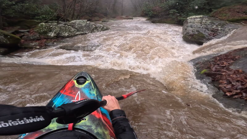
About a 4 or 5 foot drop into a very powerful hole. Make sure to get a good boof here unless you like some hole action.
I don't know how accurate the distance is from the put-in in terms of the location for this rapid. I gave an estimate of where I thought it might be as a placeholder. [THIS WILL NEED TO BE UPDATED]
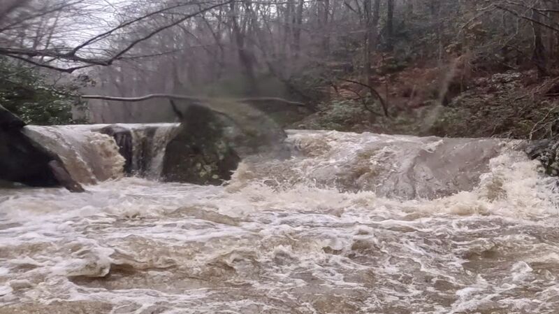
This is the largest drop on the run (about 10 feet); run to the far left to avoid the gigantic undercut rock on the right.
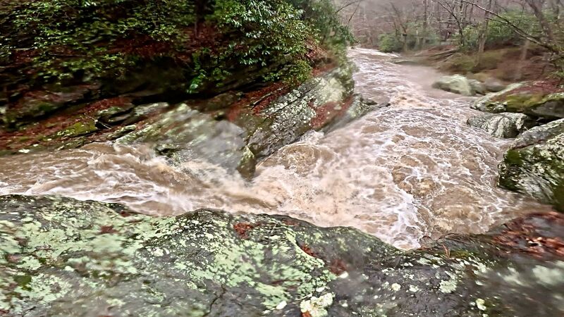
Dec 26, 2023
Me and my friend Jem Baker got on this on December 26th, 2023 after decent rainfall in the area and with it continuing to rain throughout the day. Without much beta, we picked our way down and scouted things that we couldn't see. There were several river wide logs towards the beginning (before the gorge) that had to be portaged and then one somewhere in the middle of the run. There was also other wood here and there. We put-in along Richland Road [1372] and then chose to takeout at a small pull-off along Yadkin River Road [1560] as there wasn't really a good spot along HWY 321 to park. We think the level was at a Medium flow. The Patterson online gauge was reading 800 cfs for reference. Overall, we had a good time. This was a neat stretch to check out. Happy we got it :).
Jan 19, 2009
So what was the level when you ran this?