Trip Reports
Log in to add a report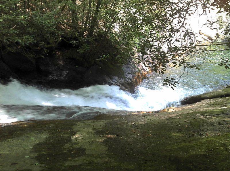
DG
Derek Gramling
Aug 27, 2008
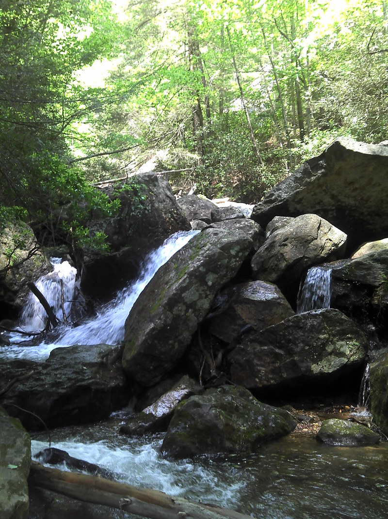
Just ran Blood Mtn. Creek yesterday, the gage on the chestatee read 8000 cfs. It was pumping but a good. Top portion is still full of strainers, hope to work on cleaning it out for the next rain. We were able to run from the drop above the cascades all the way down to the camp site, except for the small drop below the lower blood falls. It was some amazing water being 15 mins. from my house. have some video footage will try to post it. if you would like to help clean it let me know Kayakerd@yahoo.com
RB
Rick Bellows
Mar 15, 2006
Per USFS, the gate on Dick's Creek Road at the ranger station will be open for the season as of March 17.
KB
Kyle Bergner
Jan 30, 2006
I'll go up this weekend and take some pictures of the higher up stuff. Its pretty sick. I've gone probably .5 miles up from Blood Mtn Falls, and its all pretty dicey. THere is another water fall that you could run at high enough levels (3000 CFS on the Chestatee) up at the top, but I am not sure if there is anything past that.
RB
Rick Bellows
Jan 11, 2006
New Streamkeeper: Rick Bellows, chestateer@yahoo.com.
KB
Kyle Bergner
Nov 15, 2005
And yes, there are actually two HUGE pot holes in the last drop on river right. I'm talkin, 6-7 feet deep and at least 3 feet in diameter.
KB
Kyle Bergner
Nov 15, 2005
This is a great spot known to us NGCSUers as either slidding rock or the rock slide. Currently the first falls are blocked up with wood from last year's hurricane season. If anyone wants to help me clear this area out anytime, preferably someone with some chain saws, email me at kyle.bergner@us.army.mil
FB
Frank Boston
Jun 4, 2005
Summer of 2002 Bill Alexander,Myself and Justin Barr run all three drops in that order.The bottom two had to be run together.Bad pothole in bottom drop.
BR
Brad Roberts
Jul 4, 2003
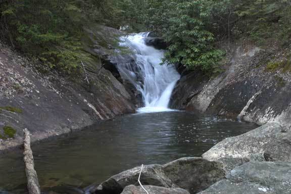
At the ford is a camping area river left on blood mtn creek. The last rapid before dicks creek is an unrunable boulder drop. The drop is full of wood and sieves out in places. Above that is a small pool, and above that is a 25 or 30 foot falls that is similar to boxcar on the NF French Broad.
CG
Chris Gorman
Feb 4, 2003
Got this from http://www.n-georgia.com/waterfal.htm
'Blood Mountain Falls - This splendid waterfall is located on the Blood Mountain Stream. The stream flows approximately 20 feet through a rock cut, creating a churning sluice of water. An unmaintained path leads to the falls.
Directions: Start at the intersection of US 19/129 (Turners Corner). Go west on US 19 for approximately 1/2 mile. Turn right and travel up Dicks Creek Road. The road soon narrows. Go 2 1/4 miles to the Blood Mountain Stream. The falls are located on the right.'