Lawsons Fork Creek
Glendale to Goldmine Rd.

| Difficulty | I-III |
| Length | 4.4 mi |
| Avg Gradient | 20 fpm |
| Gauge | Lawsons Fork Creek at Spartanburg, Sc |
| Flow Rate as of 1 hour | 23 cfsbelow recommended |
| Reach Info Last Updated | December 25, 2015 |
The Lawsons Fork is a great whitewater resource for paddlers in the Spartanburg area. This creek flashes quickly during big rain events, but offers one short, relatively steep section that is runnable down to low flows.
This river has approximately 14 runnable miles, from the base of the Whitney dam on Hwy 221 in north Spartanburg to the take out at Goldmine Road, just prior to its confluence with the Pacolet River, east of Spartanburg.
The upper two-thirds is comprised of flat water interspersed with the occasional class II rapid. Most people, however, opt for the final 4.5 miles which has the best gradient: this section is known for Glendale Shoals at the beginning of the run and for Little Five Falls near the end.
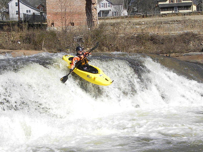
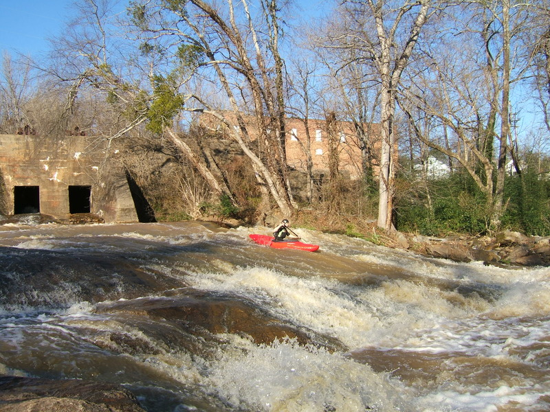
The best stretch is Glendale Shoals, a 250 yard long set of rapids that falls about 25 to 30 feet (extrapolated 180+ ft/mile). It starts at the base of the dam at Glendale and culminates in a five-foot drop called Lawson's Dawg. Hit your boof, and you'll be back for more. Many laps can be had here.
Those folks continuing past Glendale Shoals are met with a quiet stretch of river that averages a gradient of less than 20ft/mile. The next few miles past Glendale have some small rapids and offer some great eddy lines and outstanding waves during higher flows.
At just under 2.0 miles, you'll float under the decaying truss of an abandoned bridge. You'll pass a clearing at mile 2.5 and another set of clearings (natural gas rights of way) at mile 2.8. At about 3.5 miles, Little Five Falls begins, your reward for enduring the flat water upstream.
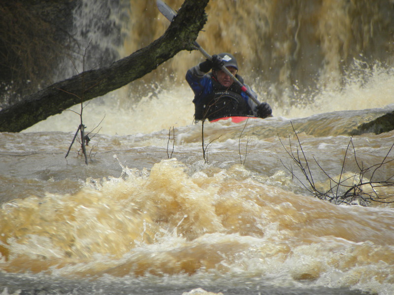
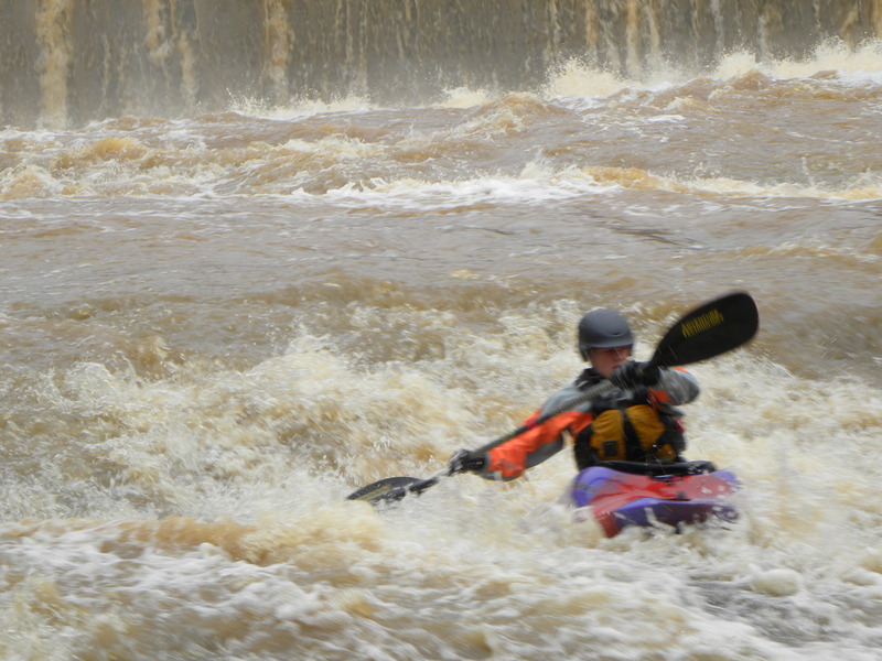
Here, five rapids come in quick succession. At low flows, pick a line. At higher levels the final four rapids can merge into a class III boogie feature with some near river-wide ledge holes, so scout accordingly.
Watch out for strainers and wood on this section. Lawsons Fork is heavily forested the entire run and offers a scenic tour of high bluffs, mountain laurel, rocky sho
...
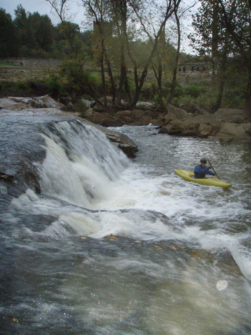
After putting in at the stairs at the base of the dam, ferry across to river left and run this slide into a nice play wave. In low flows, all of the water channels down the slide. At high flows, it engulfs the entire shoals, creating numerous lines.
Below Glendale Slide is Lawson's Dawg. At medium flows, this rapid offers a first rate boof. It vaguely resembles Soc-em-Dog on the Chattooga River, but is easier to hit. Some of the river peels off to the right, so you'll have to work a little bit to hit it perfectly. In low water, the approach is a little boney and can kill your momentum, but it's still good to go. The run out is manky in levels under 300 CFS.
At higher flows, this is a first rate rapid. Just be weary of everything to the right of the boof, as it gets scarry looking. Lines open up left of the boof in higher flows as well. The run-out can be a little manky.
An island splits the water into three channels. The far right channel is the easiest, although it bends sharply and may pose a challenge to new boaters. The middle offers several, more challenging lines that generally run from middle to right. The left is a straight shot, but is no good in low flows. At about 250 - 300 CFS the left starts to open up and provides a short slide that runs through two boulders at the base. In high water, multiple lines across the entire feature open up.