Big Piney Creek
3) Helton's Farm (Treat) to Long Pool Campground (8.4 miles)
| Difficulty | II+(III) |
| Length | 8.3 mi |
| Avg Gradient | 15 fpm |
| Gauge | Big Piney Creek at Highway 164 Near Dover, Ar |
| Flow Rate as of 1 hour | 0.62 ftbelow recommended |
| Reach Info Last Updated | April 7, 2014 |
This is a popular class II-III stretch. Most rapids are straight forward class II in nature, but several offer wavetrains and holes which can easily swamp open canoes, deserving class II+ to III rating. The 'Mother' (aka 'Cascades of Extinction') is the most difficult and potentially dangerous rapid about a mile above the take-out. This is a classic Ozark stream, emerald pools, scenic bluffs, remote setting and nice rapids. USFS Longpool Campground offers tent and RV spaces, water, heated bathrooms and showers.
Put-in: From Long Pool Campground, travel South for 2 miles to the first road to the left (East). Follow this gravel road up the mountain for 2.4 miles to the first main intersection. Turn left (North) at this Y intersection. After 2 miles there is an overlook on the left which looks down on the river. The 'Mother' and Longpool can be seen from here. Continue another 4 miles on the main road which will drop down the mountain and cross a low water bridge at Indian Creek. This can be used as a put-in if the level looks good to float down the first shoal. This creek adds a couple miles of class II+ to the run including some willow jungles. Otherwise continue across the bridge and follow the road to the left for another 1.5 miles. Take a left (go straight) at this intersection. This road will pass a cemetery on the left and descend a short hill to the river valley. This is a private property access and the landowners (the Helton's) require a $3.00 boat launch fee. Go to the house on the right to pay and access the creek via their field.
Take-out: Ozark National Forest Longpool Campground. Access from Hwy 7 North of I-40. Turn left (West) on Hwy 164 and right on Old Hwy 7. Follow the signs to the campground. A $3.00 parking fee is required if not camping.
Put-in is on private property for a $3.00 per boat charge
Optional put-in option is at the low-water bridge on the shuttle road. Indian Creek offers 2 miles of class II+. Some of which is willow jungles. If the level looks high enough to paddle, it is.

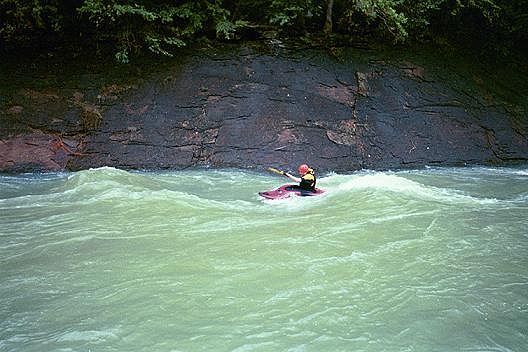
River wide 2-ft ledge which can be run anywhere. The hydraulic below the ledge is nice for those with the skills to surf and play in it, but easily cause novices to capsize.
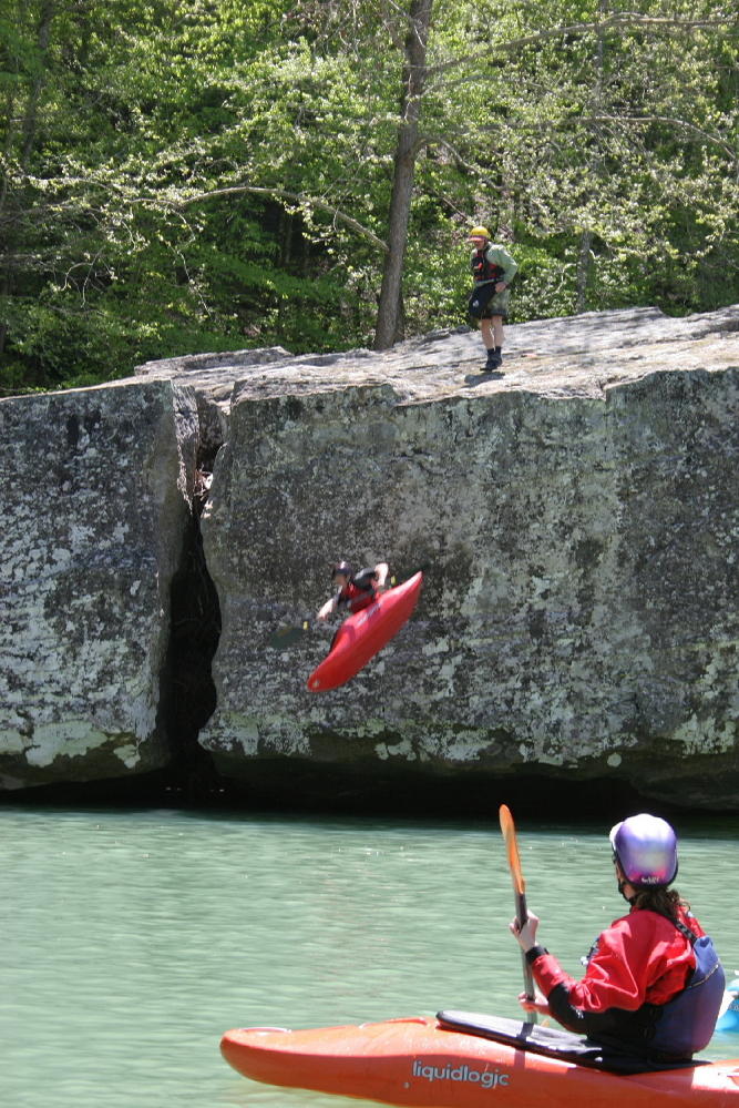
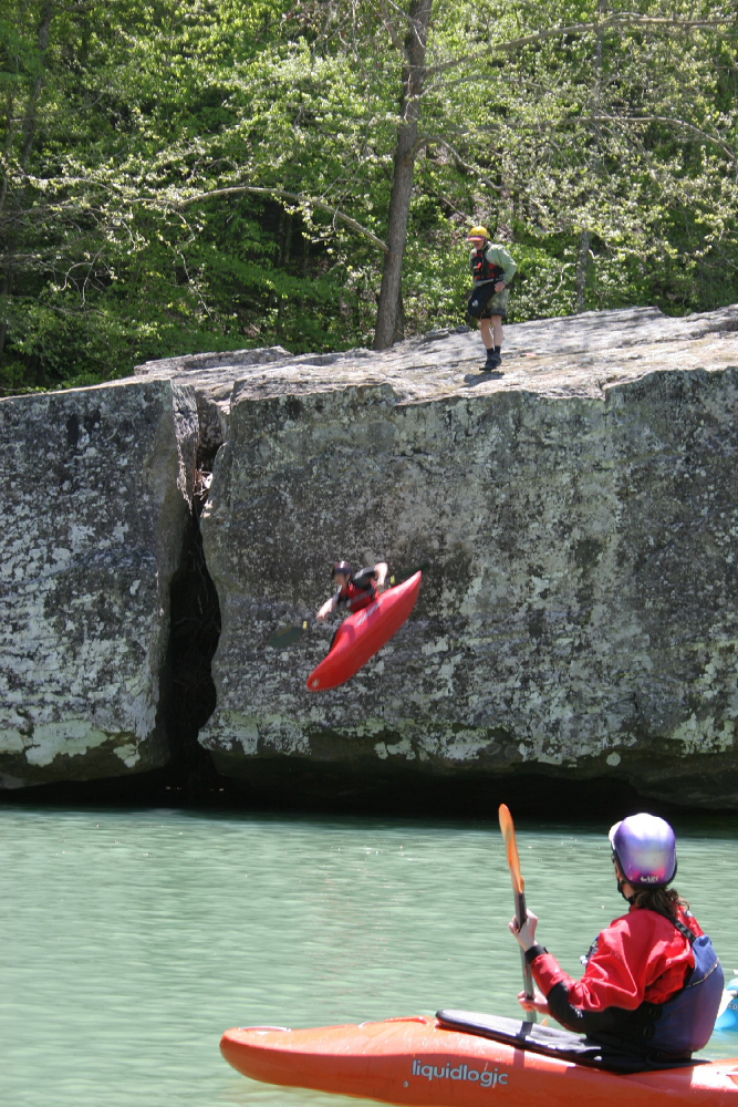
After a couple nice beaches on the right there are two large boulders in a long pool. Popular swimming hole for jumping off the 15-20 ft high boulders.
In addition a 4-WD road accesses this area (entire bend in the river) on river right. (Graves Creek Road)
At the end of the pool containing Jump Rock. This rapid offers a wave train and small holes. Recovery eddies and beaches are located below the first and second parts of the rapid on the right.
Water flows past two large rocks on the left into a deep pool. Creates small whirlpools below the rocks.
This is a great place for squirt boaters.
The 4-WD Graves Creek road can be used to access this area.
Below Graves Creek, the river turns to the left. At the beginning of the turn is a wave train which offers both play and carnage opportunities.
The beach on the left is a popular lunch spot.
Nice wave train for surfing. The waves disappeared a few years ago, but came back to life about 50 yards downstream after a couple seasons of gravel shifting from floods.
Nice riverwide shoal with surfing waves. The river turns to the left and descends the shoal. Avoid the large boulders on the right. A small beach on the left offers an excellent resting/watching spot.
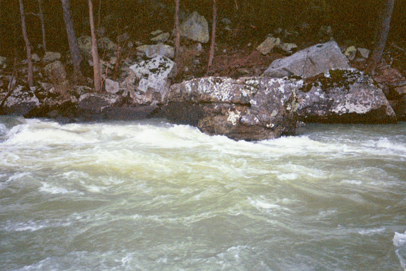
AKA 'Cascades of Extinction'
A short entrance leads to a riverwide 3-ft ledge in front of an undercut boulder on the left. Followed shortly by the 3-Sisters (rocks in the run out ready to pin wary boats that have been abandoned by swimmers)
Hug the right side of the river to follow a clean line through the rapid
A serious 4-WD road can be used to access this area on river right.
USFS campground with water and heated bathhouses with showers.
Jan 1, 1900
This rapid is a great place to watch canoe carnage! The rock to roberts left is 'little mother' it flips the canoes and then just down stream 2 rocks pin the empty boats.
careful here 'the mother' is undercut! Run this one on the right.