Yellow
4. Brown Bridge Road to Hwy 212 (above Lake Jackson)(Cedar Shoals)
| Difficulty | III-IV(V+) |
| Length | 14.6 mi |
| Avg Gradient | 30 fpm |
| Gauge | Yellow River at Gees Mill Road, Near Milstead, Ga |
| Flow Rate as of 30 minutes | 518 cfsrunnable |
| Reach Info Last Updated | February 21, 2015 |
Shuttle directions.
From I-20 take Hwy 81 South from Covington and the run starts in downtown Porterdale.
When you see the mill, you are at the put in.
There is an abandoned gas station on the North side of the bridge that has been used for parking.
The best put in is to put into the river on the northwest corner of the bridge on public property. Then
float a few yards down to take out just before you reach the 12 foot high dam. Portage on river right
and put back in just below the dam.
To get to the take out, go North on Hwy 81 close to the edge of town and turn right on River Front Road.
Follow the road till you get to the river on the right. There is a parking area with a trash can.
The run is about 1/4 mile of III+ ledges then about a mile or two of II-III.
AT HIGHER WATER THIS RUN INCREASES DRASTICALLY IN DIFFICULTY
Rocky Plains Road or Pickett Bridge are probably better and shorter takeouts.
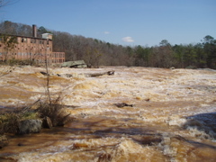
The major rapid on this section in Porterdale is at Cedar Shoals.
Unfortunatly it is now posted so the area might be closed to boaters. For more info see the comments below. Local boater Will Gosney has talked to area authorities and has been given a green light to paddle the river.
Will Gosney: 2004-11-14: We ran at about 340 cfs and is was still too low. I would think about 500+ would be more realistic. No problems from the police or residents about portaging the dam on river right.
At very high water levels, it appears that several undercut rocks would come in to play and you might want to avoid the big (house sized) rock on river right at the end of the run as it is undercut and the current might flow that direction.
Put in after portagaging the 12 dam on river right.
Run the right side at lower flows, at higher flows a
left hand channel opens up. At really high flows
this rapid can aproach Class V
Bolder field type rapid at lower flows requires
picking your way down.
Working your way amongst the bolder fields, there
is some nice surfing at the bottom.
Aug 29, 2009
josh lowry ran cedar shoals at 1780 cfs it was one hell of a ride scouting this river is a must the last rapid aka. #5 is a 4ft wall of water that is hard to punch threw big water boats only no playboating in this hole.
Mar 27, 2009
Justin Hodges, man you know who pulled you out of that river and it wasn't the fire dept.! Haha, but seriously Justin and I paddled this river at 1600cfs and it was a lot of fun. Nice rapids at the bottom and one heck of a ride when I hit it at 2100cfs. A whole lot of junk in the river though so I wouldn't recommend staying upside down or swimming! None the less, this river throws you something new every time whether 20ft trees floating next to you or something else. Ryan Roth
Dec 2, 2008
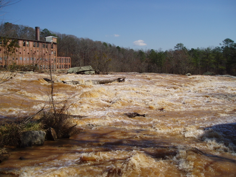
I notice the water in all of the pictures here is quite brown. Are these pics at flood stage? Does anyone know the level that they were taken at; as they all seem from about the same time?
yes the pic were taking @ flood time around like 3000 CFS i think. When i kayaked this in 1600 CFS the water was completely red/brown.
Jul 17, 2005
Shuttle directions.
To get to the run, from I-20 take Hwy 81 south from
Covington and the run starts in downtown Porterdale.
When you see the mill, you are at the put in. There is
an abandoned gas station on the north side of the
bridge that has been used for parking. To get to the
take out, go north on Hwy 81 close to the edge of
town and turn right on River Front Road. Follow the
road till you get to the river on the right. There is a
parking area with a trash can.
The best put in is to put into the river on the
northwest corner of the bridge on public property.
Then float a few yards down to take out just before
you reach the 12 foot high dam. Portage on river
right and put back in just below the dam.
The run is about 1/4 mile of III+ ledges then about a
mile or two of II-III. AT HIGHER WATER THIS RUN
INCREASES DRASTICALLY IN DIFFICULTY.
Feb 22, 2005
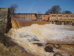
This is the dam that I consider a mandatory portage
although it is only 12 feet high, the landing is very
shallow.
Put in here after portaging the dam on river right.
Don't dawdle as the police have ok'd a quick
portage, so don't abuse it. Run this rapid right of
center and avoid the island at the bottom
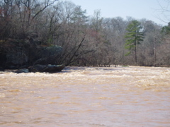
This is a view from the last rapid on the Cedar
Shoals run on the Yellow River below Porterdale,
GA. There is some nice surfing there at higher
water. Take out on river left at the parking area.
This is a picture of the dam which you need to
portage on river right.
This is the first rapid, put in on river right and run
down the middle. At high water a left channel
opens up.
After working through some boulders, enjoy the
surfing wave at the right levels.
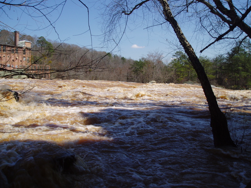
This is a view from the river right side that you
would see from the road to help you identify the
run. You actually need to put in above the bridge,
then float the 100 yards or so near to the dam to
take out to portage. Do not carry all your gear
from your vehicle to put in below the dam as this
would be frowned upon by the police. They have
given us permission to quickly portage the dam on
the private property if we don't abuse it.
Nov 14, 2004
Ok, finally got to run this section. We
ran at about 340 cfs and is was still too
low. I would think about 500+ would
be more realistic. No problems from
the police or residents about portaging
the dam on river right.
At very high water levels, it appears that
several undercut rocks would come in
to play and you might want to avoid the
big (house sized) rock on river right at
the end of the run as it is undercut and
the current might flow that direction.
Sep 9, 2004
I went by the Porterdale run recently and asked the police about their policy for access to the run.
I was told that the purpose of the keep out signs on river right was to keep people from loitering on that area. I asked and was told it was ok to put in above the bridge on river right, take out to portage the dam and put back in below the dam. They said 'just don't take an hour and keep your contact as minimal as possible'.
I would strongly suggest anyone considering this actually stop either at the Porterdale police station in the center of town to ask or track down the officer on duty and let them know what you intend to do.
If you think you want to run, call me at 770-560-3600, cause I'm about 10 minutes away from the run.
Will