Yellow Creek
SR 1242 to Cheoah/ US 129
| Difficulty | IV-V |
| Length | 1.3 mi |
| Avg Gradient | 375 fpm |
| Gauge | Cheoah River Nr Bearpen Gap Nr Tapoco, Nc |
| Flow Rate as of 1 hour | 115 cfsbelow recommended |
| Reach Info Last Updated | August 5, 2015 |
American Whitewater began investigating the whitewater potential of the Cheoah River in 1999, and advocated for a controlled whitewater flow study in 2000, which formed the basis of the next 4 years of negotiating for releases, access areas, land protection, etc. Flows on this river were severely impacted by [...]Read More
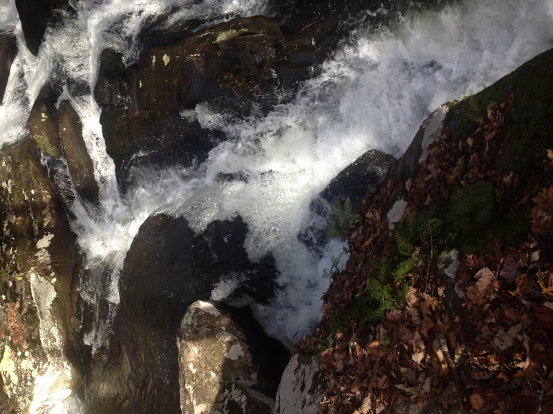
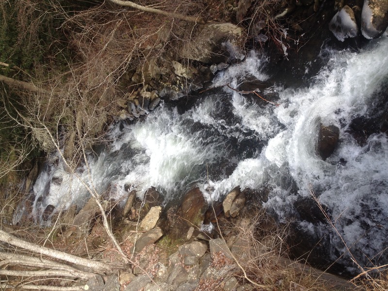
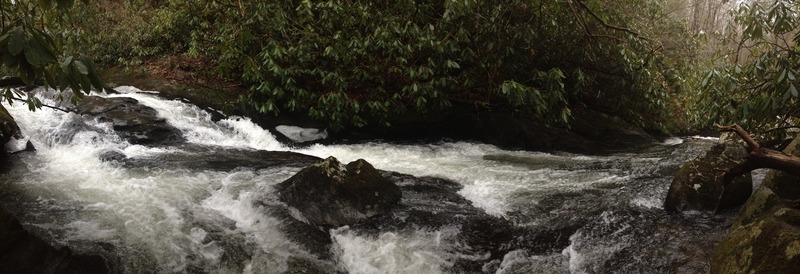
We've tried to hide Yellow Creek for quite some time, since it is arguably one of the best-kept secrets in Western NC.
But, since its gorge and land buffer are now at stake in the Tapoco relicensing (I think we've secured it from development, but still), we need to get the word out how wonderful this run really is.
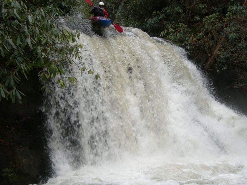
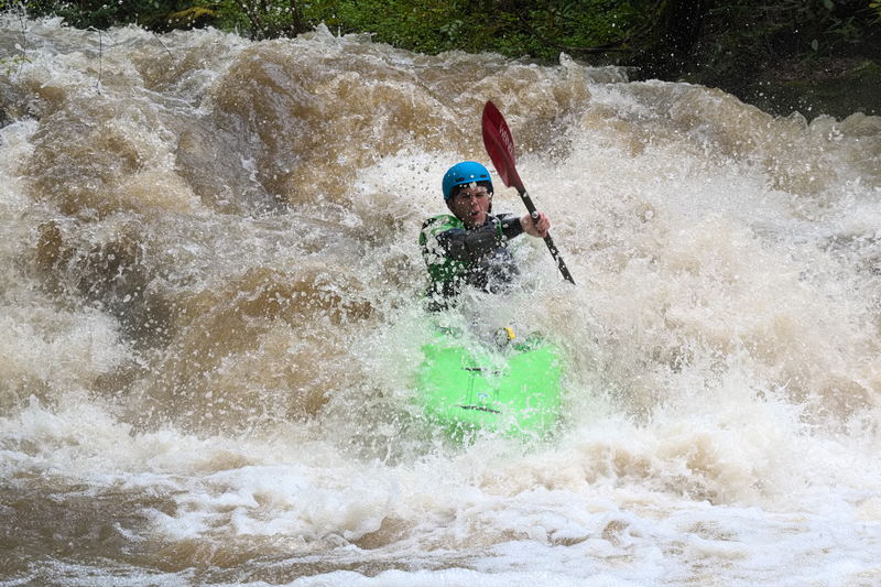
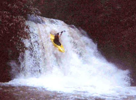
You'll often hear Yellow Creek called the easiest 500 fpm creek in NC. But that's not to say it's easy -- there's a slide bigger and steeper than Rapid Transit, there's a clean 20-foot vert, there are some wonderful boulder garden drops, and a truly nasty sieve. Overall, it's a solid IV-V, about the same difficulty as the Green if not just a hair easier. And it's really easy to miss when driving by the Cheoah since it is well hidden from the road due to its man-made constriction to fit Yellow Creek through the culvert. However, a short 15 yard hike upstream reveals a beautiful gorge. From there, you can either hike up to the 20 footer in rhodo hell for some park n' huck or drive up to put in all the way at the top, which I recommend.
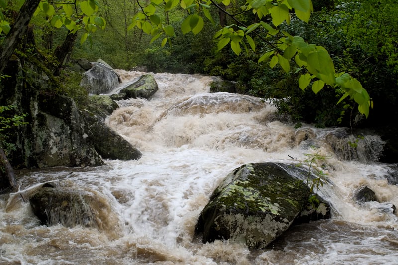
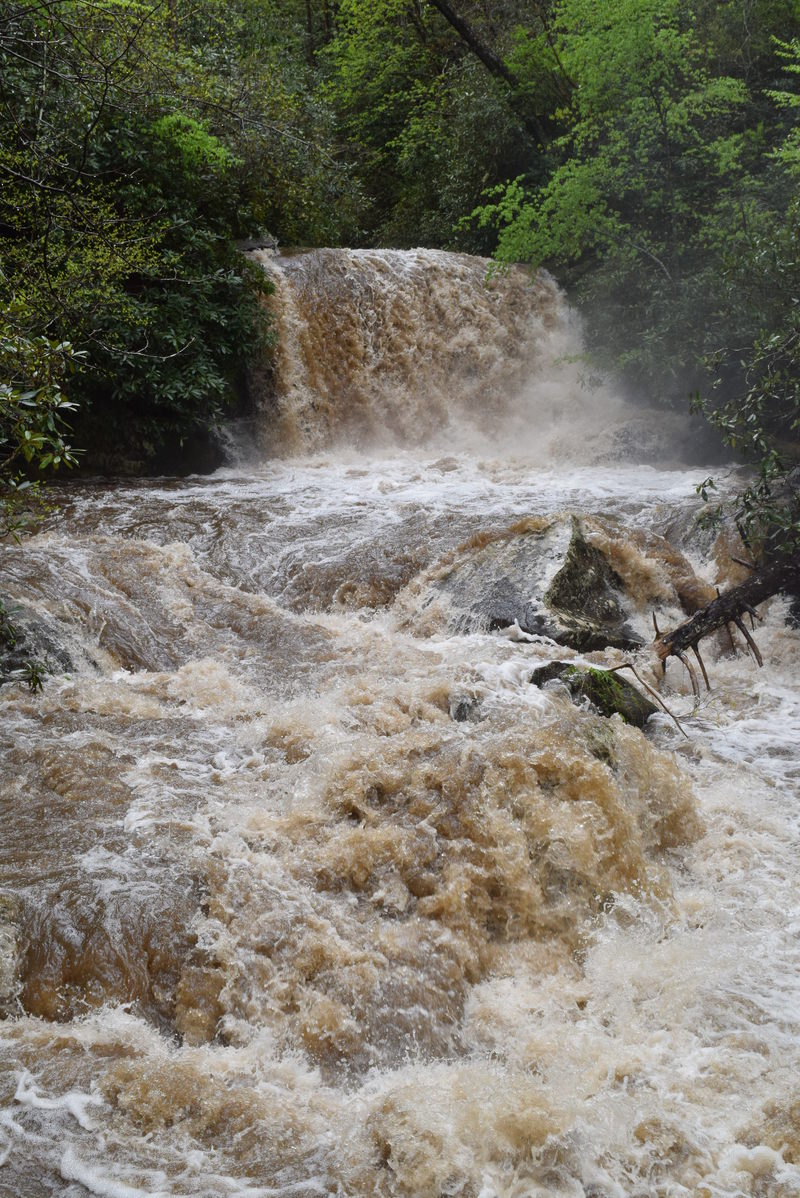
Sounds great, right? But you know what the absolute best part of Yellow Creek is? It has a 15 square-mile drainage. Farmlands up at the top. It doesn't take much rain to get going and then it often runs for a day or two after everything else drops down. When I was last there, it was a good day after a big rain, Yellow was at a perfect level and holding while the Cascades had already long dropped out. And I'm sure it ran the day after that, too. Also, for one more nearby drainage comparison, that same day, Upper Santeetlah was also about as low as can be run.
It appears the most dependable way to anticipate if Yellow Creek is running is to check the Wauchecha AFWS rain gauge, which sits on the southeastern corner of the upper watershed. In the summer a minimum of 1 inch of rain 4-5 hours before putting on is needed. In the winter the same amount of rainfall would create a nice level.
Another wa
...2ft visual, ~1800cfs peak on Cheoah gauge