South Fourche LaFave
Hwy 7 to Deberrie low-water bridge (11.3 miles)
| Difficulty | II+(III) |
| Length | 11.5 mi |
| Avg Gradient | 15 fpm |
| Gauge | South Fourche Lafave River Near Hollis, Ar |
| Flow Rate as of 13 hours | 2.25 ftbelow recommended |
| Reach Info Last Updated | January 26, 2009 |
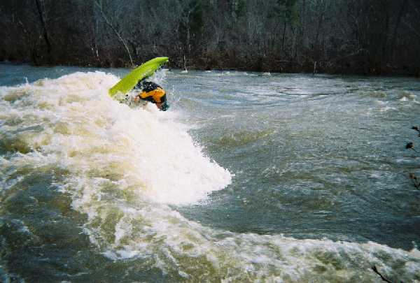
Remote class II run with nice scenery and some nice waves at levels between 4.5 and 6.0 feet.
Run starts off through some willows but shortly opens up for a straight forward run through most rapids. Watch out for the hole at 'Big Rock' just a little downstream from where Cedar Creek enters on the right about half way down the run.
There are a couple nice long rapids between here and where Cove Creek enters on the left. Cove Creek can be used as an alternate access point.
Save some energy to play the waves and ledge just above the take-out. At lower levels < 4.5 ft, the waves are mild, but between 4.5 and 6.0 ft the waves and holes at and above the ledge are pretty sweet. Below the ledge, the property is private so park and play requires a paddle/drag up from the take-out bridge or run a long shuttle to put-in just upstream at the confluence of Brushy Hollow.
Put-in: Hwy 7 bridge at Hollis. This is located about half-way between Russellville on I-40 to the North and Hot Springs to the South.
Take-out: Main take-out is the low-water bridge at Deberrie just above the confluence with the Fourche LaFave. From the put-in go North on Hwy 7 for 11 mi. to Fourche Junction, turn right (East) on Hwy 60. Go 11 miles to Aplin and turn right (South) on Hwy 155. Go about 3 miles to the end of the pavement turn right (West) at the 4-way gravel-road intersection. Go about 3 miles to the low-water bridge.
There are shorter ways to run shuttle and other areas to access the river, but require a good map and travelling rough dirt roads.
Feb 13, 2010
This is at Blockhead Rapid on the far right side of the river. Do not take this way if you are in a canoe. It's too tight to manuever.
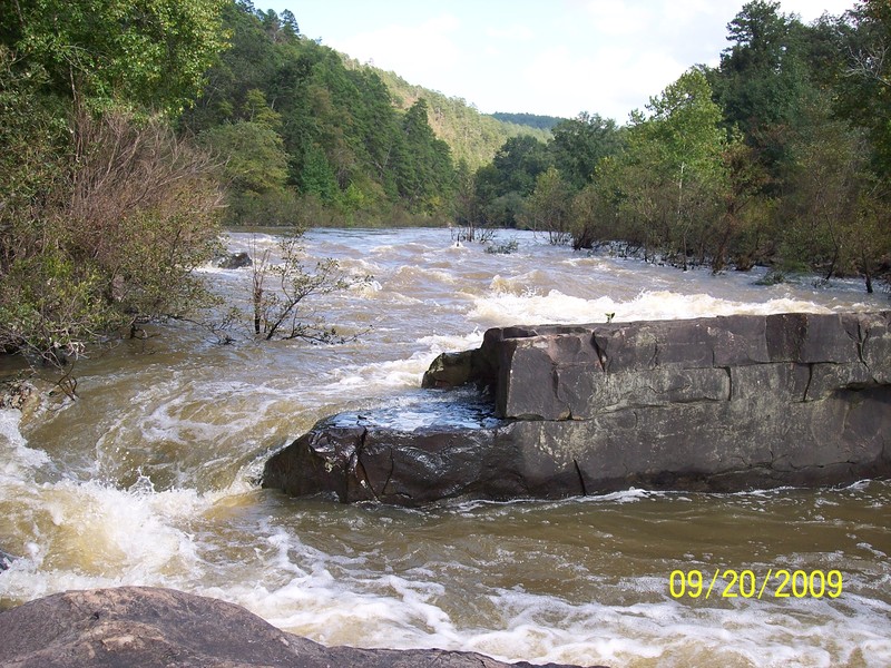
Sep 20, 2009
I floated this river at a 5.5; 6 is considered dangerous so the current was moving fast this day.
There's a horizon when coming upon the rapid. Go river left and avoid the hole in the middle of the river. There's a rock in the middle of the river that's hidden at this level. If you do go river middle then you will go over this hidden rock and plunge into a 4 ft hole. Regardless if your canoe has floatation, you will surely swim...
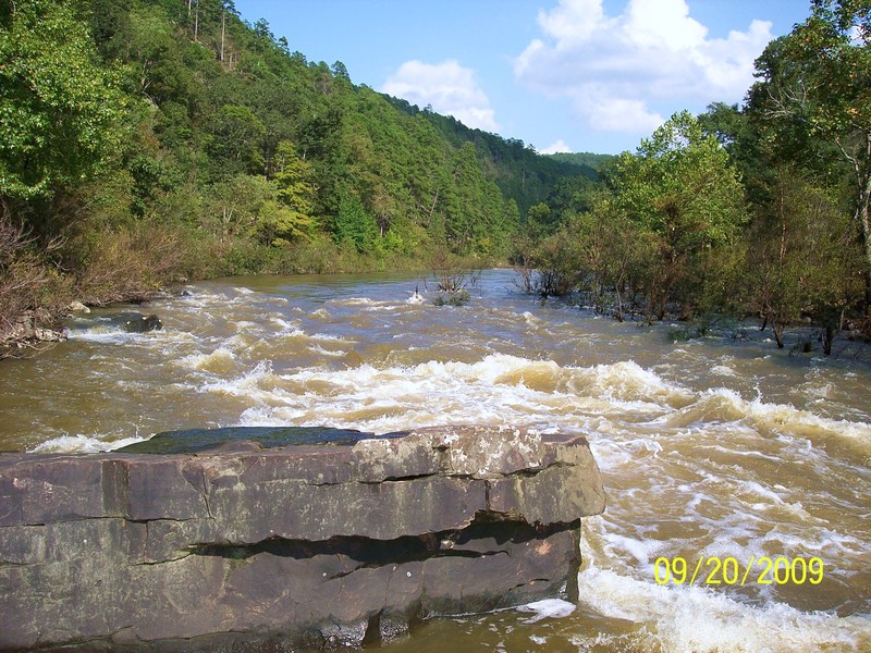
Sep 20, 2009
The river was at a level of 5.5 when we floated it.
Jan 25, 2004
Wave/hole above the main ledge near the take-out.