Flat Shoal River
1: Hwy 11 to Flat Shoals Bridge
| Difficulty | I-III(IV) |
| Length | 3.4 mi |
| Avg Gradient | 60 fpm |
| Gauge | Chattooga River Near Clayton, Ga |
| Flow Rate as of 1 hour | 1.39 ftbelow recommended |
| Reach Info Last Updated | October 29, 2006 |
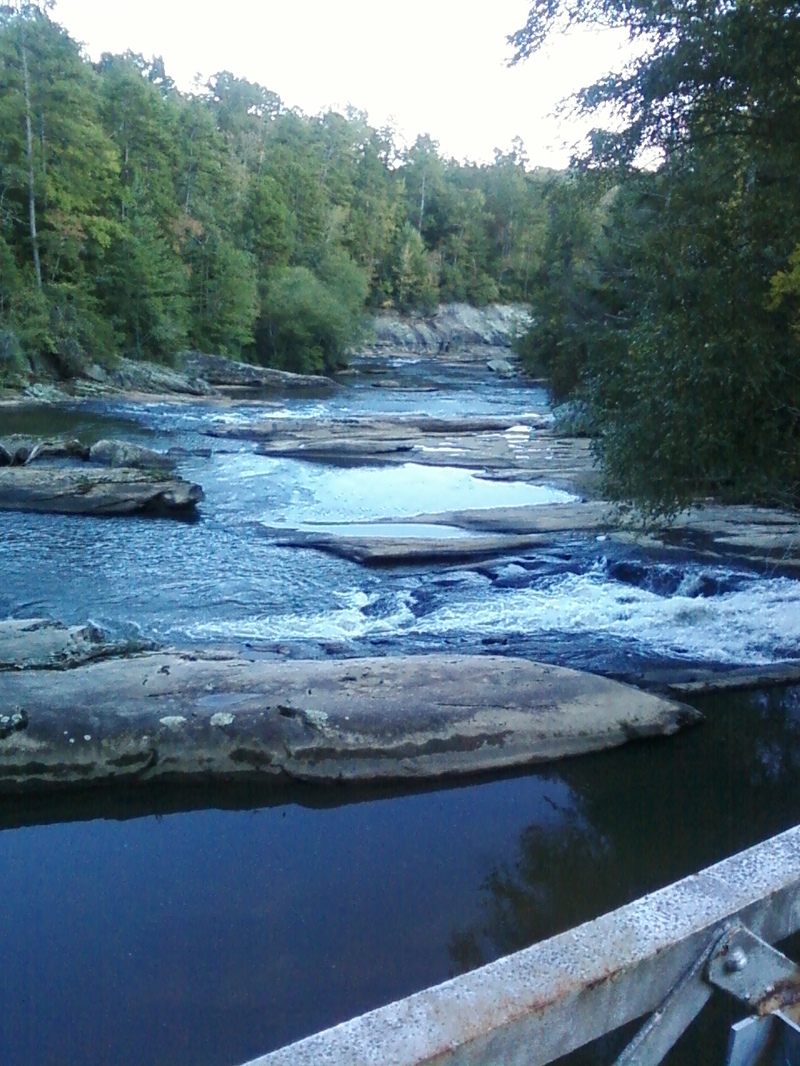
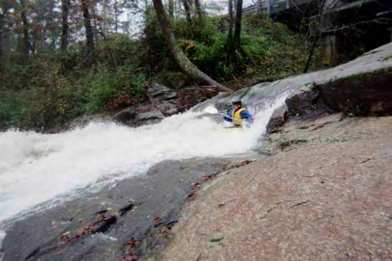
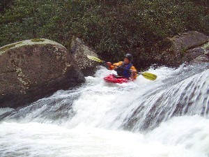
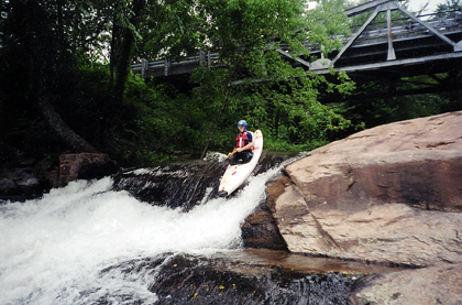
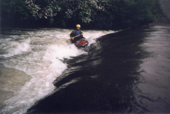
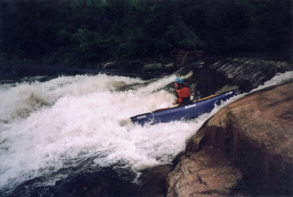
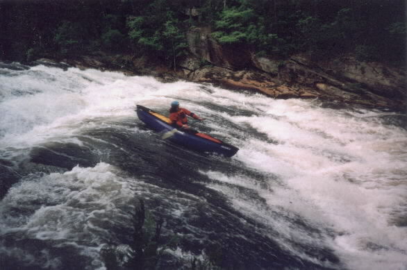
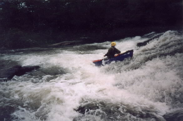
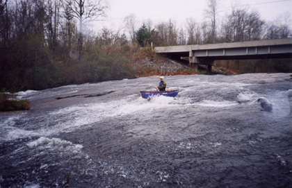
Flat Shoal starts off with quite a bang. The put in is a submerged old roadbed that forms a nice hydraulic and possible play spot at most flows. There are a few small play holes about twenty meters downstream and then the river goes under an iron bridge and plunges over Flat Shoal Falls. The first drop is a nearly vertical ten-foot ledge. Be careful when running any of the ledges because there are up thrust rocks at the base of most drops. There is no doubt that from this point to the edge of downstream view the river is dropping at an incredible gradient. Next three rapids are a quick succession of nearly vertical slides and ledges. Some of these drops have alternate lines and pining rocks so be careful and scout often. Trees also get stuck in the rapid after floods. The river makes a sharp turn after the falls and appears to calm down. Don't be fooled because another potentially dangerous rapid can creep up after the next island. Flat Shoals then slides over some additional rapids before flattening out for about a mile. The river picks up briefly immediately above the Little River Lane access point on river right. Contrary to the topographic maps there are no bridges between the falls and Flat Shoals Bridge at the takeout. After Little River Lane the river flows over several small ledges before plunging over a big 20 to 30 sliding waterfall. Flat Shoal then picks up gradient again and produces a few more class II rapids before flowing over the sliding drop at the takeout.
In order to clarify the lines the following comments were given in a recent email by Will Reeves
So here are my takes on the steepest section of falls on Flat Shoal - 1.
As a disclaimer I am an open boater and only assume my lines work for kayakers.
The first drop is immediately past the steel bridge. It has some concrete additions that make the drop almost even across the top on the right. I have not scouted the drop at low flow to determine if any rebar remains from t
...
The river crosses a roadbed at the put in, which forms a decent play hole at some levels.
Flat Shoal plunges over four distinct rapids at 'The Falls'. All of the drops have relatively clean lines, but be wary of trees in the slides. At high water this half mile of river becomes one huge rapid.
The class IV rating for the run really reflects the fact that the four rapids or drops of the falls are very close together.
There is an access point a the top of first drop.
A trail runs down the river left bank to the base of the third drop.
The first ledge on the river is almost below the iron bridge. I suggest boofing left a high water or running the main tongue at lower flows. Rebar might be present but none has been detected yet.
You can put in here at the bridge.
The second ledge is the largest single drop on the river. The run down the right seems cleaner than the left, but either are probably ok. At high flow a huge hole forms above this drop.
The third ledge is easier unless you take the far left line down the slot (class IV). A slightly undercut rocks guards the middle of the drop.
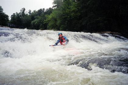
The last ledge is the easiest. Just don't go down the left into the rocks.
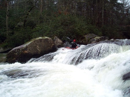
After the falls the river appears to calm down but don't be fooled. A big 8 foot ledge with a huge undercut rock in the center of the river is lurking past the first island. The left side lines appeared best a medium to low water.
Alternate takeout/putin
Some easy class I-II rapids lead up to the road access.
This takout will cut off most of the flatwater and all but a few drops.
This access point is a fire department water pumping point. It is illegal and unadvisable to park in a way that would block a fire engine from reaching the hydrant here.
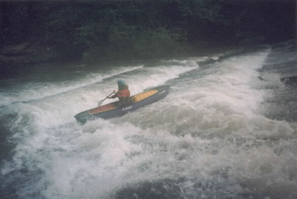
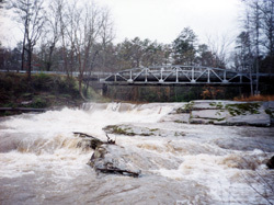
The river picks up again after passing the Little River Lane access point. A huge horizon line and some streamside buildings mark a large sliding drop. Other than the possible trees in the rapid most lines appear safe.
This big slide is the final drop in section one of the Flat Shoal River. Take out on the left past this drop and carry up to the road.
how long does it take to paddle this section
Takes about 21/2hrs at 2.68 on gauge. Would not run any lower than this level...Surprised even at this level it had plenty of water to run for such a small narrow creek.