Clear Creek
1- confluence of Nth. & Mid. Forks to Moiser Gulch Picnic area(The Canyon)
Jun 5, 2010
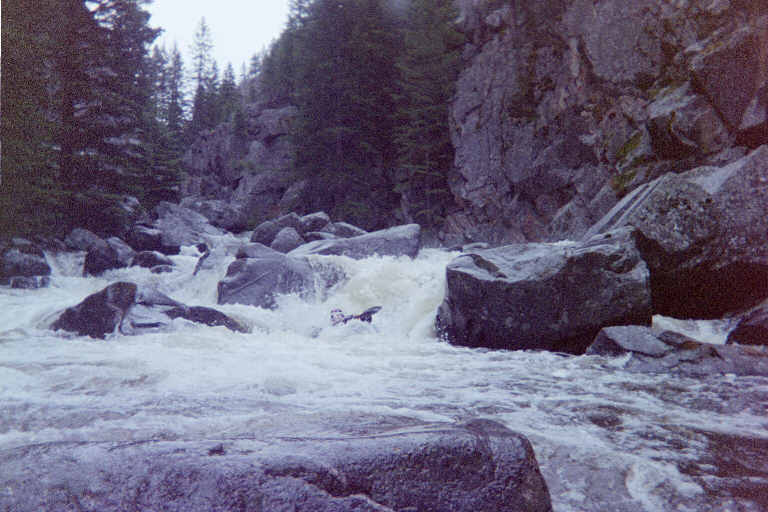
We went up to Buffalo and the Clear Creek canyon today and were lucky enough (or unlucky enough) to catch a high water event. This description and the book description (both by Dan Crain) say 1.9 ft on the town bridge is a high level. We observed ~3.0 ft on the bridge gauge. I believe this correlates to 750 cfs or more on the NOAA site gauge:
http://water.weather.gov//ahps2/hydrograph.php?wfo=riw&gage=bccw4&view=1,1,1,1,1,1,1,1&toggles=10,7,8,2,9,15,6&type=0
This is the proper gauge for this run, but I don't know how to change it on here. We walked the stuff near the picnic ground then up from the low head dam (take out). Don't think we saw any of the named big rapids, but it looked like big pushy swift class 5 (and should be at that flow). Very beautiful canyon, like to see it at a reasonable flow.
May 15, 2002
New wood and old wood at Turnback. Hopefully will get it out before 2003.
One of the best feelings in life.
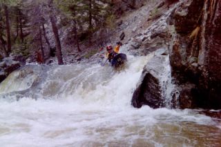
Brownie is the run out of the steepest and tightest spot in the Canyon...
Ledge Island is 3 ledges followed by this run out.
May 15, 2001
Turnback a nice little rapid on a 90 degree right turn proceeded by a strainer in 2002. Turnback feeds into the needle.
The needle. Make sure you shed it. Comes directly after Turnback.
If you can be in love with a river I'm in love with Clear Creek.
This is a must make eddy due to wood downstream
Jan 1, 1900
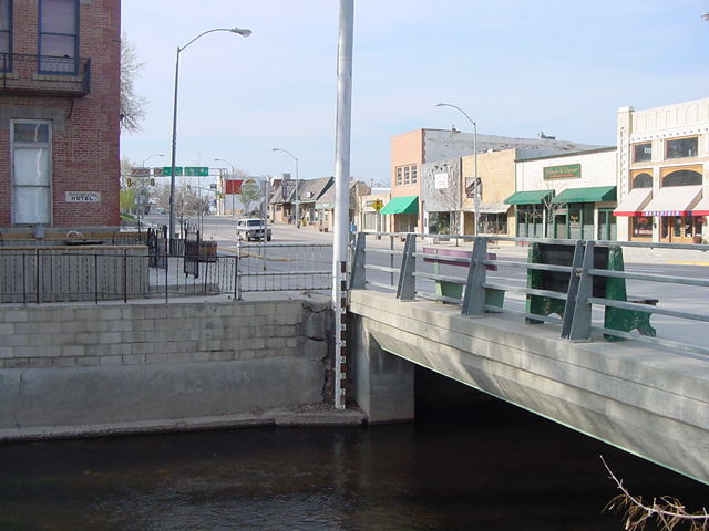
This is the downtown river gauge. 8' to 1.5' is nice for the Canyon. Mosier Gulch section is nice between 1.2'-2.0'