| Difficulty | IV |
| Length | 4.9 mi |
| Avg Gradient | 120 fpm |
| Gauge | East and West Hickman Creek Combined |
| Reach Info Last Updated | February 19, 2011 |
River Description
White Oak creek was first partially hiked and then paddled in early summer 2001 by Hugo Araneda, Rob Pinkerton, and Doctor Noname. This trip and one other in the same summer are the only known descents.
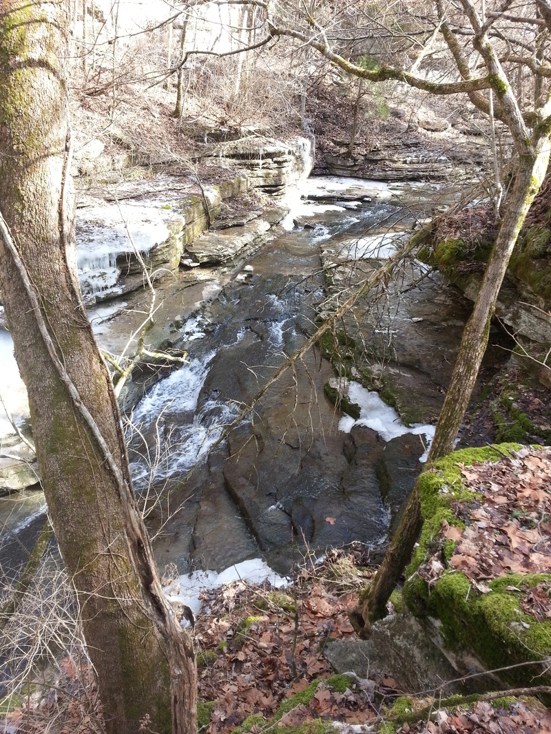
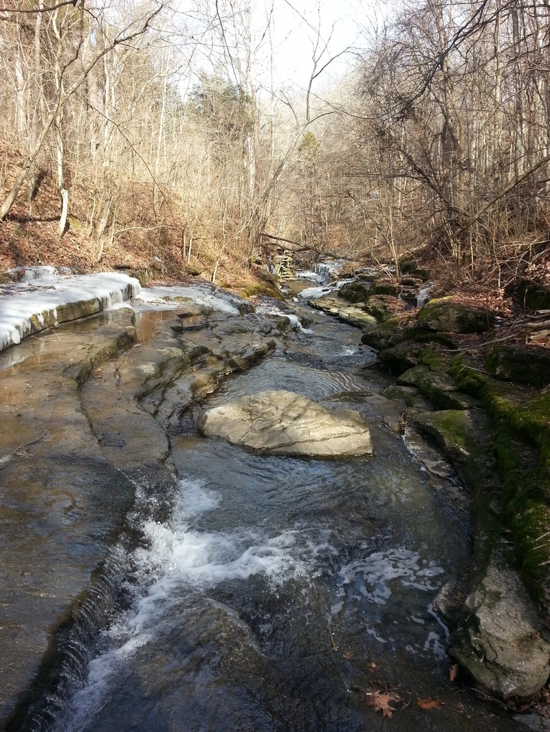
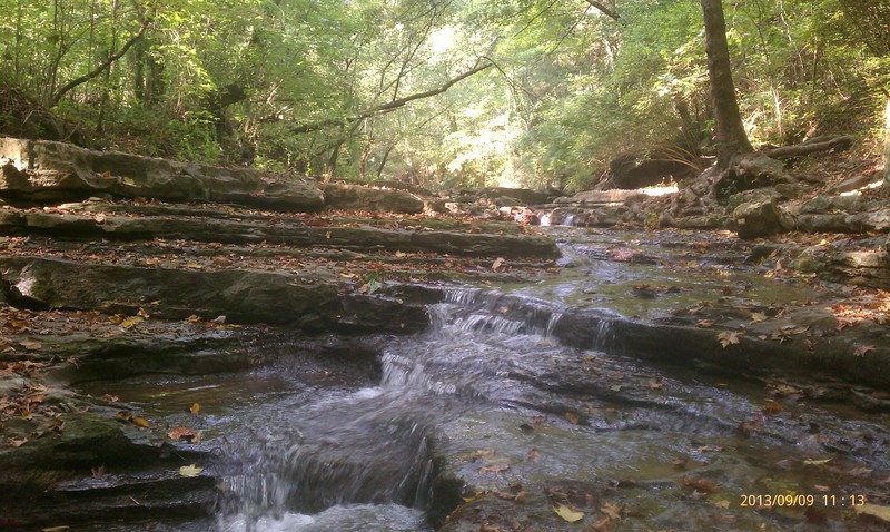
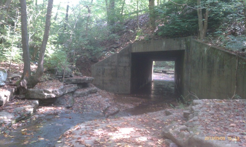
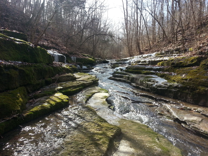
The creek is very narrow for most of its length (sometimes only a couple of boat widths), continuous, and contains numerous fast sliding rapids. The put-in consists of a decent warm up rapid leading into a concrete culvert, and is only the beginning of an approximate half-mile series of slides that culminates in a dramatic 10-15ft drop. There are also several blind areas with limited bank scouting, and (when paddled in 2001) at least three strainers that posed danger. Additionally, the creek is in a steep, high walled gorge that would present a difficult hike out in the event of a mishap.
Unfortunately, White Oak creek is extremely hard to catch because of a small drainage and limited takeout access. The put-in is best accessed by a short 'trail' through the woods leading from a single vehicle pull off on the left just before the KY 1845 bridge. The only known takeout option is to paddle upstream on the Kentucky River approximately two miles to the Riverview boat ramp located under US 27. The ramp is accessed by turning left (if coming from Lexington) and driving one mile on 'Old Lex. East' road just at the top of the hill across the Kentucky River in Garrard County. This was done on one trip, with the other being assisted by a motor boat shuttle. The trick is to catch the creek after a summer thunderstorm with plenty of water, but before the Kentucky River has started to rise.
Land adjacent to White Oak Creek has been purchased as a preserve by the Nature Conservancy. This could potentially lead to better access if trails are developed, however, several rare species have been identified in the area. Be aware of their protection goals if accessing the area and promote cooperation.
River Features
Take Out
Access PointDistance: 2 mi
Trip Reports
Log in to add a report?
Untitled
Feb 2, 2014
Checked out White Oak yesterday (2/1/14). Due to the icy/muddy conditions and increasingly steep banks, I was only able to hike a few hundred yards downstream from the put-in. I have much respect for anyone who has paddled or will paddle this creek. It is probably the most demanding of the palisades area runs when you consider the vertical nature of the gorge, the gradient of the stream (scarcity of eddies), the many blind turns, the high potential for wood, and the difficult takeout. I even found a small boulder sieve in one spot which, while easily avoided, is very unusual for this area. Once you put on this creek you are pretty much committed until you hit the river. I look forward to coming back in the summer, because the only feasible way to scout this run is by hiking down the streambed, and that just wasn't possible yesterday due to the ice. A final note -- there is a real trash problem in the gorge, with people dumping everything from beer cans to refrigerators. I also found a homemade deer stand that was fairly new, judging by the condition of the wood. I plan on contacting the nature conservancy soon, and sharing the photos I took of all the trash with them. With their help, I would like to organize a cleanup of the gorge sometime this year. I will post more details if this comes together.
?
Untitled
Feb 2, 2014
The gorge has a lot of mature cedar trees. While this deadfall wouldn't pose a hazard in its current position, there are doubtless many more downstream.