Hudson
6. Feeder Dam to Glens Falls(FERC P-2554)

| Difficulty | I |
| Length | 1.6 mi |
| Avg Gradient | n/a |
| Gauge | Hudson River at Fort Edward Ny |
| Flow Rate as of 34 minutes | 1870 cfsrunnable |
| Reach Info Last Updated | April 12, 2016 |
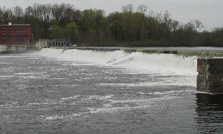
This is a short flatwater paddle between two dams, but briefly:
-To portage around or put in at the feeder dam, carry river left over the bike path bridge over the canal and put in near the rocks on the other side of the bridge.
-The best take-out just above Glens Falls (the falls, not the city) is on river right at the sign that says 'Canoe Portage Access'. Park at the park across the grassy field. Construction on the Rte 9 bridge has the area a mess for a while.
-Access in this stretch includes Haviland's Cove Beach on river left and South Glens Falls Beach on river right.
A great map of this section is at Glens Falls Urban Bike Map.
South-Eastern Adirondack Area Reaches
Batten Kill Beecher Creek County Line Brook
Dunning Creek East Stony CreekElbow Creek
...