Madams Creek
Madams Creek Road to New River at Hinton
| Difficulty | III+(IV) |
| Length | 2.1 mi |
| Avg Gradient | 75 fpm |
| Gauge | Piney Creek at Raleigh, Wv |
| Flow Rate as of 41 minutes | 1.95 ftbelow recommended |
| Reach Info Last Updated | January 5, 2006 |
This creek is one of those that rise and fall very quickly. Usually it will run for about 30 hours after its watershed in Summers County receives an inch or more of rain. Only the final two miles is runnable until it reaches its confluence with the New River right below the Hinton New River Bridge.
To get to this creek from interstate 64 you would take the Sandstone/Hinton exit and follow rt. 20 through Hinton and turn right at the first stoplight and cross the bridge. Then you would turn right after the bridge and then left. You should now see Madams Creek. Gauge the creekÂs level by looking at the waterfall you just passed over on the small bridge. If water is pouring over the entire fall from bank to bank it is at a runnable level.
The majority of this creek is road scoutable so take advantage. The put-in is questionable since it is all private property so be respectful. Follow this road alongside the creek for approximately 2 miles until the road splits and you see a waterfall to your right. There is room here to pull off and put-in. Only the last 3/10 of a mile will provide any appreciable elevation drop so take time in this section to warm up and get your game on. It is class II-II+ with a few fun slides and ledges. Be aware of the strong possibility of strainers.
The first large horizon line will signal the start of the fun stuff. This is a 5-6 foot two stage fall. Run center or right-center because of a large strainer 12-15 yards downstream on river left. Your next horizon line is a 4 foot drop. Run left at lower water and right at high water. Beware of the strainer on river left below the drop. As you make your way down the creek a small island will split the creek. AVOID going anywhere near this island by staying left; there is a chain link fence strung between its trees.
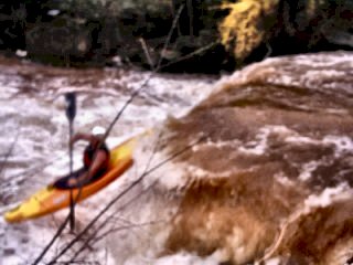
Now get ready for the best (or worse) rapid of the day. I would rate this a class V simply because of its danger. It is a 3 section, almost continuous slide ab
...Sep 15, 2007
From: Dave Hersman
Several people I paddled with ran it in the early nineties (some in open boats!) and I suspect it was first run in the 70s.
Nov 19, 2003
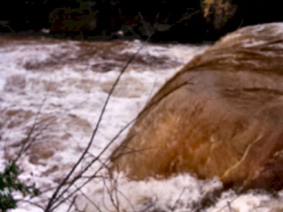
Usually there is water over only about 20% of this lip.
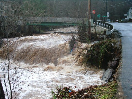
Wow. And this was after it had gone down about 2-3 ft after peak.
You can see how high it had been earlier by the road that was almost washed out.
May 18, 2003
Have you ever seen a more horrible looking undecut?
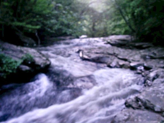
Nice relaxing slide in the woods with a nice surprise at the end. Two nasty undercuts!