Pipestem Creek
Tom Honaker Road to Bluestone Lake
| Difficulty | II-III(IV) |
| Length | 4.3 mi |
| Avg Gradient | 80 fpm |
| Gauge | Bluestone River Near Pipestem, Wv |
| Flow Rate as of 25 minutes | 3.36 ftbelow recommended |
| Reach Info Last Updated | November 19, 2003 |
For a local boater this creek is a nice experience.
Directions:
To get to this creek take Route 20 South from Hinton or North from Princeton. To keep things simple I will reference all lefts and rights coming from Hinton. The takeout is the boat launching area on Bluestone Lake on Pits Road. (Its not in the Gazetteer, but itÂs the last left before Bluestone State Park.) Continue up this Rd. for a few miles until you see a small white church on your right called Community Bible Chapel. A few seconds up the road you will see a pull-off on the left and a mailbox that is #208. Stop here and take a look at the small bridge on the Creek. If the bridge is totally immersed in water 4-6 inches deep then the creek is at a good level.
Continue up the road about another mile until you see some old railcars that have been restored sitting in a yard on your left. The roadÂs name is Tom Honaker Road. This is the put in. Another creek comes in right here and adds just enough extra volume.
Pipestem creek above this put in is quite hairy (some unrunnable class VI sieves), especially right below the 20 ft falls that are a mile or so up the road but, alas, there is usually never enough water for a run.
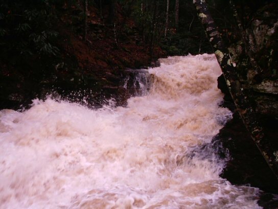
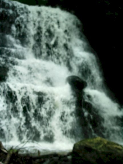
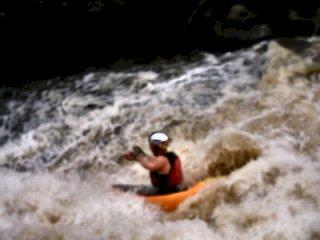
Put in here at this bridge and enjoy the almost constant class III rock gardens and slides. There were a few strainers when I ran it, but they were all easily avoidable. There are also a few short ledge drops to mix things up. There are only two major rapids that need detailed description. The first you should have seen by the road just below that convenience store named Bluestone Satellite. It is a diagonal curler that could mess you up if you run it blind. Just make sure that you have the right angle to punch it. Shortly after this is the highlight of the day. There is a dirt road that crosses the creek not far downstream from this curler. It creates an eddy on each bank. Get out and scout on the river right bank. There is a class IV,
...Possibly runnable at really high water. 3 problems - 1) a large shelf sticks out in the middle of the fall along with a boulder, 2) the pool is shallow and short not allowing a for a good launch at top, and 3)exit? what exit?
exit? - what exit?
To beat it all, look how sketchy the lead up would be!
landing pool or kiddie pool?