Dicks Creek
1- First WMA Gate to Old Waters Creek Campground(Falls Section)
| Difficulty | V |
| Length | 0.7 mi |
| Avg Gradient | 135 fpm |
| Gauge | Chestatee River Near Dahlonega, Ga |
| Flow Rate as of 1 hour | 171 cfsbelow recommended |
| Reach Info Last Updated | February 18, 2006 |
The Falls stretch of Dicks Creek is a little under a mile of some roadside park & huck gnarr. You can see it all from the road. Rather than staying on the water for the 1.5 miles of flat water to the old campground, most folks take out and walk the nearby road back up to run again.
Park anywhere near the first gate (open except from January 1 to about March 15) on Dick's Creek Road, but don't block the road. Restrooms are available on a side road jus off Dick's Creek Road on the nonriver side.
The well-known Waters Creek Campground is now closed: USFS has turned it into a day use area. Parking on the river side of the road is gone, but parking is available down the short dirt road across Dick's Creek Road from the old campground.
Starts with a gnarly manky drop full of undercuts on all sides with a nasty undercut rock and a few nasty potholes tossed in marks the top of this stretch. Its also got a log stuffed in the center.
This is followed by a big slide in the bend in the road.
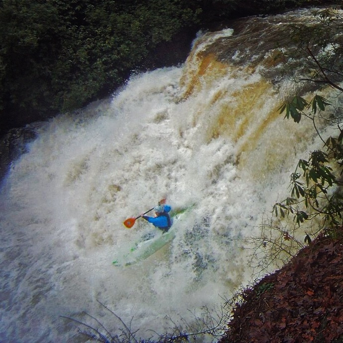
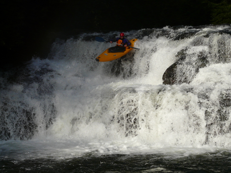
Then the big, 20-something foot vertical falls. Watch out for the piton on the right side, and the undercut on the left.
Then another slide.
Then a slide, with another piton on the right and an undercut on the left.
Then another big slide, less steep, but with a big rodeo type hole in the middle, and a strainer where you would want to roll if you just flushed out of the hole.
All of these drops have fast moving flatwater between them. All of them are roadside. All can be portaged. None of them are particularly clean. After the last slide its about 1.5 miles of flatwater to the big slide above Waters Creek Campground, so we made that a separate run.
DIRECTIONS: From Turners Corner, take Highway 19 west just over a half mile and turn onto Dick's Creek Road. (Look for the 'Mt. Pisgah Church' sign.) This reach begins at the ranger station or at the gate just uphill of it.
Both sides are undercut. Strainer still lodged in the middle. Pothole on the topleft that looks like it goes to the center of the earth. The rock in the bottom of the photo makes a diagnol undercut ledge. Just an Ugly rapid. Dangerous.
The slide on the right is a safe line to avoid an undercut sluice.
A 10 foot boof which lands directly on another 10 foot boof. This rapid is similar to the middle line at Gravity on Overflow Creek. When there is water, this is a great drop. You have to link Boof, Land, and Boof extremely quickly. This is a rewarding feeling when you nail both boofs.
Big slide with a big hole at the base. Last seen there were some strainers in the pool backing up the hole.
Mar 15, 2006
Per USFS, the gate at the ranger station will be open for the season as of March 17.
Jan 11, 2006
New Streamkeeper: Rick Bellows, chestateer@yahoo.com.
Jan 1, 1900
There looks like there may be one clean line about 24 inches wide on the right side of the slot that appears at the top right of the picture. The protruding rock on the bottom right is at least a hanging vertical pin and at most a decapitation.
Looking down from the top-this may or may not be clean. Note the very bad rock on the left side.
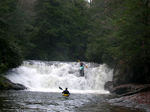
Two drops above falls plus local posers.
This is the undercut after the second drop above the falls.
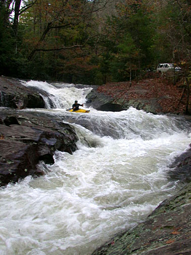
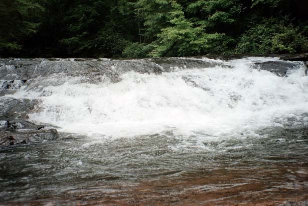
Last slide after falls.
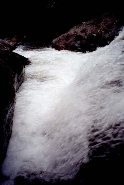
River left side of the first slide after the falls.