Timmerman Creek (III-V+)
PUTIN: Youkers bush road
TAKEOUT: Route 5/Main St. (follow mill road down the hill and take left on main road. first creek immediately when you take a left)
Description:
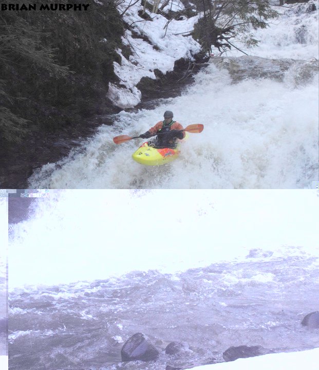
Another day in paradise for the DEMJOEZ crew laying down the first descent. The crew this day (3/19/11) consisted of Todd Caza, Dustin Caza, Edward Moorhead, Gino Dicollia, Brian Murphy, Pat Underwood, and Steve Edmunds. Please make note if you have ran this section before for proper credits.
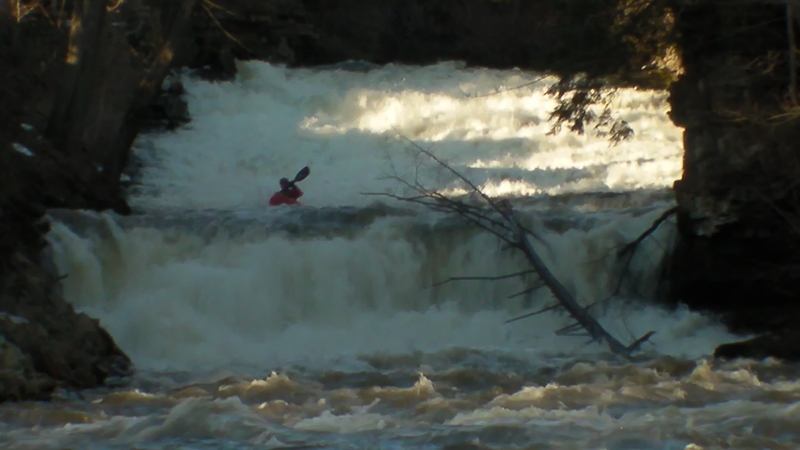
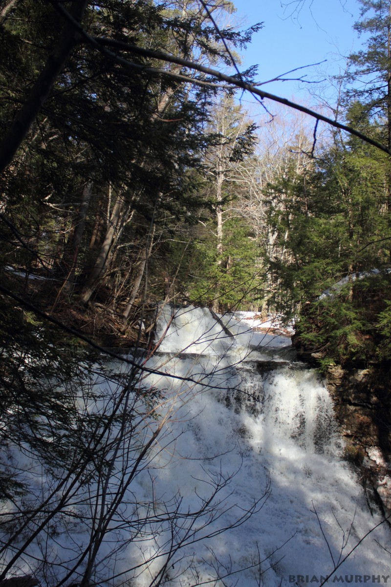
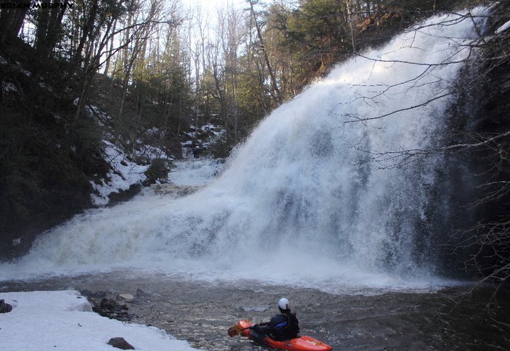
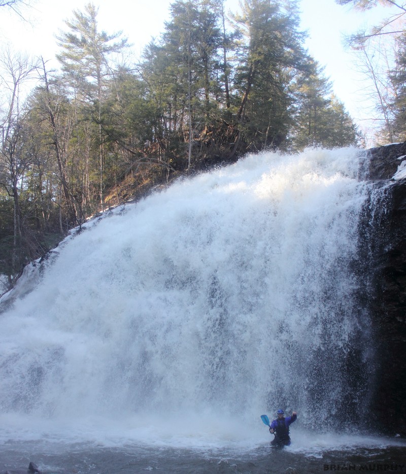
First thing first, the gauge indicator that I took note of was a bridge toward the first ¼ of the run (Richards road I believe). When we ran this, the water level was about 2 inches below the cement step under the bridge. I would recommend this at a bare minimum level. An even water level would be a good level, anything higher hang on to your trousers because eddies will disappear and there is a few large drops you don’t want to get into without a scout. Be cautious of strainers as we encountered many all of which we were able to pass (including a garage, yes, a garage that is washed into the middle of the creek after the final large slide). ****SCOUT THE LARGE DROP**** on crum creek road, there is a benefit club on the right hand side. The people here were nice and gave us some info on the large falls (approx 80 ft from top down) they allowed us to go behind the club and over the fence to scout. Take note of visual indicators and make sure you get out before the falls as they are not passable river left of the island. Scout the right side and decide accordingly, portage would be recommended on river left though on a faint trail that walks into the gorge vs. river right side that has steep canyon walls.
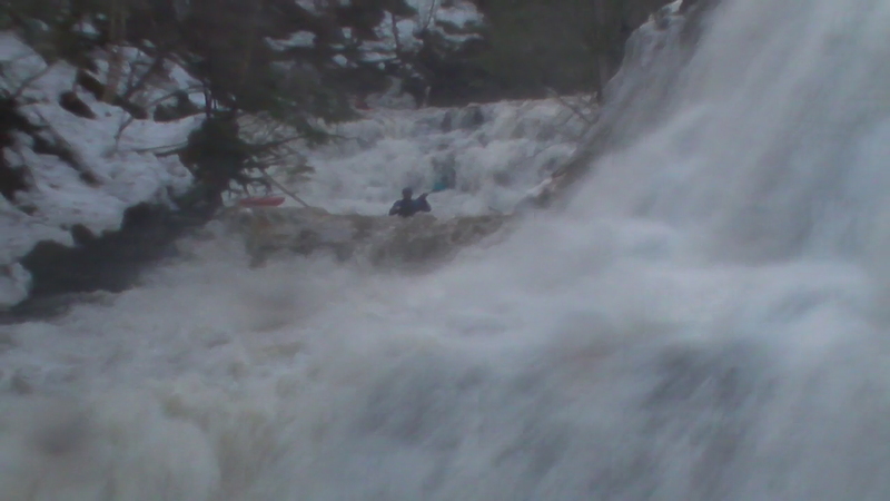
This creek consisted of non stop whitewater with micro eddies here and there. The first 2 miles or so consisted of class III+ boogie and slides with one main drop to be noted before Crum Creek Road. It can be scouted from the road, you will not miss it when driving shuttle. Just beware of the no trespassing and keep out signs posted all around it. We ran this rapid to river left side; hit the boof at the bottom. After this rapid you will go under Crum Creek Road Bridge. Take out here if it’s been too much, otherwise you’re committing to some large drops, or having a crappy steep hike out. After the bridge strainers became more abundant around some blind corners, you will not have any major rapids until the large drop that you scouted behind the benefit club, and took note of a place to stop and scout. A large rock island splits the river into two flows, with the left side taking most of the water. The river left side of the falls consists of a manky slide for about 10-15 feet, then you fall off the face of the earth and drop approx 70 ft into a 3 ½ foot pool. (I stood at the base of the falls and the water was below my waist.) Definitely not runnable. The right side of the island is one of the gems of this creek. Staircase falls (Class 5.3). From top to bottom is a cascading staircase of water that spirals around to the left. It starts with a 5 foot boof, instantly into the first slide, stay right. If you end up left, you’re going to drop much faster than desirable into a rocky bottom. Stay right. A quick flat to blink, then immediately into the next slides down about another 15-20 feet. From here the river turns the corner and quickly drops again on a steeper slide another 10-15 feet, land and catch the current and build up speed driving right for one final boof of 8-10 feet and whoa buddy, it’s over before you know it! You made it to the end. Turn around and take in the glory of the vertical river left and right sides combining into the pool your sitting in. Boogie on down the river for a while and you will come up to your final series of slides that will end you with a bang (Brian’s Cannon, Class IV+). Brian’s Cannon is named due to Brian ‘s camera falling out of his boat as we scrambled to catch an eddy and downstream it went. (A side note, local townspeople are great here. One guy searched the river and found the camera caught up in a strainer and went in to get it, and return it, clothes and all. We were welcomed at the end with beers and hospitality just down the road. Thanks again Kevin!) Back to the rapid; once you enter this rapid, you’ll be taking off barreling down the creek. Scout this from high above as you set the shuttle. This set will be just upstream of a large 4 story old stone house. This rapid is pretty strait forward but if you flip, you’ll be the new scar face. Drive right the whole time due to a tree in the last drop on river left. This whole rapid starts with a bend in the creek to your right and into the first large slide. A short calmer area, then into another large slide, with a 10 ft ledge at the bottom. After this rapid the only thing to watch out for now is some strainers, and a garage that washed into the creek during a recent flood. You can get around it on river right. Takeout will be just downstream. This creek will surely become a favorite in the whitewater community!