Moccasin Creek
W. Wildcat Rd to Lake Burton
| Difficulty | III-IV(V+) |
| Length | 4.3 mi |
| Avg Gradient | n/a |
| Gauge | Tallulah River Near Clayton, Ga |
| Flow Rate as of 15 minutes | 78 cfsbelow recommended |
| Reach Info Last Updated | December 21, 2006 |
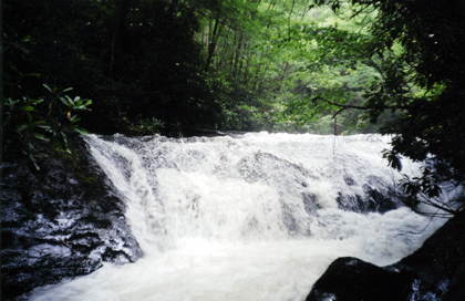
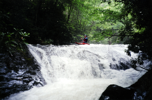
There are really two different runs on Moccasin Creek. One option is to drive all the way to the end of W Wildcat Rd. and put in on the headwaters near a wildlife opening. The stream is open and shallow but surprisingly deep in spots. This option take lots of water and has some disadvantages including LOTS of trees and one huge waterfall that proably must be walked. There is a nice trail and campsite on the river right. The second and more realistic option is to carry up the Hemlock Falls trail for a mile or more. The trail degrades quickly after Hemlock Falls but there are plenty of difficult and large rapids in this section. Most boaters will probably take out at the WMA trailhead but you can boat all of the way down to Lake Burton. There is a small dam for the trout farm ten yards above the final road crossing. Please walk around the dam to keep the Park folks happy. Remember this is a popular trout fishing creek.
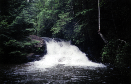
A vertical waterfal with scetchy landing zones. If you carry up from the bottom this is almost at the one mile point.
Sep 13, 2009
rapids: (from top) hemlock falls, ambrose alley, corner box, little hemlock falls, jungle boogie, big snake, double dog and alien eyeball. enjoy!