Wildcat Creek
roadside to W. Wildcat Creek Road
| Difficulty | III-V |
| Length | 2.2 mi |
| Avg Gradient | 238 fpm |
| Gauge | Tallulah River Near Clayton, Ga |
| Flow Rate as of 16 minutes | 78 cfsbelow recommended |
| Reach Info Last Updated | February 17, 2021 |
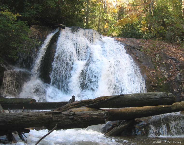
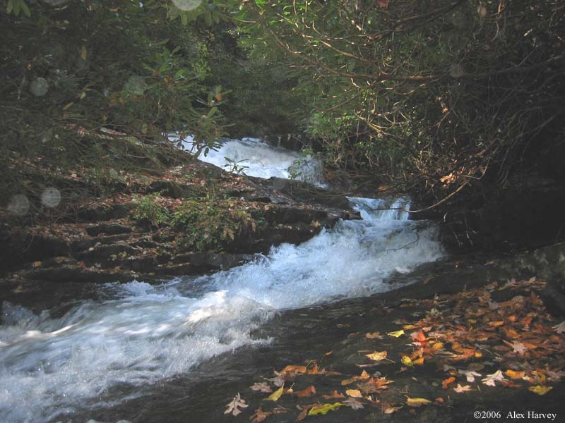
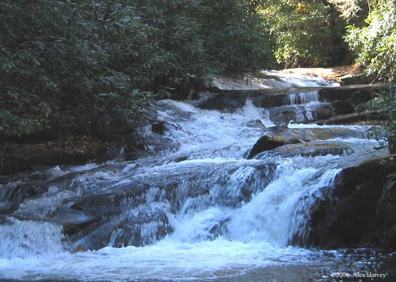
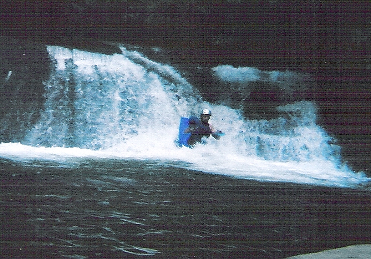
Wildcat Creek flows off of Dismal Mountain and is in the gorge just south of Moccasin Creek. It is a very small creek that has a lot of potential, considering its diminutive size. This information comes from one run that I did with no flow and no beta; if anyone has any information on the names of the rapids or when it runs, please contact me and I will update the page. At mile 3.1 (see below for directions), just above a campground is a mini-gorge in which the creek drops about 80 feet through a series of sluices and slides. The creek is extremely small at this point but is confined by the bedrock and seems runnable. One sluice does pour menacingly into a mild undercut so a scout would be in order. Below a bridge at mile 2.5 is a good access point for the heart of the run, which drops ~290 ft in just over a mile. Jessie Branch comes in just downstream and increases the flow significantly (but you can still count the cfs on both hands). The gorge is predominantly a series of small slides. The rhodo is heavy but tolerable, there is little in the way of major wood blockages. Be wary of a large falls, tentatively named Deflection Falls. It is a beautiful 25 ft cascade preceded by a 4 ft weir-like drop. The falls is not runnable due to logs at the bottom, even without the logs, the landing zone is tiny, but does seem to be enticingly present. There is an easy portage on the left. Another significant cascades of about 20 feet, tentatively named Gravity’s Little Helper, deserves a look and is a very cool drop. Scout on the left. After the bridge at mile 1.4, there are some fun roadside slides that are used as park and hucks. Just above a menacing drop decorated with old wood is a nice takeout point. The creek abruptly drops thereafter, with one large cascades, Wildcat Falls, that is obstructed by wood. The runnability of the Falls deserves a look. Directions: see p. 16 of the Georgia Gazetteer. From Clayton, drive west on hwy 76. Turn south onto hwy 197. After passing
...