| Difficulty | II-III |
| Length | 17.6 mi |
| Avg Gradient | 27 fpm |
| Gauge | Piedra River Near Arboles, Co. |
| Flow Rate as of 44 minutes | 18 cfsbelow recommended |
| Reach Info Last Updated | April 27, 2026 |
River Description
IMPORTANT: Please visit the Southern Ute Indian Tribe's website for regulations on boating and fishing the Piedra River within the SUIT reservation boundaries. The Tribe permits non-Tribal members to float through reservation lands on the Animas River, Los Pinos River, the Piedra River, and the San Juan River. However, only people who are actively fishing (and with a valid fishing permit) using a small craft may put-in or take-out at specified fishing access points. See below for additional information should you choose to complete the entire 18 mile run in one day.
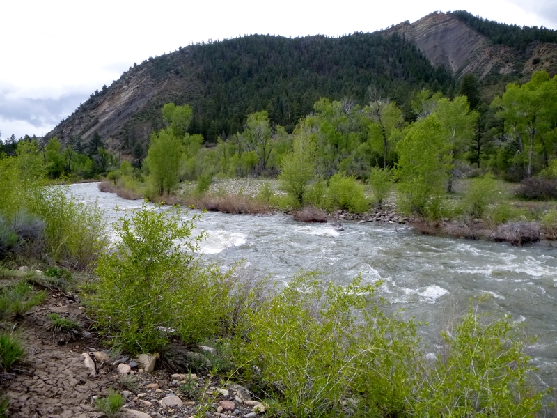
Within a mile of the Piedra Campground, the river canyon starts opening up. The valley gets wider and the river meanders more the further it goes. Most of the rapids are in the first few miles, but it looks like there can be waves and riffles here and there most of the way to the reservoir and even into the reservoir when it is low.
Getting There: This section of the Piedra is just north of the Colorado- New Mexico border and is about 50 minutes east of Durango Colorado.
The put in elevation is about 6590 feet and the take out is about 6096 feet, for a total drop of 494 feet over 18 miles.
Other Information Sources:
River Features
Put In
Access PointDistance: 0 mi
Take Out
Access PointDistance: 18.2 mi
Trip Reports
Log in to add a reportPB
2025 Update - Peter Bradley
Jun 12, 2025
We had a great run in two packrafts and a Blue Hole canoe today. We paddled from just below the campground put in to Windsurf point on Navajo Lake, about 22 miles. It took us around 6 or so hours. Wanted to update this section with more beta for intrepid explorers!
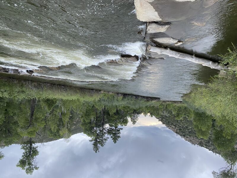
The first 5-6 miles include around 25-30 diversion dams. A handful have 2 drops (pictured below) and many have 1. The drops range from 1-3 or so feet.
Most were runnable, some needed to be portaged given low flows and weirdness of the diversions. A lot of them were recirculating after the drop, but easy to punch through. Curious to see it at higher flows and if it would get more reciruclating or more splashy/fun.
After passing through the Chimney Rock National Monument, the river has more of a natural feel, with mostly riffles and small rapids. Then the river rejoins Hwy 151 and it has a few more manmade features with a few diversion dams until it meets up with lake Navajo. One hazard of note is the 3 barbed wire fences running across the whole river in this section. All of them were runnable river center because they were fully submerged in the water and easy to navigate. However, something to be heads up for because sketch!
Would recommend taking out at the Piedra River takeout, rather than running all the way into the reservoir, unless you're psyched on more water. Coordinates are: 37.062486, -107.413955
Last thing of note was after calling the Southern Ute Tribal Office, it seemed like they wanted recreational boaters to get fishing permits. A lot of the run is on tribal land and would advise other boaters get them to maintain a good relationship and be respectful in this area. Here is a link to the permits: https://store.southernute-nsn.gov/product-category/hunting-fishing/
Here is a map of places you are allowed to go on land with a fishing permit: https://www.southernute-nsn.gov/wp-content/uploads/sites/15/2025/01/FAPiedra25-1.pdf
Great stretch that is slept on. Excellent for small boats and quite fun in a canoe!
KF
Kirsten Frickle and Mike Sweeney
May 10, 2015
Lower Piedra at ~850cfs
GS
Gary Skiba
May 27, 2014
Title should be changed to 'Lower Piedra CG to Navajo Reservoir' (replace the word 'Reservation' with 'Reservoir'. While the San Juan does eventually get to the Navajo Reservation, this piece doesn't.