North Oconee
Hurricane Shoals County Park
| Difficulty | III |
| Length | 0.11 mi |
| Avg Gradient | 80 fpm |
| Gauge | North Oconee River at College St, at Athens, Ga |
| Flow Rate as of 1 hour | 97 cfsbelow recommended |
| Reach Info Last Updated | January 15, 2021 |
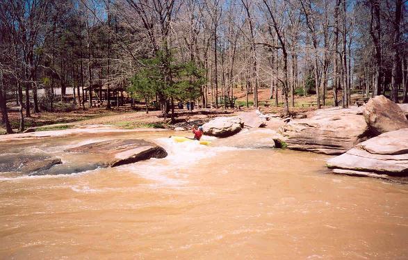
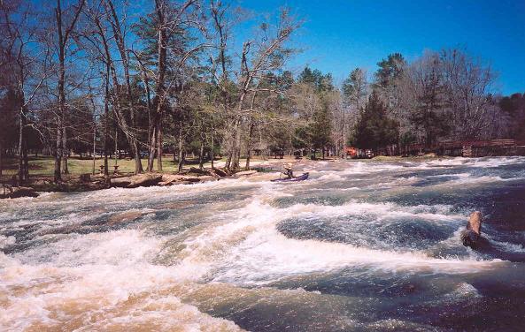
With a name like Hurricane Shoals, this little county park might draw any boaters attention. Careful examination of a topographic map shows a steep little section of rapids within the Park boundaries. The Park officials are not adverse to boaters, so this little section of rapids is open for playing. The water quality is not exceptionally poor and in the summer you are guaranteed to get some eye candy on the banks sunning themselves.
Now the bad news. Despite the name ÂHurricane Shoals the river is not all that exciting. Boaters will find a small dam followed by a series of three steep slides and a boulder field. The slides produce some surfing holes at the right water level. That is it. So this is a run for locals or UGA students who live near Commerce. It is not a hair run as you might surmise from the name of the Park and shoals.
The Park can close during the winter but you can easily boat down to the rapids and walk an extra 20 yards to get back to your car.
Also consider that the guage is downstream in Athens and is only an indicator of the water level in the run.
At high flow this set of shoals can pack a punch but also had good play spots.
Jun 16, 2018
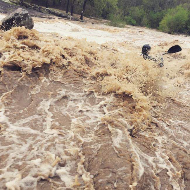
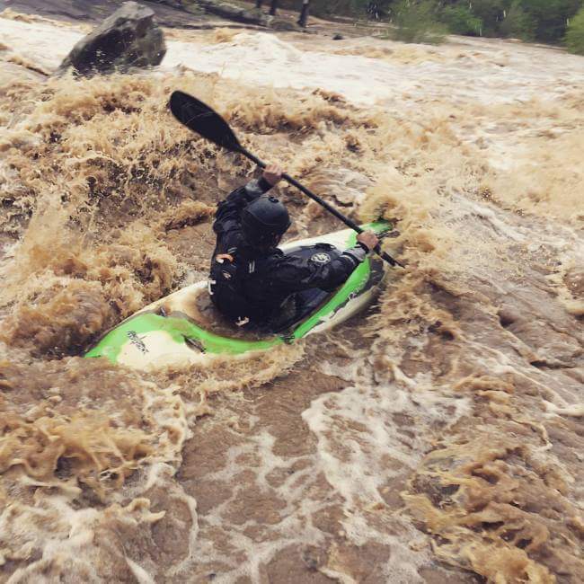
Big wave trains throughout at 8k cfs. Beware of the left side middle way down at yhis level. Monster of a hole
Apr 29, 2014
I went over here today (4-29-14). The level was about 380cfs and way to low for my taste. Had to wheelchair over a few places. There is a lot of potential here though. Lots of gradient loss over a short period. I would recommend the lower runnable threshold be moved up to at least 400 maybe even 450cfs.
May 12, 2008
i was dissapointed running this section in my kayak. i'm not confident that there is a level between not enough water and too much water to run this section. after walking back up to the top and ditching the gear, i had a blast sliding down the rocks on my behind. i would definatly recommend a family picnic here