| Difficulty | I-III |
| Length | 7.2 mi |
| Avg Gradient | n/a |
| Gauge | New River at Thurmond, Wv |
| Flow Rate as of 1 hour | 6.78 fthigh runnable |
| Reach Info Last Updated | June 1, 2023 |
River Description
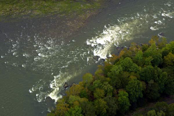
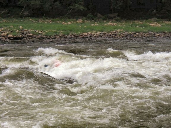
Mostly flatwater. Perhaps five class 2 rapids with long stretches of flatwater between them. There is also a class 3, with a big hole called Surprise. Surprise rapid is big enough to stand large rafts vertically at some flows.
New River Gorge National Park Website
NPS Guide to paddling the New River(Gauge Conversions Table)
River Features
Put In
Access PointDistance: 0 mi
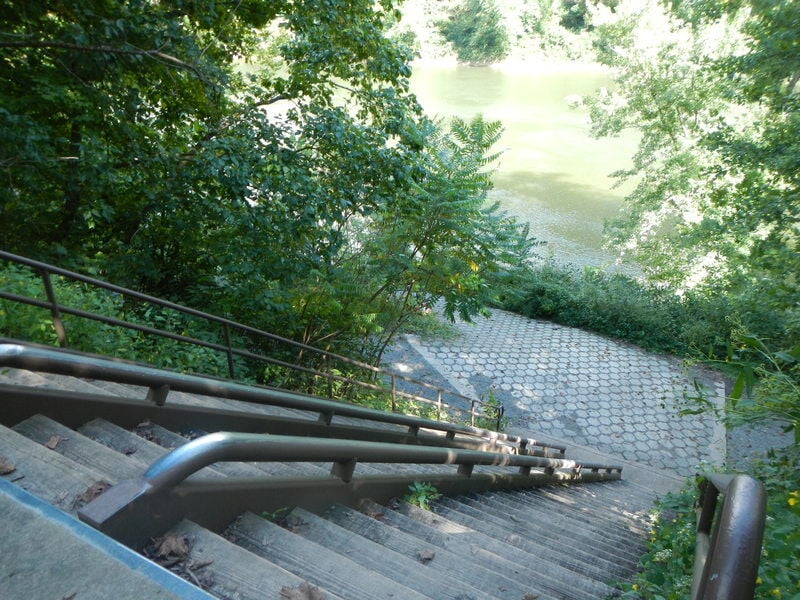
Take Out - Cunard
Access PointDistance: 9.4 mi
The Federal Highway Administration will begin improvements to the Cunard Road (Route 9) in New River Gorge National Park and Preserve starting on or around November 1, 2024, extending through the winter and early spring until around March 31, 2025. The extent and nature of the construction will require a full closure of the road and river access during this time.
The closure will begin just past the parking lot for the Brooklyn Mine Trail and extend down to the river access at Cunard and over to Angler's Access and Brooklyn Campground. Vehicles, bikes, and pedestrians will be prohibited beyond this point. Both the Brooklyn Mine Trail and the Kaymoor Trail will remain open, however trail users should be cautious of heavy equipment in the area.
The project is a coordinated effort between the National Park Service and Federal Highway Administration and involves a long series of road and drainage repairs. The old road will be removed, the roadbed and walls reinforced with improved drainage and wall stabilization, and a new road installed with a stronger and more stable surface better capable of withstanding inclement weather and heavy use.
[The Park Service has done a lot of work on the road down to the Cunard take-out. Even so, it is steep, made of gravel, and at one point a one-way. It can get very busy on a summer weekend when everyone is fighting to get down or up, especially with the buses for commercial raft trips. Once at the bottom of the hill make a right. The outfitter parking is straight ahead and the public parking is around to the left. There is not alot of parking but you can park along side the road that leads to the fishing parking lot. Do not block the road!]