Catawba, South Fork
1.5 High Shoals (Park & Huck)
| Difficulty | I |
| Length | 0.2 mi |
| Avg Gradient | n/a |
| Reach Info Last Updated | December 12, 2025 |
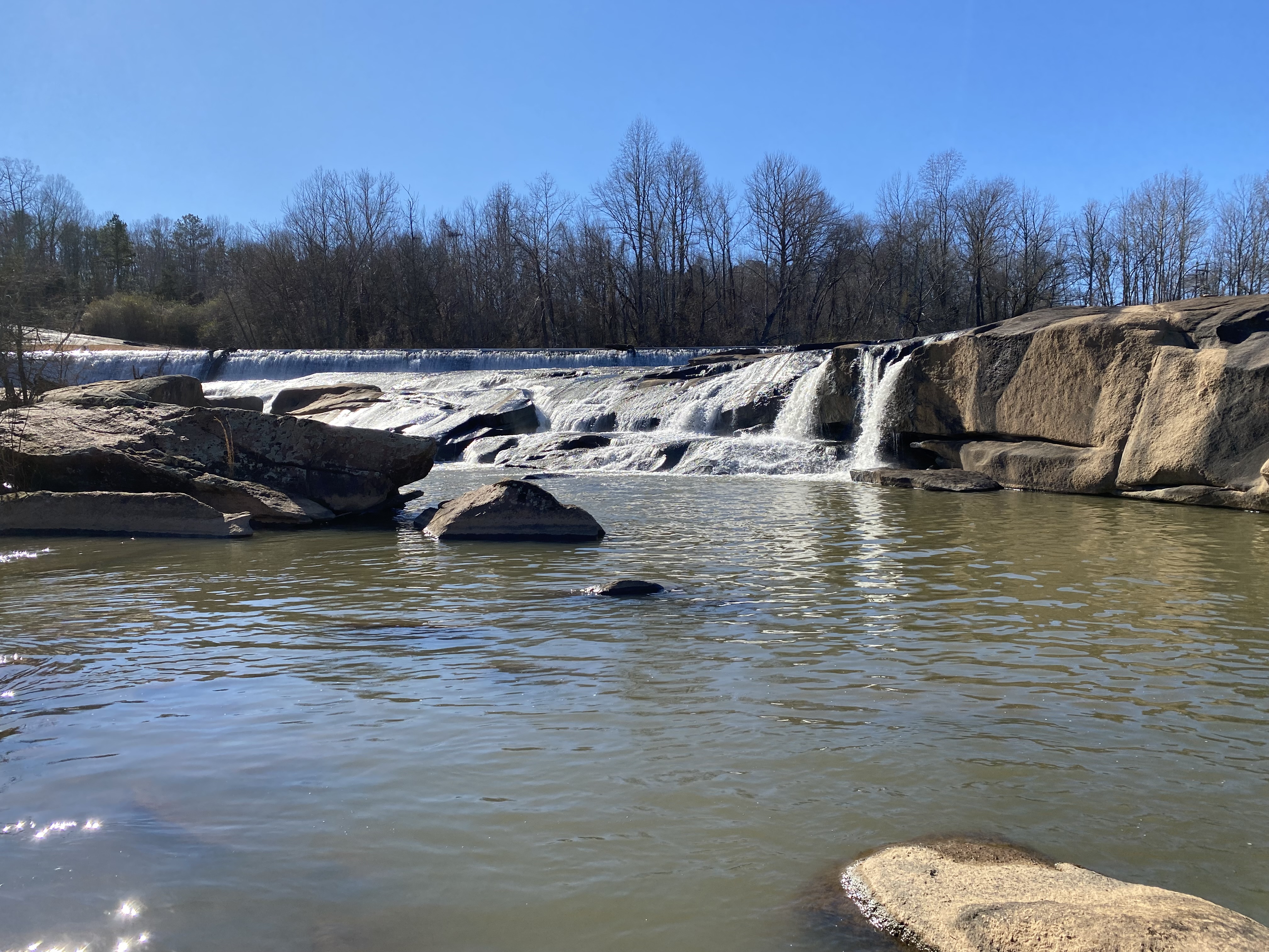
Site of an old textile factory with a dam. Looks like it could be ran in a few spots. Several slide lines exist as well as a decent drop but unable to determine if it is a runnable drop. Appears the surrounding area is private property/no tresspassing so run at your own risk.
From Boatertalk:
Date: Sep 01 2003
From: ncriverboarder
There are two spots in on the south fork of the catawba gaston county that I have looked at as I have been driving through. Both of them are short so you can park and run them.
One is high shoals immediately below the dam at the town of high shoals. I stopped by the bridge over the river on old hardin road. I wasn't able to walk all the way up to just below the dam due to the water being high and there is an old factory that is fenced in, blocking getting a better walk in to just below the dam. There were a few people clearing overgrown growth on the factory grounds so I was afraid of getting busted for trespassing. From what I can see at the bridge, it looks like few good slides right below the dam, then short ledges right before the bridge. Right before the bridge the river flows through small trees and brush at high water.
See also S.Fk.Catawba, McAdenville for the other spot mentioned.
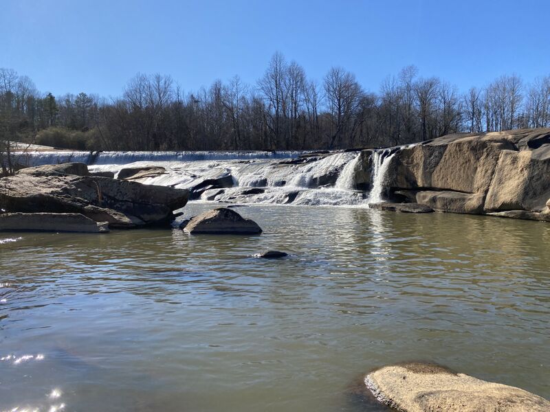
Site of an old dam. Can view from the bridge above. Several slide like lines are avalible. Surrounding property is private/no tresspassing.
Feb 6, 2023
Scouted High Shoals Falls. It is an old dam next to the ruins of a factory. Was able to spot a few lines that looked like slides. River right side is more of a traditonal waterfall but wasn't able to get a good visual. In high flood water this thing looks beefy.
Nov 23, 2009
The Catawba Lands Conservancy has designated the river between Spencer Mountain and McAdenville a 'Blue-way.' There is a nice CLC put-in on river left at Spencer Mountain. 5 miles downstream in McAdenville there is a CLC take-out on river right, just downstream and visible from the I-85 bridge. This is a decent beginer run. After a rain there are some class 1-2 rapids. It's very scenic for the area, meandering through protected forestland. Watch for the rare Big-Leaf Magnolias growing on river right. Gary Mims, Nov 2009
Sep 1, 2003
Water quality is terrible... New
Forum: BoaterTalk
Re: Any NC foothills or piedmont paddlers ever ran either of these rapids in gaston county? by ncriverboarder Sep 01 2003, 2:02 GMT New
Date: Sep 01 2003, 12:15 GMT
From: wsboater
I haven't personally played at these spots, but I know of people that have - and they all wondered what chemicals were in the water. Numerous textile/industrial complexes upstream of that area.
Buddy of mine that worked for Meck. Parks/Rec called up NC Water Advisory, etc and asked what test results they had for the water quality and was it safe to kayak in? According to the state, it is classified as 'water suitable for drinking' (just not immediately suitable I presume), whatever that means. I mean, they dumped how many million gallons of sewage into Lake Norman the other year and it is classified as safe with respect to recreation/water supply?
Guy kept giving him ambiguous answers about the being in contact with said 'drinking' water, then finally the guy told him that he wouldn't be coming into contact with it at all.
Take a look at the rocks out there in the river bed sometime, I'm not sure what chemicals are there, but I know that textile dyes are a regular occurence in the area. Supposedly the locals nicknamed the area the 'rainbow river' for all the varied textile dyes that float down at different times.
There is a lowhead dam just visible when you cross on I-85, water feature of some sort is present below that, sounds like you have already found the trail to get to the river from below.
Wes