| Difficulty | II(III) |
| Length | 9.1 mi |
| Avg Gradient | n/a |
| Reach Info Last Updated | August 19, 2024 |
River Description
Lat/Lng coordinates are totally wild guesses. Put-in/Take-out unknown.
Anyone having knowledge of this paddled reach is encourag ed to provide more detailed information.
Little Falls video
River Features
Take Out
Access PointDistance: 0 mi
Put In
Access PointDistance: 0 mi
Trip Reports
Log in to add a reportMR
Mack Roebuck
Apr 13, 2020
Ran, today, 4-13-2020.
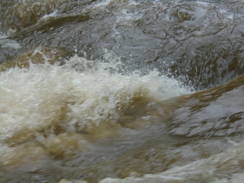
there had been a 3 inch rain, after midnight. Level was 9 inches above previously described footing. Fast float trip. Lots of small waves. Many small surf spots. No strainers. 41/2 foot weir had a nasty boil. Portaged on the right. Ran the other significant rapid, way left. Very nasty hole just to the right of my line.
MR
Mack Roebuck
Sep 28, 2015
Here is that wicked hydraulic Jeff jumped into. Level; 2 inches above footing.
MR
Mack Roebuck
Sep 28, 2015
Ran Little from Chestnut Grove Church Road, today. Level was 2 inches above footing mentioned before. At the first island, about a mile in, the left channel, which has more of the flow, was blocked by a tree. It is not visible when you make your choice. Posted some pictures with the higher flow.
MR
Mack Roebuck
Sep 28, 2015
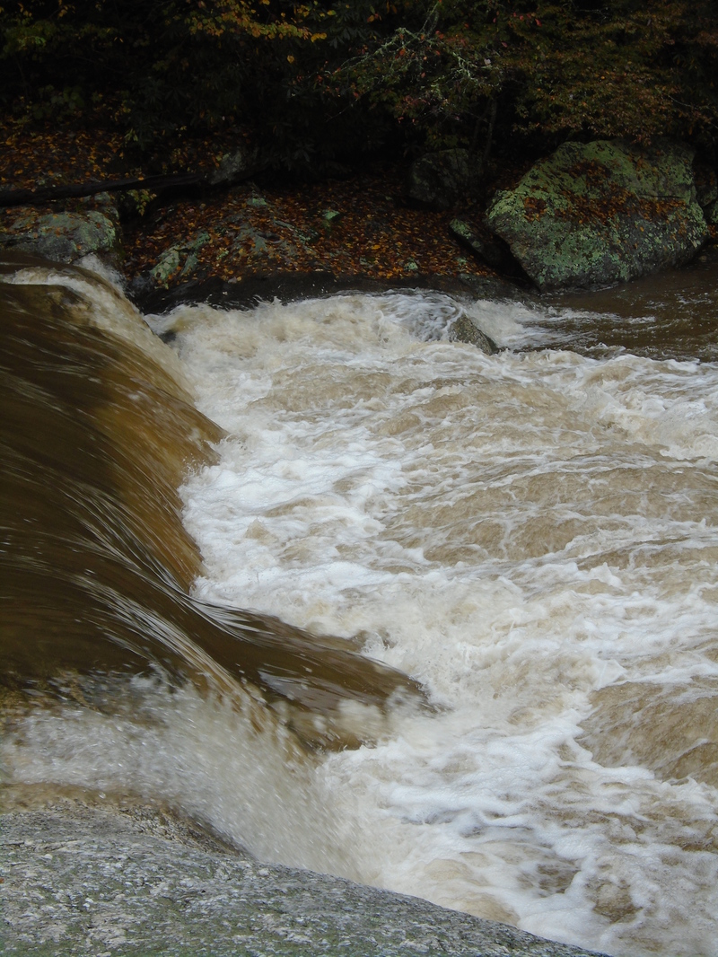
natural weir at 2 inches above bridge footing
KS
Kenneth Swarey
Oct 7, 2012
The section downstream of Rt. 18 can be run when the Roaring is running about 180 cfs or more. The Chestnut @ Galax should also be running more than 60 cfs. The Little at this point has much larger than areas upstream of Brushy Creek. I ran the first couple miles of this section and there is some class II action just downstream of the Rt. 18. There are other rapids downstream
The put in is at a roadside pull off about 1/2 upstream of the Rt. 18 bridge.
MR
Mack Roebuck
Jan 24, 2010
This winter is the time to run the Little. We ran yesterday. It had been a couple of days since rain. The level was about 3 inches below the previously mentioned footing. This level is more of a sane minimum. It was scrapey in the wider shoals but no knuckle paddling was required. Under the bridge is one of the more narrow sections of the river. The Mitchell guage read 180 and the Fisher guage read 250.
?
Untitled
May 11, 2009
We ran the Little today. The level was 7 inches below the top of the footing as described before. It was scrapey with some knuckle paddling, but we did not have to get out of our boats. This level is the minimum for kayaks. While we were on the river the Mitchell River gauge read 150 cfs and the Fisher River gauge read 200 cfs. Good luck with your guess. Mack
MR
Mack Roebuck
Mar 11, 2007
This is a beautiful intimate run with frequent deer and turkey sightings. I put in at Chestnut Grove Church Road. If the water is within 7 inches of the top of the footing for the west side of the south piling you can get down the river without getting out of your boat. The shoals at the start is typical of the run.
After two miles the river narrows through a saddle into a pool formed by a four foot natural weir. Run right angled right to avoid underwater ledge. A senic rest stop and portage is on the right. A mile after a 90 degree bend of river look for a high rock bluff on right. To portage take out early on left. Run rapid way left. At high water a wicked hydraulic develops just to the right of this line. Also at high water a twisty line opens on right.
The take-out is at the low water bridge on Ridge Glenn Road. At low levels float under bridge to an easy take-out. At medium levels take out just above bridge. At high levels take out upstream on river left. Keep this approach in mind if you think the river is rising while you are on it.
If conditions have been dry, it will take a flood to run the Little. If it has been wet and you are prompt, a half inch rain may be enough. You may have to do a combination hike and paddle to ever catch it.