| Difficulty | I |
| Length | 8.5 mi |
| Avg Gradient | n/a |
| Reach Info Last Updated | June 26, 2009 |
River Description
The following description is courtesy of Donald Kelly.
The Chipola River rises in Alabama near Dothan, runs through Marianna, Florida, and joins the Apalachicola River near Wewahitchka, Florida. At low water levels, a small rapid appears about 0.8 miles south of County Road 274, southwest of Altha, in Calhoun County, Florida. A USGS gauge is located at CR 274. No evidence of the rapid exists much above 9.5', with this rapid not of much interest until the river drops below 9.25'. No lower limit has been observed; even during the most severe summer droughts; the Chipola runs when other North Florida rivers have stopped flowing.
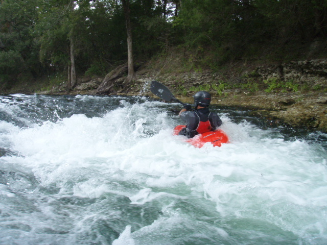
This a very small rapid that would escape notice on a substantive whitewater river. Nonetheless, it is one of the few rapids in Florida with sufficient flow and structure to provide a paddler with enough to work with. The main channel of water through the rapid is near river left and provides some small surfable waves and a sharp river-left eddy. Squirt moves are sometimes possible on the eddy line below the rapid.
On the west side of the CR 274 bridge, you will find the entrance to a small dirt road that parallels the river to the rapid and slightly beyond, permitting park and play. Alternatively, the rapid is the preferred take-out for a downriver trip from CR 278, a trip of about 8 miles. (At low water levels, the downriver trip includes several minor shoals.)
In the summer crowds of nonboaters show up at the rapids for swimming, fishing, tubing and other good times. The crowds can be a bit boisterous, but there've been no real problems yet, and a Sheriff's deputy will drive by every hour or so. Because of the potential crowding and the limited parking, boaters should arrive early.
River Features
Take Out
Access PointDistance: 0 mi
Put In
Access PointDistance: 0 mi