Holston, South Fork
Damascus to Alvarado
| Difficulty | II(III) |
| Length | 3.8 mi |
| Avg Gradient | 30 fpm |
| Gauge | S F Holston River Near Damascus, Va |
| Flow Rate as of 50 minutes | 165 cfsbelow recommended |
| Reach Info Last Updated | March 30, 2024 |
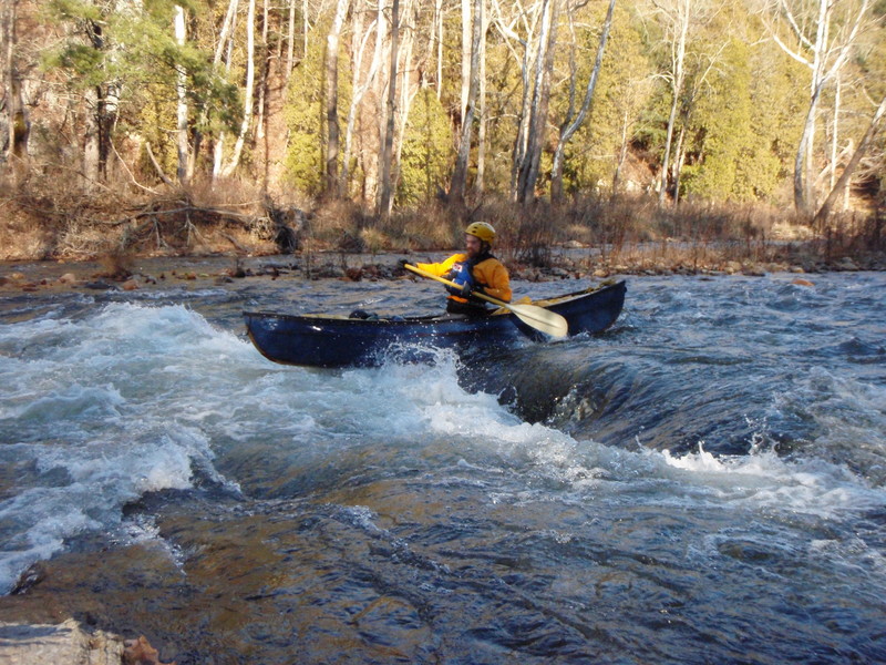
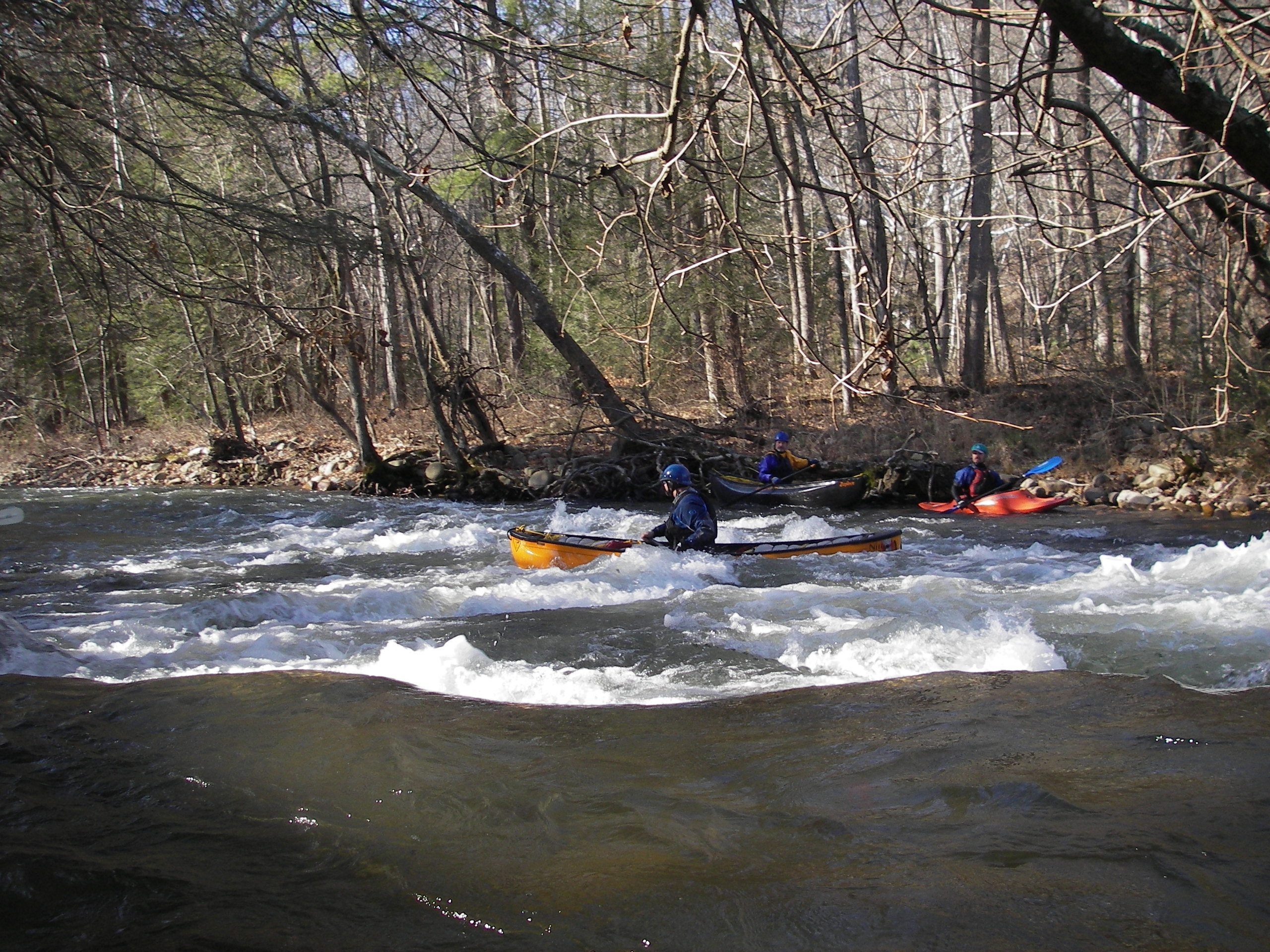
This river is a great run during every season. There are several nice drops and there is one class three at higher levels. It's very fun to run any day of the week. If you have about three hours to spare, grab your gear and come on down to the South Fork of the Holston. At higher levels the river runs very swiftly. This is due to the fact that in most places it is 50 feet wide at the most. If you happen to come out of your boat be prepaired to swim hard and for a long time. The most interesting rapid is about a 1/2 mile from the metal bridge (you will know the bridge when you see it). This rapid is frequently refered to as Tripple Drop and Three-Falls. In order to run this correctly, start off river left and go towards the right. There are some major rocks that one could hit and bust a boat up really well. Half-way down the rapid you want to stay towards the right.
See Also:
Classic Virginia Rivers, Ed Grove (1992 ed), p. 338.
Virginia Whitewater, Roger Corbett (2000 ed.), p. 429.
Exploring Virginia's Waterways, Ed Gertler (2022 ed.), p. 385.
There are several put-ins. One is located right past the Drowning Ford bridge on Route 58 going towards Damascus. Take 58 towards Damascus. You will go down a hill for a good distance and then the road will go to the right around the side of a mountain. There is a road on the right just after you cross the bridge. Take a right and you will see an area that is safe to park your car. You can carry boats down to the river, across the Creaper Trail, and hop right into the river. Be ready as soon as you enter the water because one of the major rapids (Drowning Ford) of the river is just downstream. Other Put-Ins are along Drowning Ford Road.
In order to get to the take out, follow the signs on Route 58 to the Vineyard. Go past the Vineyard for about 1/2 of a mile and you will see an opening with picnic tables and cars parked in a lot along the road. This is Alvarado. DO NOT PARK IN THE GRASS! The owner gets very angry at those who do.
Aug 13, 2013
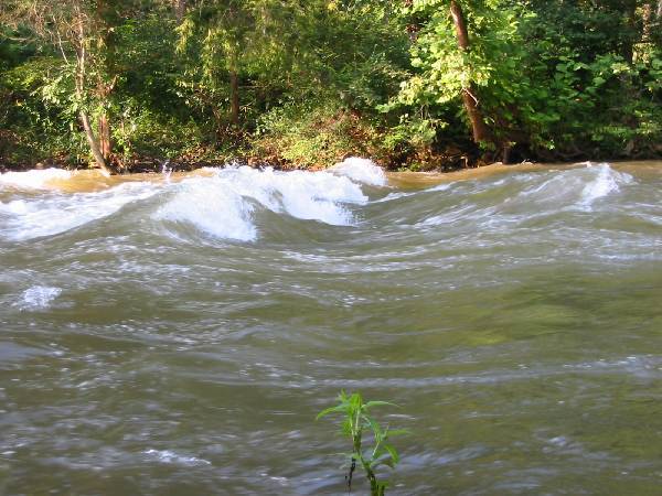
Above 800 cfs, I would call this a solid class 3 run with one four--the mill dam drop about halfway down to Alvarado. Ran it the other day at 2500 cfs--a solid class 3 with huge waves and holes. Even at 500 cfs, be sure to scout from the river right rocks above the ten-fifteen foot vertical drop at the mill dam. There is one slot at the center and another far right which will, with enough thrust off the top, avoid the hydraulics below. Otherwise, you may find some hydraulics asking you to stay!
Jan 14, 2008
The true min for this run is about 200 cfs. I have done at 150 but it is a little rough, 200cfs there is plenty of water. This is a great run for folks just getting into the sport or for us who like staying local and having some great class II rapids. Very pretty stretch to.
Dec 31, 2007
First Rapid below the Iron Horse Campground put in
Jun 24, 2007
Ran from Drowning Ford to Alvarado today June 24, 2007, at 148 cfs. Two boats - my brother and 2.5 year old niece in one, me and my 3 year old daughter in the other.
Scrapy several places, and almost had to get out at one, but I would say the minimum is somewhat lower than 148 cfs and closer to 100 cfs. My brother and I each felt there was ample water to get down it (although not enough to be a play run - but with little kids that was not our focus).
It was a delightful run - interesting drops and good gradient but nothing very big. I'll definitely run it again when in the area.
Very easy shuttle biking along the river on the Virginia Creeper trail.
Jun 14, 2005
I don't understand 'Suggested Min. Level'; that sounds awfully subjective to me.
I think of 'boating zero' as 'the lowest level at which a boater, skilled to the class at which the stream is rated, can get down without having to get out of his boat (barring strainers and other ephemera). This is a fairly objective criterion.
By that definition, the minimum for this stream is somewhere below 430cfs/3.6', because on June 11, 2005 I ran ~9 miles from VA-724 to Alvarado at that level barely touching any rocks. I wouldn't be surprised to learn that boating zero is actually closer to 300 cfs.
It would be nice if AW adjusted this minimum to turn the S.F.Holston green at -- say, until better intelligence is in -- 400cfs, because this is a delighful pretty float for Class II paddlers, and it's a shame to send them elsewhere when it is boatable.
-Oci-One Kanubi, His Kanubic Travesty
Jan 1, 1900
This is a great playspot on the South Fork. It's a great place to learn basic playboating moves. There is an eddy just down stream. No need to worry if you wipe out.