| Difficulty | I-II |
| Length | 10 mi |
| Avg Gradient | n/a |
| Gauge | Antietam Creek Near Sharpsburg, Md |
| Flow Rate as of 20 minutes | 2.32 ftbelow recommended |
| Reach Info Last Updated | May 26, 2024 |
River Description
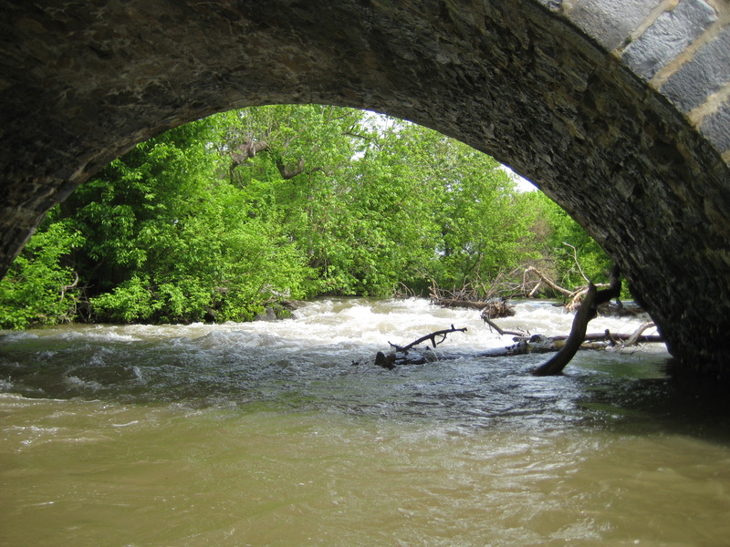
Located SouthEast of Hagerstown, MD, Antietam Creek is a great Class I-II run through beautiful natural scenery.
Put-in (for the 9.9 mile run) is from a lot on southeast side of the Oak Ridge Rd. bridge, just north of I-70. A shorter put-in (resulting in a run of 6.7 miles) is downstream at Wagaman Rd which cuts off about 3 miles of moving water and preserves most of the Class II rapids. Take-out in either case is at Devil's Backbone County Park above the dam. Alternatively, carry the dam and takeout at the MD 68 bridge.
The creek can be floated further upstream during wet periods. See Maryland and Delaware Canoe Trails Gertler, Ed, for the upper reaches.
Description:
There are four Class II rapids on this run, making it a wee bit more difficult than the lower section. Strainers are also a problem on this section, particularly near the end. Some bridge crossings have landowner access issues.
An excellent website about the creek is at Antietam Creek Canoe Co..
River Features
Take Out - MD.68 (Devils Backbone Park)
Access PointDistance: 9.95 mi
Take Out - MD.68 (Devils Backbone Park).
Trip Reports
Log in to add a reportDR
5/15 and 5/31/25 trip report - Devin Rainey
Jun 20, 2025
Ran this section twice in May of 2025 at 4.1ft. I personally wouldnt run it much lower just because some sections could get very scrappy 3.8 would probably be my minumum. We put in on Wagamans Rd where there is a new park with very easy access for boaters. There were no serious strainers, just a few trees here and there that were very easy to avoid. There is an adventure park or something not far from the put in and at water 5 feet and above could be very dangerous because they have a few rope bridges low over the creek. Other then that this is a great run with a little more excitement then the lower section
JW
jim walraven
May 8, 2011
Upper Antietam: Ran this 10 mile section(Oak Ridge Rd. to Devils Backbone Park) at 3.78 ft. on May 7th 2011. I scouted all problem bridges, and found them to be runnable (Wagaman Rd. Bridge, Poffenbarger Rd. Bridge, and Roxbury Rd. Bridge). I prefer this run to the lower for it's comparative abundance of rapids, and fun little play spots. (for you rec. boaters) My friend ran this in her 10 ft. skirt-less rec. boat, and did fine the whole way down, and only got minor water inside her boat. Add a ft. to the level we ran this, and skirt-less rec. boaters may get swamped. Is there flat water on this run. Yes. Do the fun rapids in between, and beautiful scenery make up for it. Yes! 3.78 ft. was a good level and not scrapey, and the flat water still pushed you along for the most part. Add a ft. the level and the fun factor would go up 1 to 2 points. 3ft. and below I wouldn't run this due to the rapids becoming so boney that you may have to portage them. 3.5 may even be pushing it. My recommended running level would be 4-5 ft. Enjoy as we did.