| Difficulty | IV-V |
| Length | 4.6 mi |
| Avg Gradient | 250 fpm |
| Reach Info Last Updated | January 14, 2024 |
River Description
Feeling the need for speed? The Gragg Prong of Lost Cove Creek offers paddlers the chance to put the top down and feel the wind in their hair. The creek boasts a number of large, clean granite slides, one of which rivals Oceana in size.
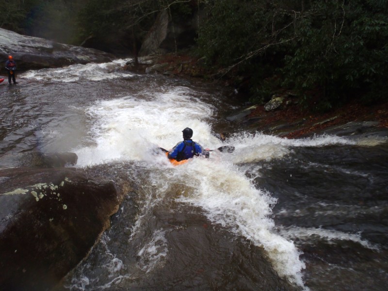
The Gragg Prong starts as class III through a tight rhododendron tunnel and follows FS 981 for a short while. When the tunnel opens up, the gradient increases dramatically. First-timers should scout anything they can't see the bottom of. In most cases, scouting is pretty easy. While all the drops are relatively clean, some features can interrupt the progress of a moving boat in a few of the drops.
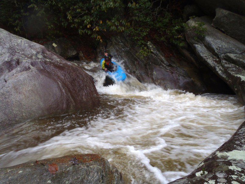
The biggest drop, Dragstrip, comes at the end of the steep section. It comes after a long, multi-tiered, multi-channeled slide with an overhanging rock at the top on river left. Some folks scout this drop and the Dragstrip in one trip. The Mountains-to-Sea Trail on river left makes covering the distance down to the Dragstrip easy. The horizon line of the Dragstrip is not entirely obvious from river level because the entrance is occluded by foliage and some large boulders. Fortunately, there are last-chance eddies on both sides of the creek. Both left and right lines are possible. The right line at high water involves a pretty dynamic direction change. The left line at low water is a bit thin. There is one more rapid of importance after the Dragstrip. Be on the lookout for wood in the rest of the Gragg Prong and Lost Cove Creek down to the takeout. Beware of wood on Lost Cove! The beavers are dropping a LOT of trees into the stream.
As if one might need other reasons to paddle this section, the gorge is decorated with spectacular, successive Catawba rhododendron, mountain laurel, and rhododendron blooms in May and early June. The water quality is superlative.
Shuttle directions: The takeout is the confluence of Lost Cove and Wilson Creeks in the settlement of Edgemont. Be aware that the land on the side of Lost Cov
...River Features
Put In
Access PointDistance: 0 mi
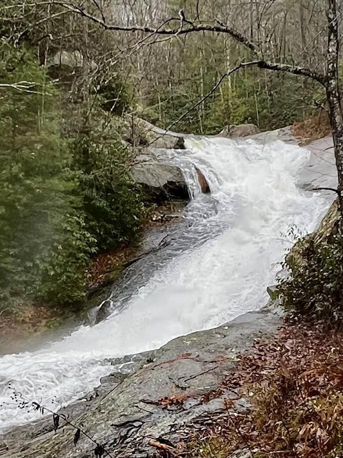
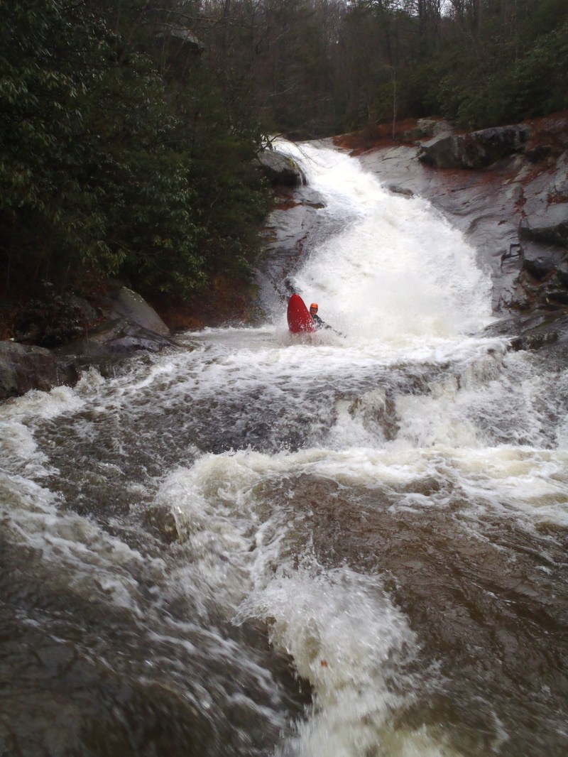
Upper Gragg Prong Falls
OtherDistance: 0.38 mi
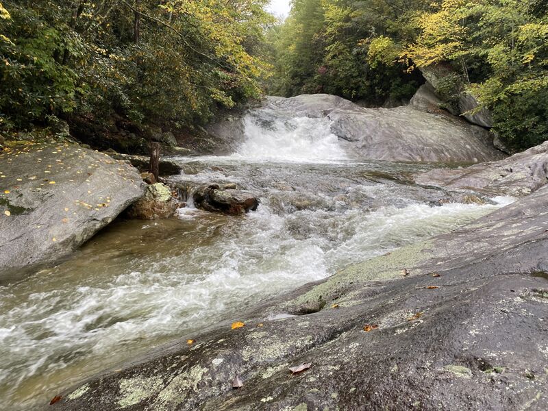
25ft waterfall that leads to a slide with an undercut at the bottom
Middle Gragg Prong Falls
OtherDistance: 0.76 mi
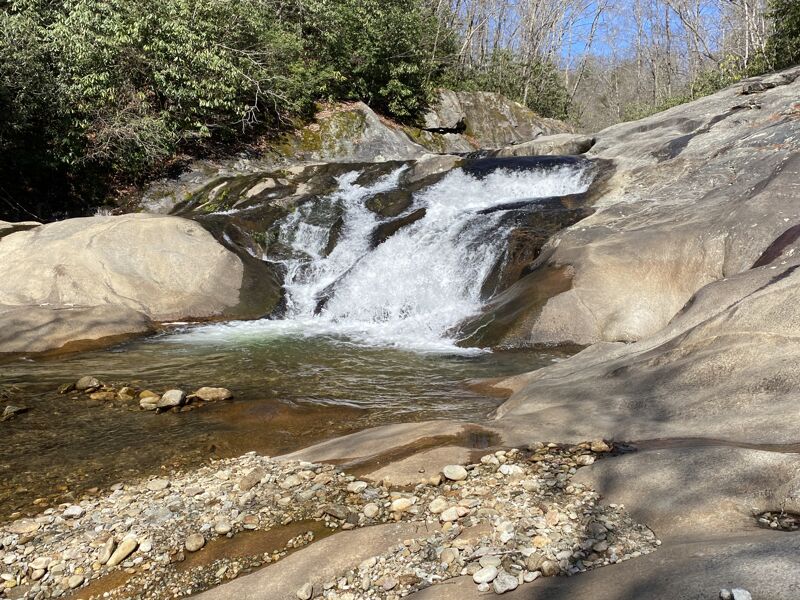
16-20ft slide with several more downstream
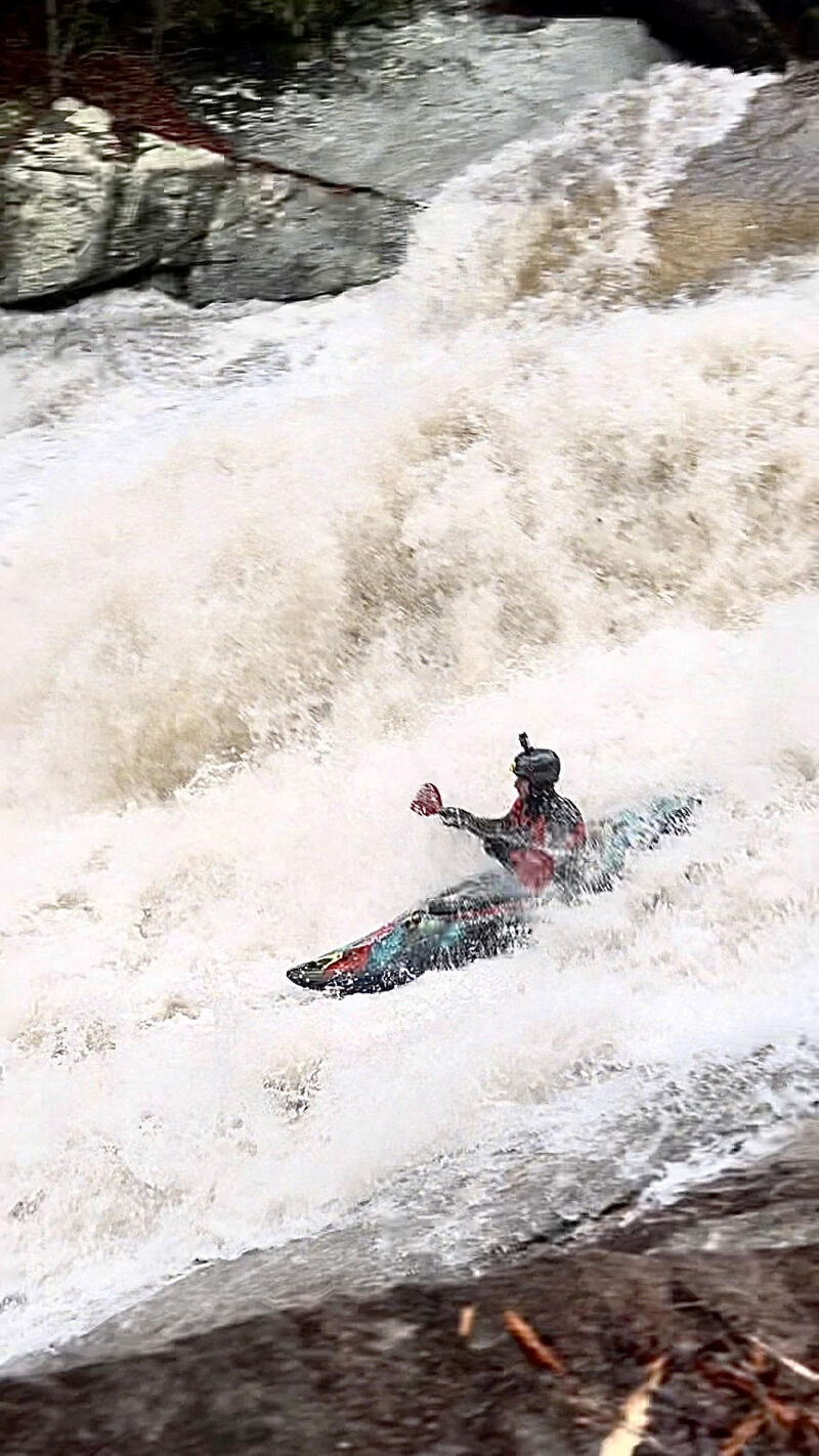
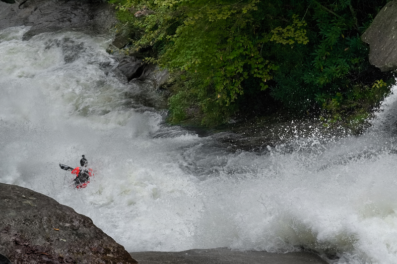
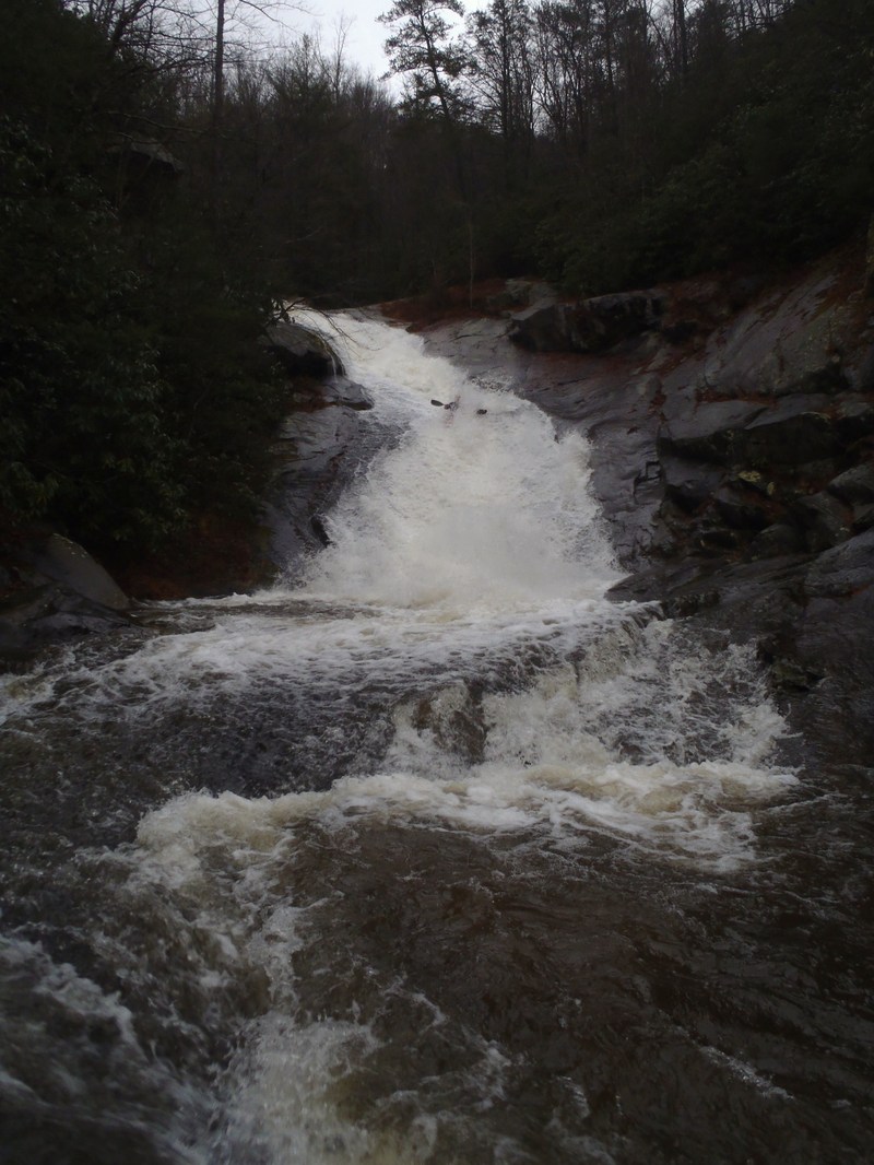
Gragg Prong Falls (Dragstrip)
Waterfall / Large DropRapidClass: VDistance: 1 mi
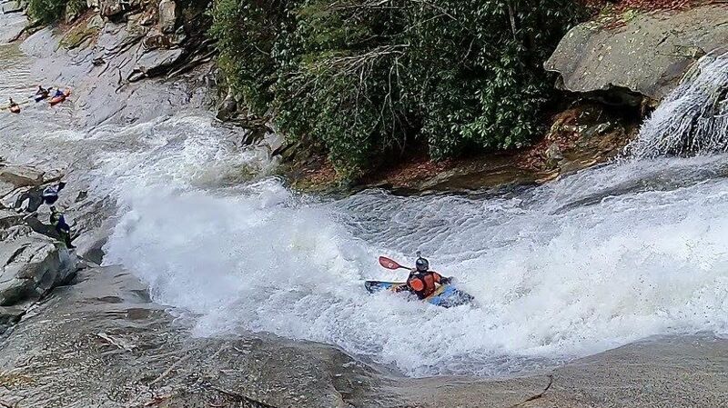
The biggest drop, Dragstrip, comes at the end of the steep section. It comes after a long, multi-tiered, multi-channeled slide with an overhanging rock at the top on river left. Some folks scout this drop and the Dragstrip in one trip. The Mountains-to-Sea Trail on river left makes covering the distance down to the Dragstrip easy. The horizon line of the Dragstrip is not entirely obvious from river level because the entrance is occluded by foliage and some large boulders. Fortunately, there are last-chance eddies on both sides of the creek. Both left and right lines are possible. The right line at high water involves a pretty dynamic direction change. The left line at low water is a bit thin.
Take Out
Access PointDistance: 4.6 mi
Trip Reports
Log in to add a reportIF
Scout Trip - Ira Fowler
Oct 10, 2024
Post Helene scout trip...not as much damage as one would expect here.
NA
My 2nd run on Gragg Prong - Nathan Anderson
Jan 14, 2024
Managed to catch Gragg at a high flow on January 2nd, 2024. It was pretty full on. There were some nasty holes and then Dragstrip was insane. I did decide to fire it up :). Soooooo Goooood!!! The runout below Dragstrip was also sick.