Gallatin, South Fork West Fork
Ousel Falls to .75 miles downstream
| Difficulty | IV-V(V+) |
| Length | 0.9 mi |
| Avg Gradient | 85 fpm |
| Reach Info Last Updated | November 6, 2010 |
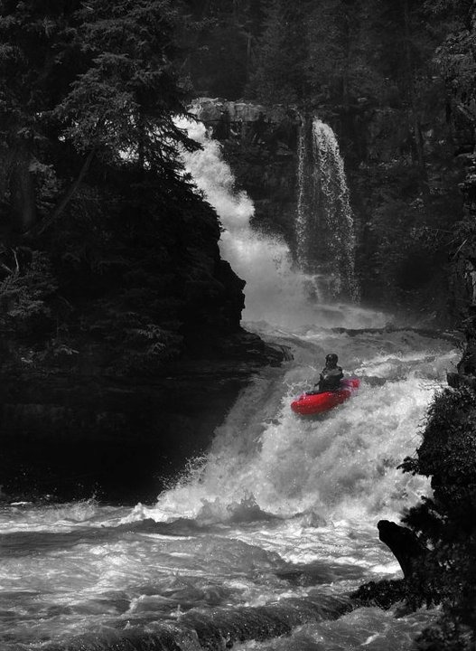
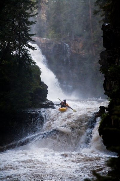
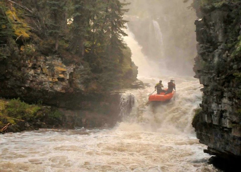
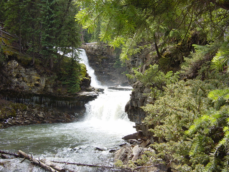
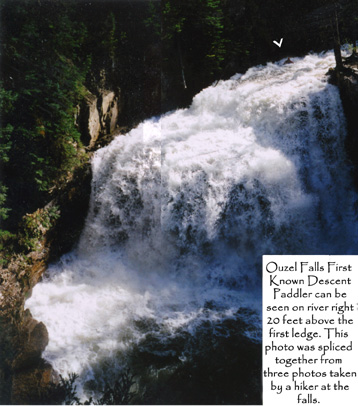
This is a fun blast of creeking in an area lacking good creeks. It can and should be combined with a run on the Gallatin, which is always running strong when this stretch is floatable. You can put-in above or below Ousel Falls. Ousel Falls is a cascading 35-foot falls with a very tight landing zone which is extremely shallow. If you decide to run it, be warned: it is shallower and more dangerous than you think. Be careful.
The standard putin is at the base of the main falls, allowing a peelout into a fun ten-footer just above the start of the action. Below this there are some low-angle slides and a few great boofs before you arrive at the big ol' logjam that marks your takeout. Give each other some space in here as the eddies can be scarce. Hike up the steeps on river left and back to your car.
The trailhead to Ousel can be found by taking a left onto Ousel Falls Road off of the main road heading to Big Sky (Lone Peak). About a mile up on your left is the parking lot. Hike in, Hike out.
Best guidebook for the area: Montana Surf, but it's out of print.
Lat/longitude coordinates (especially of the takeout) are an estimate from online maps.
Jun 18, 2025
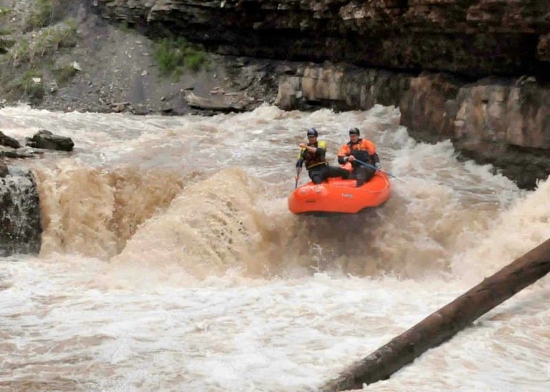
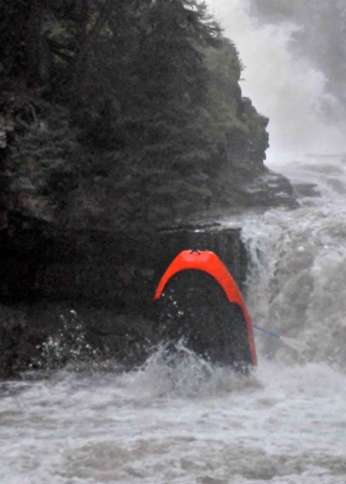
It's hard to find information on flows for this section, so figured I'd give a baseline. Ran 2 laps today with the Gallatin at around 1,950. This was our first time out there and felt like a good introductory level. The first drop is great at this flow, looks intimidating, but is pretty forgiving with a nice pool at the bottom. The second drop was on the edge of runnable, very scrapey entrance, much less water over this drop than the first due to some other channels diverting water. Still good to go, but probably wouldn't want to run it much lower, the runout to the takeout was pretty boney as well. SEND IT!!!!!!
May 24, 2014
Update:
There is new wood in the section between the hiking bridges. Make sure to scout. It is currently possible to run. An obvious right channel at the first tree, then left side of a pour-over out of a new pool created by a down tree and mudslide. There are still branches on the tree - thus left at the pour-over to minimize branches.
Below the second walking bridge is about 1.5 miles of class 3 boogy water with an occasional slide in the first quarter mile. A great alternative to hiking out however there is no clear place to leave your vehicle at the takeout road bridge. This entire section had been cleaned of wood until spring melt of 2011. There are now 3 log jams that must be portaged. This section has a super remote feel- beware of moose. Also a nice alternative to hiking out.
Mar 22, 2014
Below the main falls.
Mar 22, 2014
Log is out as of 2011 or so. It's now just below the second drop.
Mar 22, 2014
Pat Kamman, Matt Larson spring 2013
Mar 22, 2014
Pat Kamman, Matt Larson spring 2013
Jun 15, 2013
Pat Kamman, Matt Larson spring 2013
Apr 6, 2012
Hey, I want to say thank you for an intriguing site about a ecujsbt I have had an interest in for a while now. I have been looking in and reading through the comments avidly so just wanted to express my thanks for providing me with some very informative reading material. I look forward to more, and taking a more active part in the talks here, whilst picking up some information too!!
Jan 1, 1900
2 severed tendons, clipped 3rd tendon, severed vein. Stay upright on the slide!!
Stay upright on this slide. I've seen a few go over after clipping the R cliff wall. It pushes you right more than you'd guess. Always blood, always skin.