Colorado
12. Big Sur(Cameo / Lucky 7)

| Difficulty | III |
| Length | 1.2 mi |
| Avg Gradient | 15 fpm |
| Gauge | Colorado River Near Cameo, Co. |
| Flow Rate as of 27 minutes | 1770 cfsbelow recommended |
| Reach Info Last Updated | June 9, 2017 |
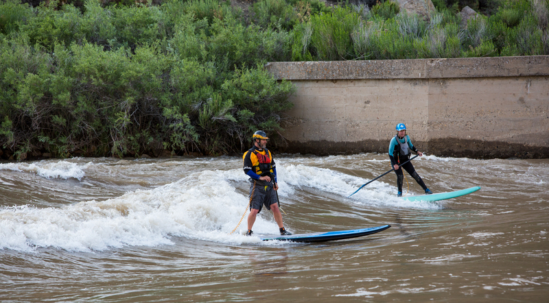
Big Sur on the Colorado is a unique feature that occurs when flows reach 20,000cfs. High flows are provided by coordinated reservoir operations upstream, and are intended to support endangered fish in the Grand Valley.
Lat/longitude coords are approximate.
Reaches of the Colorado River:
01. Hot Sulphur Springs to Hwy 40 bridge (Byers Canyon) (CO, IV)
02. Gore Canyon (CO, IV-V)
03. Pumphouse campground to Rancho Del Rio (Pumphouse) (CO, III)
04. Hanging Lake Exit 125 (I-70) to Shoshone Power Plant Exit 123 (I-70) (Barrel Springs) (CO, IV-V [V+])
05. Shoshone Power Plant, Exit 123 (I-70) to Grizzly Creek, Exit 121 (I-70) (Shoshone) (CO, III-IV)
06. Cameo Dam (Big Sur / Lucky 7) (CO, III)
07. Loma to Westwater (Ruby / Horsethief Canyons) (CO-UT, II)
08. Westwater to Rose Ranch (Westwater Canyon) (UT, I-IV)
09. Cisco (Rose Ranch) to Moab (Professor Valley) (UT, I-III)
10. Moab to Powell Reservoir (Cataract Canyon) (UT, I-IV)
11. Lees Ferry to Lake Mead (Grand Canyon) (AZ, I-V)
12. Black Canyon (AZ-NV, I)
From the Beavertail Mountain cutoff, 'Parking Area' by the signs on i70, park 250m past the off ramp and walk underneath the overpass on the concrete bike path where put-ins are plentiful.