| Difficulty | II-IV+ |
| Length | 4.6 mi |
| Avg Gradient | 100 fpm |
| Gauge | Three Fork Creek Nr Grafton, Wv |
| Flow Rate as of 57 minutes | 3.15 ftbelow recommended |
| Reach Info Last Updated | November 6, 2010 |
River Description
The put-in can be found on CR 29 between Gladesville and Browns Mill.
The maximum gradient is found in the section below the put-in and down to the confluence of Stony Run which comes in on river left.
Brief description by David White, 2005-05-24 11:13:31
Did an ELF run down Fields (with a hand saw) for the sole purpose of cutting a few lanes through the logs in the last class II section heading towards the bridge. It didn't work out. The water was dropping fast and by the time we got through the ledges we were too tired to start cutting lanes. It was an awesome trip nontheless. The good drops are clean, but after the last real ledge the logs start coming.
The easy take-out is on Three Forks Road, off Rte. 92. The second bridge you come to will be the one on Three Fork Road. There is a little rock about 30 yards upstream of the bridge. If it's close to, or under water you're good to go in my book---as long as it's not too far under water. You can also take out on river right after the last ledge and hike back to the ford. For those who don't mind a good hike carrying a boat, it's not bad really. The scenery in the last section (the class II section) is great, but the log portages can be taxing. The class II section starts basically when Stoney runs in on river left.
I am a local here and from my experience, most hard core locals are more interested than anything. (Editor's note: see the Comments tab for a warning about one landowner.) I have hiked the trail on river right a number of times in a variety of seasons and have never caught any crap over it. That doesn't mean it can't happen though so be careful and please tread lightly. If you see trash, pick it up if you can. ~~Peace
Lat/longitude coordinates are approximate, from online maps.
River Features
Put In
Access PointDistance: 0 mi
Take Out
Access PointDistance: 3.6 mi
Trip Reports
Log in to add a report?
Untitled
May 29, 2008
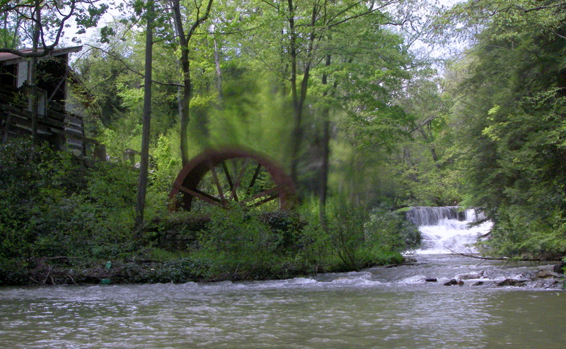
this creek has a nasty landowner on river right, just downstream from the put-in, at a low bridge(must be portaged). the landowner was very aggressive. make sure you portage on river left and move quickly and discretely. he seems to think he owns everything in site. also the run is choked with logs. we ran this at a very low level and a few of the logs would have been scary with more water. there is an old mill which should be portaged as well. there a few cool slides and a sweet boof off a ten footer. you decide if it's worth running. very pretty, but a lot going against it(wood, crazy landowner, wood, and more wood)
JM
Jeff Macklin
May 17, 2008
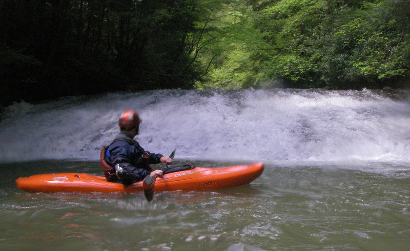
Fields Creek Falls.
Just downstream of our put-in, the land owner IS NOT BOATER FRIENDLY. His driveway bridge crosses Fields where the creek turns away from Gladesville Rd. Be quiet, become invisible. Don't confront this guy!
JM
Jeff Macklin
May 17, 2008
We chose not to run the dam/falls in the background. Too much of a rocky & shallow landing for us.
JM
Jeff Macklin
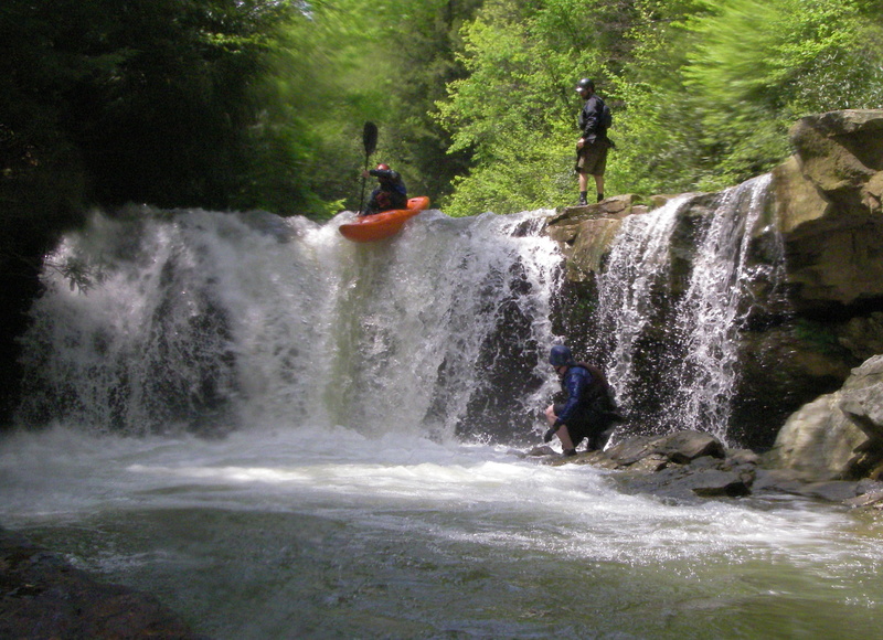
May 17, 2008
I think this wad the last major feature on this creek, before the tree infested, flat-ish water paddle out.