Thunderhole Creek
Globe Road to Upton
| Difficulty | III-IV |
| Length | 3.9 mi |
| Avg Gradient | n/a |
| Reach Info Last Updated | May 17, 2025 |
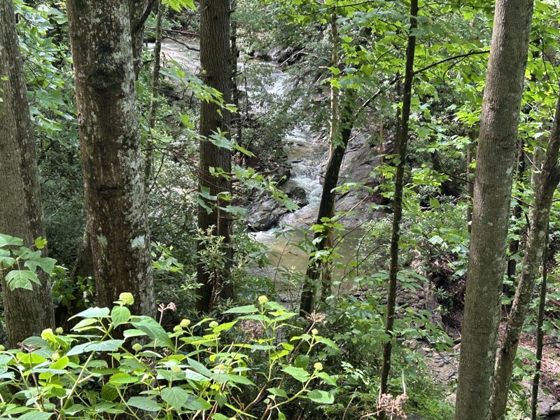
Thunderhole Creek is off of Globe Rd. between Collettsville and Blowing Rock. If you have a NC gazetteer, it's easy to find. The access trail is a spur off of FR 4071. We hiked in about a mile to get the footage you saw. The rest of the creek was too low to run. Thunderhole would need a lot of rain to run. Very small watershed. A run of about 3-4 miles could be made down to Upton, there's good access there. Don't know about in between, but it looks as if the gradient is all in the upper parts. A put-in as high as the confluence with New Years Creek would be possible I think. I would say that it is mainly class III, but boat control and eddy catching skills are a must as wood is always a problem on creeks this small.
You could use the short put in option to cut out some of the scrappy stuff near the bottom but you'll have about .2-3 of a mile hike out.
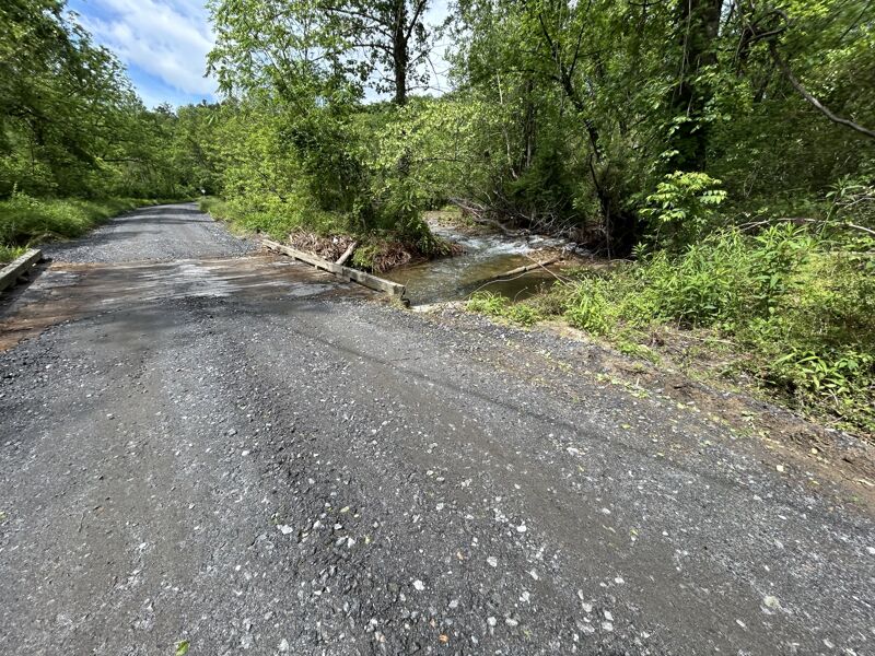
In the event of a hike out the trail crosses Thunderhole Creek several times but is generally on river left.
Put-in : ~1850' at New Years Ck Conf. at 36.1062, -81.6949
Take-out: ~1200' at Upton at 36.0682, -81.6948
Elev.loss: ~650'
NOTE: The gate is closed January 2nd - April 1
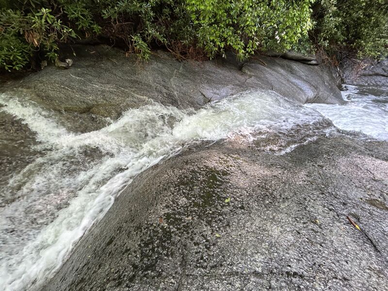
The put in is actually on New Years Creek. A really nice looking slide is just around the corner. Watch for wood.
There is also a trail down to Thunderhole Creek a short distance up the road if you don't want to run this section.
Watch for wood. From here to the confluence with Thunderhole Creek wood likes to gather.
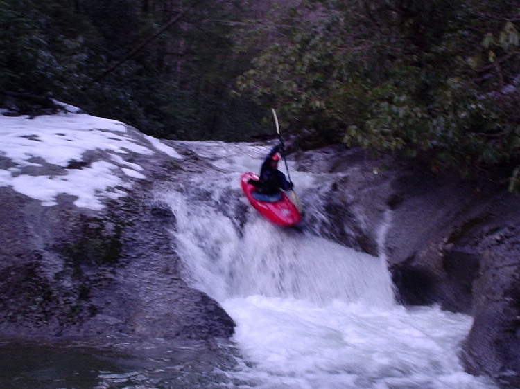
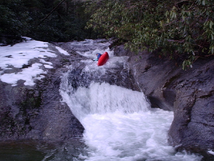
Long entry slide with about an 6-8ft drop into a 'horseshoe'. The entry is a small boof over 2 holes that could cause a problem, but should have enough speed coming through. The lip is a fading ledge of sorts & hard to get purchase with your paddle. The curtain does create a 'cave' of sorts behind it.
A nasty hydrollic develps at high water this would be no place to get boxed in. The pool is plenty deep. Has another nice slide below. Scout river right.
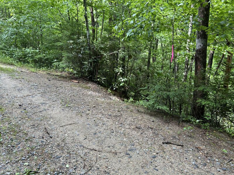
Can use this to hike out & cut out some of the low scrappy stuff. Does have a small elevation gain along the trail up to the road. Someone marked this area with pink flagging tape.
May 17, 2025
Hiked Thunderhole Creek after approximately 4.5in of rain 4 days ago with just under a half inch today. I was surprised to see the creek was holding well. Overall I'd say it was on the low side & probably the bare minimum of what I'd want to run it at. The run has several nice ledges. The highlight is Thunderhole Falls which is about an 8ft sloping ledge boof into a horseshoe rock feature. This does create a curtain behind the rock & I suspect at high water this is an extremly nasty looking feature. Lead in to it has a few holes but probably enough speed to where they wont be an issue. Pool below is plently deep & calm for a rescue.
I'd say put in at the bridge over New Years Creek, nice looking slide rapid. Anything above this is going to be extremly scrappy & I didn't see any rapids worth the effort. If going all the way to Upton it could be a long scrappy paddle out unless its raging. Use the short take out to cut this part out. All the good stuff seems to be between New Years Creek & the short take out in my opinion.
Further upstream is China Creek which is a major tributary & it has a couple nice looking slide waterfalls which I think could be ran with the right flow.
Jun 10, 2019
Ran this on 6/9/2019 with Jack and Mike. The gate for FR 4071 was open and we put-on on New Years Creek upstream of the Thunderhole confluence. For reference Watauga hit 12k, Lost Cove was flooded, and last I heard there was 8' of rain reported around the High Country recently. Expect flood conditions for this thing to run.
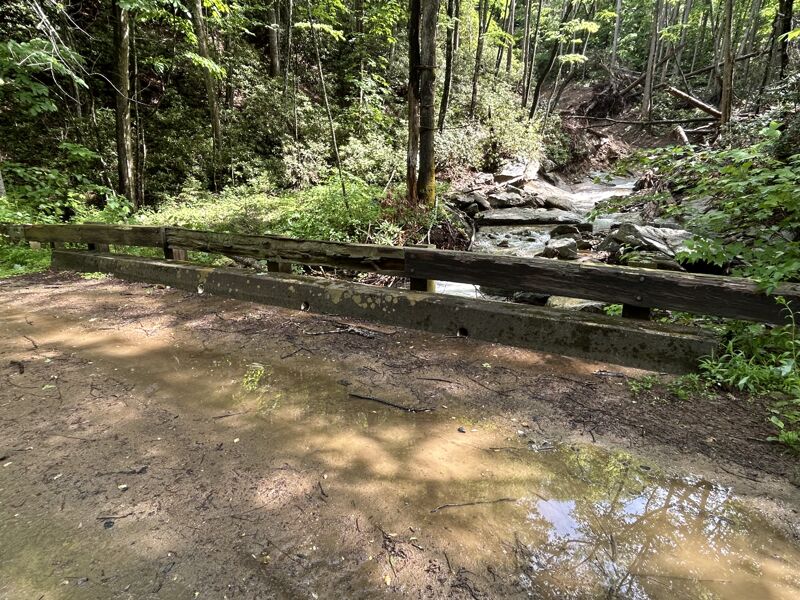
From the put-in to the confluence, expect it to be super micro. The put-in drops on New Years Creek are sweet and the creek follows a very tight course to the confluence with Thunderhole. Wood and brush are common, eddies are tiny, and visibility is minimal. After the confluence the creek widens but follows a similar Class 3+/4 creeking nature EXCEPT for two bigger rapids, one of which being the horseshoe hole in the main photo of this article. With our much higher flows it created one of the worst-looking hydraulics I've seen in a minute. All risk, no reward, obvious portage. Riverwide strainers are plentiful. A low bridge crossing the river marked our take-out.
The rating is accurate, but I would not bring a Class 3+ boater out here. This is by all means a wilderness creek run. Eddies are tiny, scouting and portaging is difficult, and mandatory portages are plentiful. If there's a place where being able to drive onto shore and get out of your boat quick is a useful skill, this is it. Regardless, it's a beautiful run and a very fun adventure that few people experience. If it's running, give it a shot, especially because you won't have many other options