Hood, E. Fork
Sherwood Campground to Hwy 35 Bridge
May 6, 2013
| Reporter | Teresa Gryder |
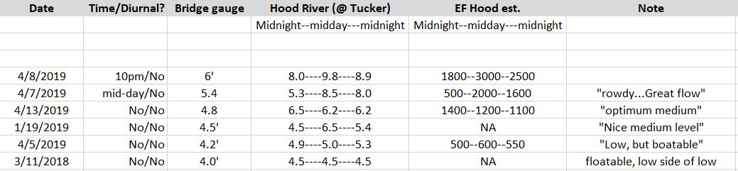
Flows notes. There's a new gauge on the West Fork, here: http://www.nwrfc.noaa.gov/river/station/flowplot/flowplot.cgi?id=WFHO3. It reads lower than the Tucker gauge by something less than a foot. The flows in the East fork increase all day long on hot (over 80 in Portland) and sunny days, esp if there's an east wind. When the AW site says it's too low at Tucker (under 5 feet but close), go late in the day.