Toccoa
Sandy Bottoms to Tilley Bend
Jun 19, 2026
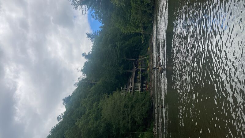
I did an overnight paddle in a canoe with my 9 year old son. My friends were in sit a top kayaks. It was an awesome trip! Flow was on the low side about 270 cfs. But even in a canoe is was ok. Not a problem for the kayaks. I would do it again. Beautiful and fun river. You only need a little bit of kayaking experience and you can do it. Camping at swinging bridge was great. Lots of camping there. It was a 2 hour paddle from deep hole to swinging bridge and 3 hours from swinging bridge to sandy bottom the next day.
Jul 11, 2024
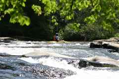
I put in at Sandy bottom, and took out at Persimmon creek. I completed it with a recreational kayak. This section is a mixture of relax, white water and 2+ miles of work out.
The most dynamics happen from Stanley rapids (a.k.a One for the road) to Big F house. After there, you keep paddling flat water to take out. I loved the multiple experiences you can expect from this river run.
May 2, 2012
I ran Sandy Bottoms to Shallowford Bridge a few days ago at 1.7 ft. Nice 1 hour stretch. Report can be found here. http://hillsidehippie.com/upper-toccoa-river-trip-report-sandy-bottoms-to-shallowford-bridge/
May 6, 2011
Extensive documentation of this run provided by Rob Butera can be viewed at http://toccoa.butera.org and http://toccoajournal.blogspot.com. The first link contains an excellent list/map of access points.
Thanks Rob ...
May 6, 2011
To see a you tube video of Toccoa River (from Toccoa Vally Campground to the steel bridge) go to the following link:
May 27, 2008
The posted property starts up at the curve in Aska Road and extends down to a drainage pipe down by the rocks. The landowner actually painted an orange line on the rocks designating her property line. Down stream from this line and the drainage pipe there is room to park cars and sit on the rocks. There is about 200 feet of space downstream from the line where it is business as usual. On 5/26/08 I witnessed landowner tell folks sitting on her side of the rocks to move over to the other side of her line. Tubing and kayaking outfitters still use this part of the pull-off to service their clients. I rented a kayak from Jon Ron (about 100 yards upstream on Aska Rd) and he said he leases the lower portion of the pull off and it's cool to park there.
Dec 30, 2007
I have started logging the TVA streamflow data for this reach (the gauge at Dial, GA). This is experimental (for example, if the power goes down at my house, the server will power off until I reset it, so some readings may be missing) right now, but provides some sense of historical information. The data is uploaded whenever modified (typically every 2 hours) to a tex tfile located at http://www.butera.org/toccoa/gauge.txt
May 21, 2006
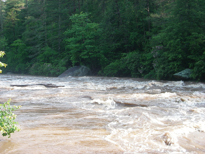
What Party Rock? Toccoa @ 1800cfs. This was taken at 9am on 5/21/2006 after Blue Ridge got 4+' of rain from a microcell that didn't move all night.
Dec 31, 2005
Self Shuttle! Today I did my first self-shuttle of the Toccoa. It was painless, and makes the river twice as fun, experiencing the rapids below the Aska road takeout. See my other post from today about those rapids.
Park at the intersection of two dirt roads: Shallowford Rd and Old Dlal Rd. This is where you take the right turn towards Sandy Bottom if running the usual shuttle from Aska road.
From this point, you can walk about 0.6 miles downhill along Old Dial Rd. towards Sandy Bottom and put in when you get to river level, just after the USGS gauging station.
The takeout is a spot on the Toccoa known as Tilly Bend. There is a sharp bend in the river - you will suddenly see houses with boat docks ater the bend. Take out before the stream that feeds in on river right. There is an ATV trail above the river, and it is an easy 0.4 mile uphill walk back to the aforementioned intersection. The trail at this point parallels the river -- walk downriver and the trail will turn right and paralllel the aforementioned stream.
It is probably a good idea to take the 10 minute hike from the intersection down to Tilly Bend to know what to look for. There are several trailheads near this intersection (including the Benton McKay) -when facing the right side of the road, take the rightmost one that heads down, initially paralleling Old Dial Rd. If you head along a ridge you've taken the wrong one!
The hike back up to the car was 13 minutes, and the flatwater paddle after the rapids stopped was under 15 minutes. Total trip time from leaving the car to arriving back was 3 hours, including a 20 minute lunch stop and very little river play.
The hike back, while 0.4 miles uphill, is not steep -- easier than hiking out of Woodall on the Chattooga, even if longer.
May 22, 2005
There is a convenient but oft-overlooked put-in between Swan Bridge and TV Campground. Cross the bridge @ Van Zandt's store (by the old Dial Bridge) when heading from Aska Rd. to Newport Rd (over bridge) to Dial road. Head right (upstream) on Dial with the river on your right. In less than a half mile you will see an empty gravel lot right after a bunch of houses with parking for a few cars and river access. This lot is at the edge of Forest Service land (after you put in, you'll see a 'Leaving National Forest sign' on river right). Expect 30-45 minutes of paddling along cow pastures until things get a little more moving by Toccoa Valley Campground.