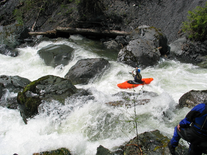
Canyon Creek (NF Nooksack)
Canyon Creek Bridge to Glacier Springs.
| Difficulty | IV-V+ |
| Length | 2.6 mi |
| Avg Gradient | 300 fpm |
| Reach Info Last Updated | March 3, 2023 |
The Nooksack River has its origins on the slopes of Mt. Baker traveling down to Puget Sound at Bellingham Bay. It flows through the traditional homelands of the Nooksack Indian Tribe and Lummi Nation . Over its short distance, the North Fork, Middle Fork, and South Fork all provide [...]Read More
Take out: Turn left off of high way 542 into Glacier Springs. There is a large sign on the left side that says GLACIER SPRINGS (you cant miss it). Take the next right onto Miller, as soon as you enter Glacier Springs. Take a left on Canyon View Dr. Go up the hill about a 1/2 mile. On the right you will see a ravine which is actually a dyke diverting canyon creek into the Nooksack. The next right past the ravine, is the take out. It looks like a driveway. Drive to the end and you will find a trail that leads to a washed out logging bridge. This is my preferred take out to miss out on the creek braiding into the Nooksack.
An alternate is at the bridge that crosses the Nooksack right after Glacier Springs on highway 542.
Put In: Get back on 542 and head east toward the town of Glacier, approximately five miles outside of glacier on 542. Canyon Creek road is just past Dougfir Campground on the left. Drive 7.5 miles up to the canyon creek bridge, or where the river comes close to the road. If you put below the bridge about a 1/2 mile you will miss some class II and log portages.
Alternate Put In: Drive six miles up the Canyon Creek road and find the pull out on the left just past the two culverts and the dirt road section. You can bushwhack your way down to the river from here. I recommend doing this the first time. If you like what you got into on the lower section then go back the next day and do the upper section from the bridge.
Brief Summary of Canyon Creek:
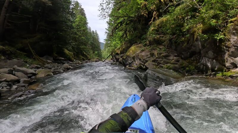
Canyon creek is a continuous class V-VI run. There are numerous portages, and scouting will be an all day affair. It is similar to its sister creek the Clearwater in the Middle Fork Nooksack drainage, except Canyon Creek is 3 miles longer.
River Description:
Our first run down Canyon Creek took us 10.5 hours. Our second (and only half the river this time) took 6.5 hours. We decided to bypass some class II-III white water and a few log portages by putting in a 1/2 mile
...May 27, 2025
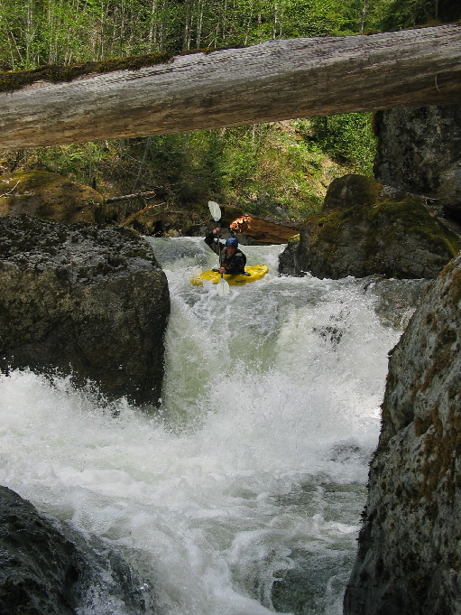
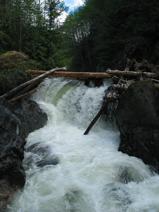
The end of the river is in a tight short canyon
Nov 30, 2024
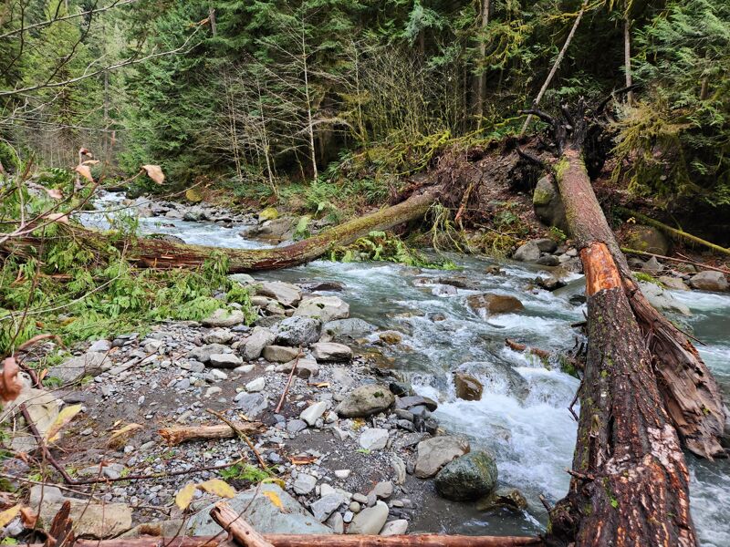
The bomb cyclone in 2024 put down more than a few new trees where the banks caved in after trees fell in Canyon Creek so be careful. High water will almost certainly m,ove them around.
Dec 2, 2007
Haven't done the upper section described but have been walking in at the trail and hiking as far up the canyon as possible and avoiding much of the nasty drops that Hale describes. This actually avoids much of the class 5 on this run and offers some clean class IV and III creeking fun. This section seems to change quite a bit with each flood so make sure and scout. There are two drops in this section (Relatively new) that are probably class V. Both can be portaged if you prefer. The first drop of these drops has pin rocks throughout the drop and one do-able line on the right. The second is less technical but definitely has the potential for a brutal swim as the hole feeds back upon itself.
Following that ledge, is a small technical III/IV gorge and then the creek opens up. If you follow it down to the NF Nooksack there is one last IV mini-gorge where there is a 2-3 foot boof ledge followed by a couple of ledges past that. At high water, there is a line at the boof ledge on the left. At low water, run the boof as you could pin or dent your boat from a hidden pin rock.