Yampa
04. Cross Mountain Gorge - 85 Rd to Deer Lodge Park Rd(Cross Mountain Gorge)
| Difficulty | IV(V) |
| Length | 4.6 mi |
| Avg Gradient | 59 fpm |
| Gauge | Yampa River Near Maybell, Co |
| Flow Rate as of 43 minutes | 65 cfsbelow recommended |
| Reach Info Last Updated | April 17, 2024 |
The Yampa River is one of the last major free-flowing rivers in the Colorado River Basin, and it has long been a focus of American Whitewater’s river stewardship work in the region. American Whitewater is committed to preserving the Yampa’s wild and unregulated character in the face of ongoing [...]Read More
Cross Mountain Updated info 11-24-2023
I would not recommend a raft below the listed flow range of 700cfs, in a kayak it is good down to 300cfs you will hit rocks at 300 but its doable!
There is not a lot of information on this section of river, so I decided to update a little. There is an old AW article from 1966: www.americanwhitewater.org/content/Journal/show-page/issue/1/year/1966/page/4/
And several other links that have been taken down or the links don't work.
The article above has names of the rapids but they have since been renamed. These are the names I have been given or seen in other forums and online information. If you have different information feel free to change it.
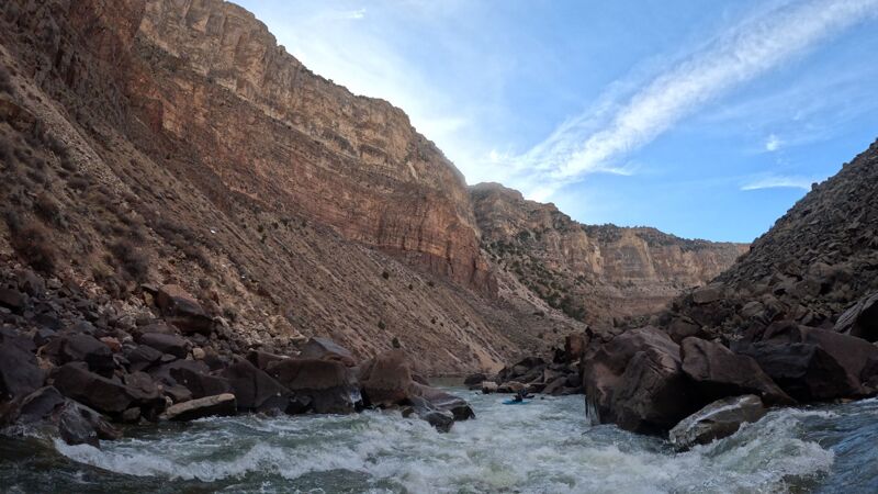
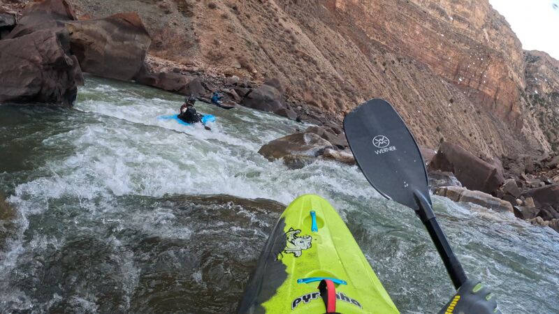
Cross is a unique section at 4.5 miles long it offers some exciting challanges at all levels. I have paddled it at 300 to 3000cfs. I have heard reports and people often paddle it much higher and flows have been seen up to 17,000cfs. The run is mostly Class IV- to 600cfs, Class IV to about 4000cfs then goes Class V.
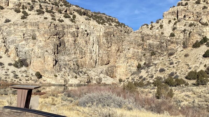
There are three put in's, the first is a campground parking lot with a pit toilet and the other two bypass most the flat water, The second and third ones take a high clearance vehicle to get to, numer two takes off about a mile of flat water and the third has a short hike down, to get to the mouth of the canyon. I typically just use the 1st one and use the flat water as a warm up. Mind you the flat water has sand bars that are pretty shallow.
As you get closer to the canyon there is a hill on the left side before you enter the gorge, on top of the hill is a monument, you can take a high clearance vehicle up there and is a great view point looking down the canyon.
The river makes a right turn and starts heading west. At the end of the flat water the canyon starts to drop and y
...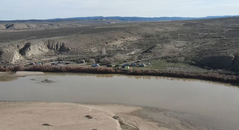
The regular put in has a few spots for truck and trailer parking, 2-3 camping spots and a pit toilet. There are several fishing access points along the fence and a gate with a steep ramp to a gravel sandbar. Please keep the gate closed there are cattle that roam in the area (river side).
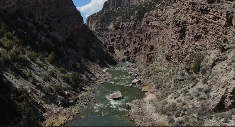
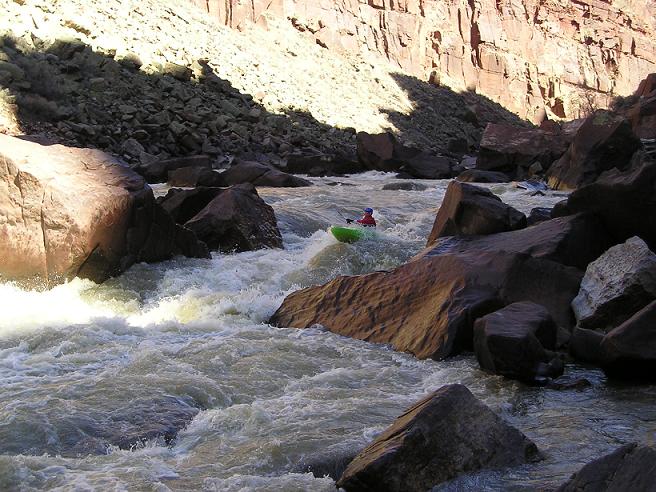
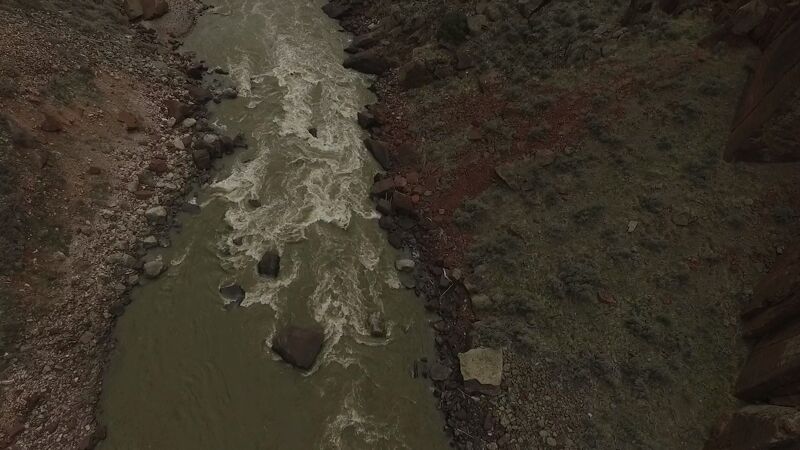
This is the begining of the gorge. There is a large rock in the center of the river, with a little Class II rapid going around the rock. Just up stream the flat water has clifts on both sides, this would make hiking back out fairly difficult.
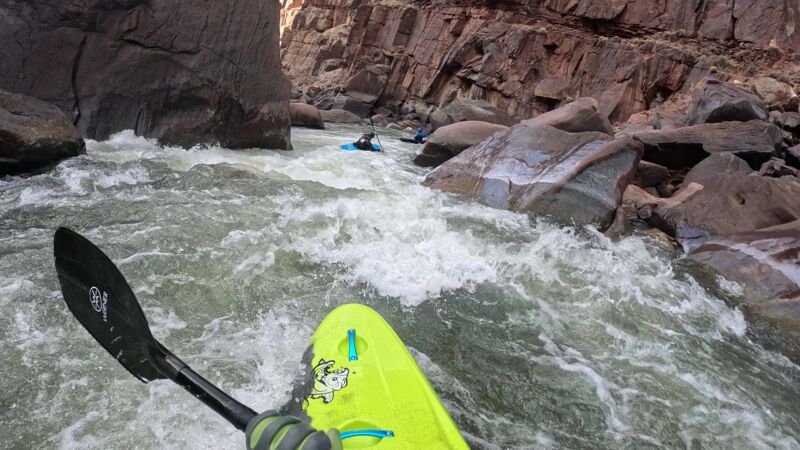
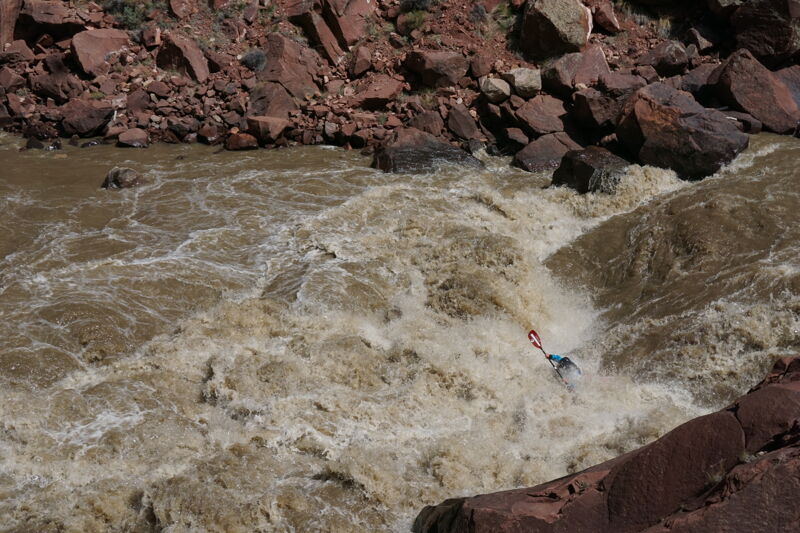
A hundred meters or so past the rock of no reutrn is Osterizer, You will be able to see Logs perched on top of some large boulders river left. At the base of those rocks is a pour over. At low flows 300-600the line is on the right or a sneak on the left next to the large rock, at meduim flows its right down the middle.1100-2700. At higher flows a right side boof opens up. There is video of a creature craft getting worked for 3 minutes in this rapid: https://youtu.be/\_AQX-UpWoG4?si=GvHHCcL-1E6Zghw4
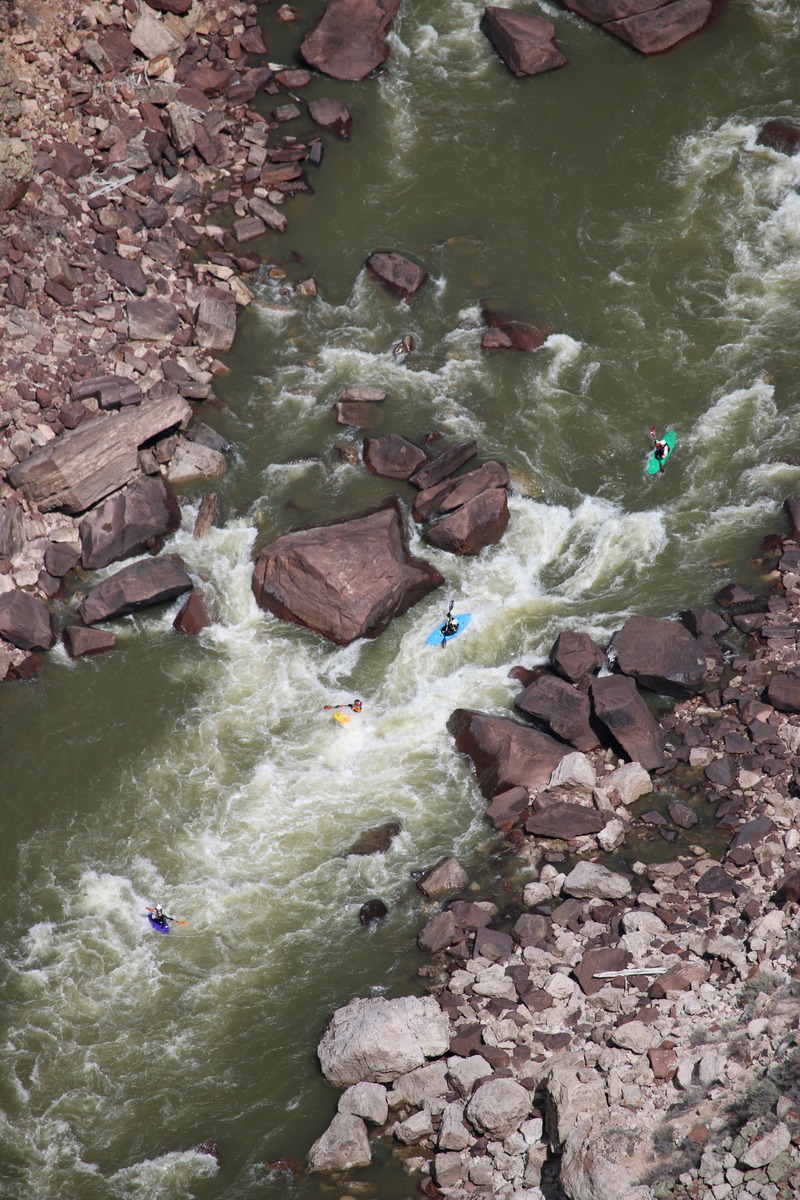
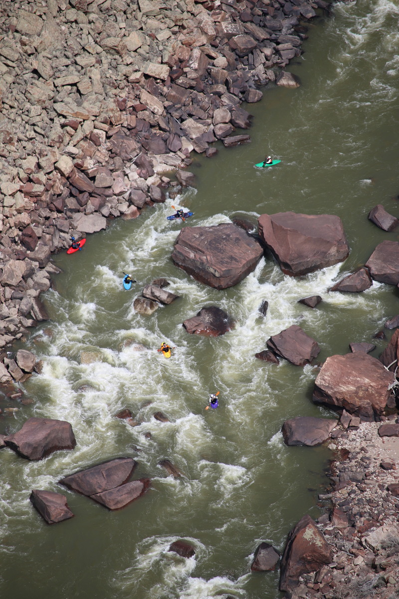
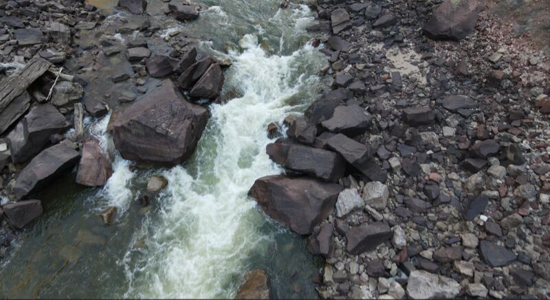
Body Pizza is a rock, hole dodge, at meduim and high levels I start center and move right to avoid the holes. At lower levels it is very tight channel that you have to slalom through. At lower flows there are seives in this area.
The scout for Death Ferry and Snake Pit are on the river left, I typically scout both since there are very close together. There is also a backboard placed here on river left.
The rapid starts on the right side passing several large rocks on your left side. once passed the rocks you need to start making your way left. at lower levels it is very channalized and rocky so choose your line carefully it is very rocky here. at meduim flows there are plenty of seives and pin potential.
Snake pit or corkscrew is a large drop, at medium flows it has a curler wave at the top which can best be described as a corkscrew looking feature, hence the name! You can punch through it pretty easy, then ride the waves down the center. The Left side gets huge pit that you do not want to be in and the right is large rocks. hang on and have fun!
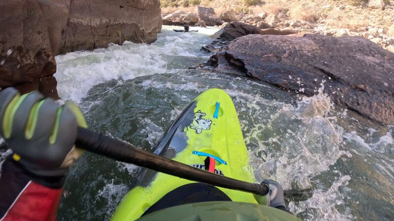
At low flows the entire river moves left, over a pour, and smashes into a cliff. then in about 25 meters there is a large rock (magnetic rock) in the center of the river. Both sides are clear. At meduim flows there are several route options to choose from.
The river exits the gorge the take out is on river left. Plenty of parking in a gravel parking lot.
Nov 24, 2023
Nov 24, 2023
I have read reports of cross mountain at low levels (300's) On a somewhat warm Autumn day 43 degrees forecasted, we decided to go for it. We stopped at the major features to scout, everything looked really good and had pretty clean lines. All in all I was pleasantly suprised how much fun I had in there.
The sand bars in the first mile of flat water were not that bad either.
Mar 13, 2023
Apr 22, 2020
Cross Mtn at about 1650 cfs on 19-April-2020 (https://www.youtube.com/watch?v=UxUDcsfNckU) felt to me like the Numbers at 2400 cfs, but with more maneuvering.
Lower water run on 4-Aug-2019 at about 850 cfs is here (https://www.youtube.com/watch?v=\_uyFeLy-GkU&list=UUqu2zhAc3NVAk\_CWVbCtnog&index=12). There's a far left sneak at Osterizer at this lower level.
Best description of this section that I've seen is here (https://www.rigtoflip.org/cross-mountain-canyon).