New Hope Creek (Haw River trib.)

Turkey Farm Rd. to Erwin Rd.

DifficultyII-III
Length5 mi
Avg Gradient20 fpm
GaugeCane Creek Near Orange Grove, Nc
Flow Rate as of 1 hour
0 cfsbelow recommended
Reach Info Last UpdatedDecember 15, 2025

River Description

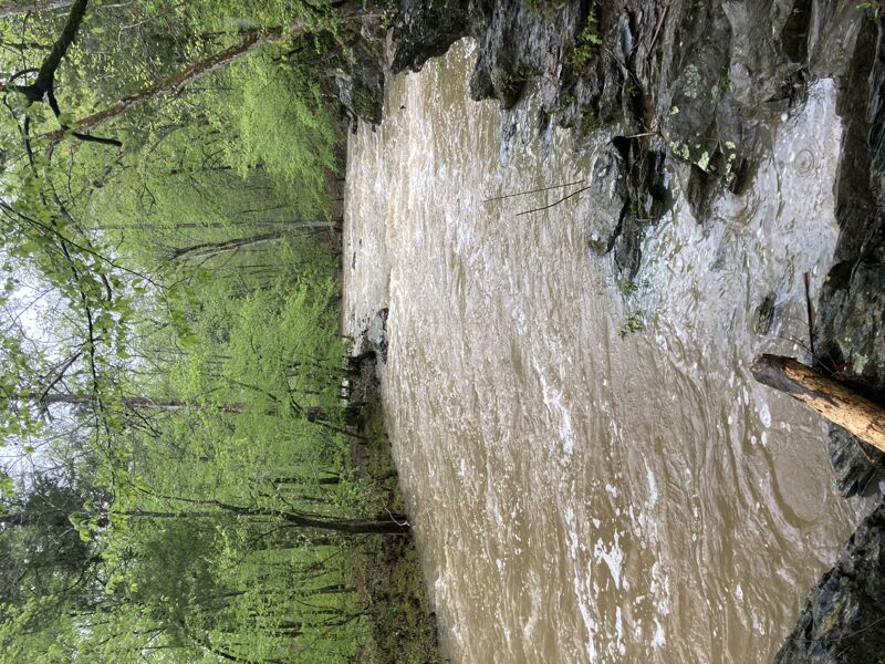
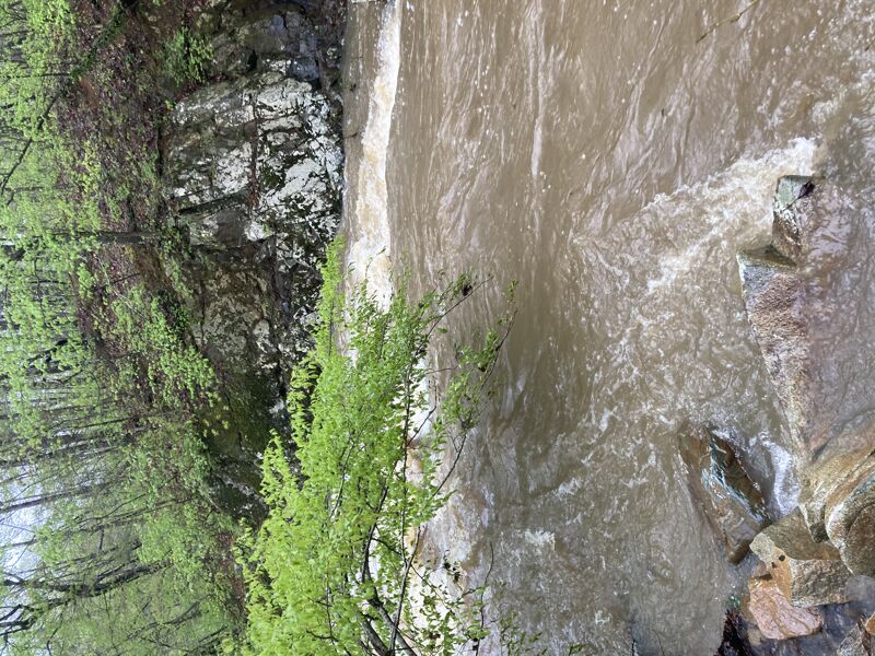
This section starts mellow with some easier rapids and progresses as you get more towards the middle of the run marked by a concrete bridge. The old concrete bridge is removed and replaced with a bridge that can be paddled under as of November 2025. The next 100 yards or so after a bend to the right is heavier boogie with some holes to dodge mostly river left. When you start to see signs for the trail river right just before the creek cuts hard right, get out on the trail and scout. Ahead is the 'Big Rapid', which is class III. At lower levels (50 CFS or so) this can be run anwhere, dodging rocks, but at higher levels stay right for the first part then eddy to the middle and then punch the hole on the right side of some rocks. This has a play wave at some levels at the bottom. This is followed by some more boogie and some neat rock formations mostly river right. There are multiple options to play in the waves at the base of many of the drops. Once you reach Erwin Rd, the action is over, but continue a bit downstream till you see a rock jutting out from river left. Take out here and follow the trail till you reach the parking at Hollow Rock park. This is an excellent run that can be done as low as 50 CFS, but gets better as levels get higher. Always be on the lookout for wood since there are always spots where fallen trees have gathered.


River Features

Put In

Distance: 0 mi

Concrete Bridge (Now overhead)

Distance: 2.93 mi
Portage
Hazard

The old bridge is no longer there with the hazard removed, but the new bridge may be difficult to pass under at very high water levels.

The Big Rapid (New Hope Falls)

Class: IIIDistance: 3.34 mi
Rapid
The Big Rapid (New Hope Falls)

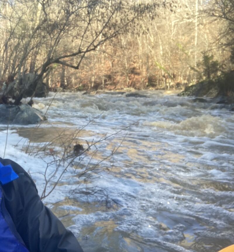
Portage and scout river right on the trail before the sharp turn right to decide your line.

Piney Mountain Rapid

Class: II+Distance: 4.15 mi
Rapid
Piney Mountain Rapid

Taken from Paddling Eastern North Carolina by Paul Ferguson. Class II/II+ wavetrain.

Take Out

Distance: 5 mi
Take Out

We started at Hwy 86 and ran to Erwin Rd taking out at the Hollow Rock park. There are a few notable rapids above the Turkey Farm Rd put in, including one class III through the Falls of New Hope neighborhood, but otherwise you'd want to just start on Turkey Farm Rd for the best rapids. We didn't scrape much and there was enough water at this low of flow to make it down, but the boogie in between major rapids was more like class I and II- before reaching the concrete bridge, whereas it is normally more exciting at recommended levels. Below here was still II+ and the big rapid was still III, but I'd recommend not putting on unless you have at least 100 CFS reading on the Cane Creek gage at the time of launching or less than a foot and a half showing at the concrete base at Turkey Farm Rd. Still a fun run and less push for those weary of the class III drop. This drop should still be scouted at any flow that floats you down and can be done from river right on the hiking trail.

SA
shane ambro

Feb 19, 2018


---update---

I've run New Hope a few times at the 'I'm desperate' level. With about 1.25' - 2' of rain in 24 hrs you can catch a bubble if you time it right. Doing the whole thing from Turkey Hill Farm is pretty scrapy and loses the fun factor by the time you get to the big stuff.

I've also walked in from the Concrete Bridge Rd. off of Whitfield. It's about a 1/2 mile hike in but at least it's downhill...you get the big stuff and beautiful scenery of Duke Forest. Parking there also makes shuttle walkable. I've decided that if there water covering the trail underneath the Erwin Rd. bridge then it's runnable. A few inches below the trail = barely runnable. Another visual are the sketchy metal fence posts, if they're covered then water's good. If 10-12' are exposed = lower runnable / desperate. Would hate to swim and get impaled by one of these.

--------------

It rained just over 6' in the last 2 days. I'd say the creek came up at least 4-6 feet if not more. As a WNC boater, I was dubious about said Class III, but it was definitely there (reminds me of last part of the Narrows on Big Laurel). Fun scenic run. There's a little play along the way and the 'rapids' get bigger throughout the run until they are actual rapids. Reminiscent of the Nanny in some points but more creeky, continuous and full of trees. Some wood to portage but easily scout-able and most of it you can go underneath/ over. Cane Creek gauge flashed to about 6 feet today and it dropped while I was on it but New Hope is still gushing even after the official gauge was at 71 cfs.

MM
Mike McDermott

Mar 30, 2009


Kayaked New Hope for the first time yesterday, rained close to 2 inches the previous couple of days, guage at Cane Creek was approx 65 CFS at the time. Creek was very runable at this level. Portaged 4 times from fallen logs, streamers. Excellent run, excellent rapids.

JW
Jim Wei

Jun 14, 2006


Ran it today, 6/14/2006. It was maybe medium level, hard to tell. There was about 2 inches of water going over the low water bridge. No decent play spots found. Nice rapids and good scenery. Lots downed trees but we were able to either get over them or go under them, no portage necessary. It took about an hour to run.

We put in at end of Mimosa Dr., had to hike down the hill bush wacking to get to the creek. It was fun.

MT
Mark Thompson

Jan 14, 2005


Just got off the NHC. It was a high flow run. What a GREAT little run. It's about 4 Miles or so and took @2.5 hours at this flow without straggling. You do need to pay attention to the strainers, there is a certain amount of wood, but not so much that it caused problems. There are 2 unavoidable portages where trees cross the river, but they are easily seen with easy eddies and accessible banks. They only caused a 5 min delay each. This is a creek with a lot of blind bends and turns. Each turn seemed to be accompanied by the next small rapid most all of them class 2. This provides for some fairly continuous paddling and limited flat water. There is one honest to goodness class three. About half to two thirds of the way down you first come to a hard left turn followed hard right turn. The second rapid (the hard right) should be scouted. There are strainers and you can

RE
Ryan Emanuel

Dec 16, 2004


This may be a little outdated, but I ran this section of New Hope Creek after Hurricane Fran in 1996. The entire section was choked by strainers and windblown trees. The run took about 5 hours and ended in a muddy slog through the dark. It looked to have been such a beautiful run through a small and intimate gorge, but the hurricane ended that.

Despite the countless portages, there was one nice playspot (small hole) in the very heart of the section near the point where a trail forded the stream. I think Nealy even noted it on his map of New Hope Creek.

Does anyone know if the run has been cleared since 1996? I heard tale of plans to have a volunteer unclogging before I moved away in 1999, though I can't imaging Duke allowing such alteration to the Korstian Division of its forest.