Kennebec
1) Kennebec Gorge: Harris Station Dam to Carry Brook
| Difficulty | III-IV |
| Length | 3.4 mi |
| Avg Gradient | 40 fpm |
| Gauge | Kennebec River at the Forks, Maine |
| Flow Rate as of 31 minutes | 1620 cfsrunnable |
| Reach Info Last Updated | April 23, 2021 |
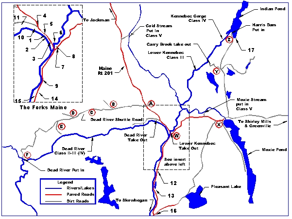
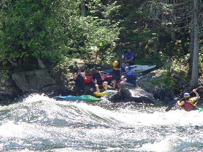
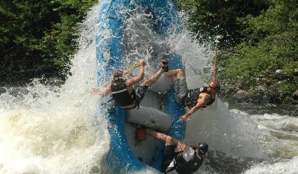
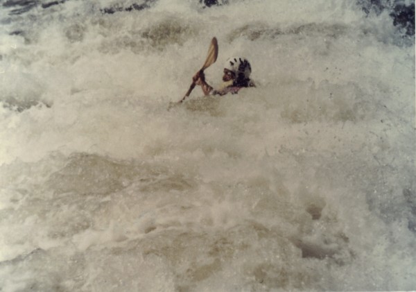
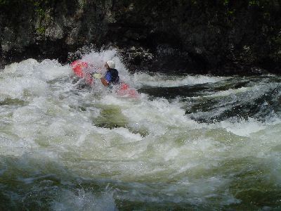
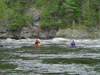
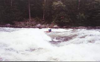
Once you enter the gorge below Harris station, you are commited to the run. The gorge has sheer walls with class IV big water running for approximately 2 miles. The main concern is big waves, crosscurrents, and some large holes. The shoreline is shale that tends to break up into sharp jagged edges. The Alleyway continues up to Cathedral eddy were there is a good wavetrain. After Cathedral eddy the Kennebec widens and the shear gorge walls dissappear. Z-turn rapid lies 1/4 mile downstream. This is an easy class II playspot with surfing waves and an ender/sidesurfing hole. Another 1/3 of a mile below Z-turn is the biggest drop on the Kennebec. Run left for a dip into Magic Hole. At levels above 3500cfs Magic Hole can be punched but be ready to roll. Below 3500cfs Magic gets sticky and trashy. Take the 'Highway' which runs just left of center of the river. Do not run river right at any level below 8500 cfs. Maytag hole can hold rafts for days. This is the most significant horizon line on the run, so if you are not sure of where you are and you come to a horizon line, you are at Magic falls. Maytag is below Magic, on the center right. The takeout is another 1-1/2 miles downstream at Carry brook. There is a steep stairway on the left. Trips can continue down to the Forks (9 miles) but the river becomes more sluggish the further downstream you go. The following information is from AW Director Tom Christopher, quoted in various message boards: 1. The 300 cfs minimum flow will not be in place until FPL receives their operating license from FERC, hopefully in about a year. It is an excellent Class II-III run, fine for open boats and not pushy, with 2, perhaps 3, easy Class IV drops that can be easily portaged. It will provide a wonderful opportunity for folks with a lower skills level to enjoy the remote beauty of the Kennebec Gorge. 2. The normal 4800 cfs release is a classic Class IV run with big water waves and crosscurrent crashing off of the Gorge walls, a few serio
...
At the gate to Harris Station you will need to sign a waiver form for Florida Power and Light. The old $1 access fee is no longer collected thanks to the hard work of Tom Christopher of American Whitewater.
Drive past the gate to an open area by some service buildings, to the left is the commercial raft companies meeting area and a new public bathroom facility. To the right is the private boater parking area. If you get there before 9:30 am you can drive in through the gate just before the service road, to drop off boating equipment at the top of the stairway. You cannot leave your vehicle here; it must be brought back up to the private boaters parking area.
Boaters no longer have access to the paved road drop off to the base of the river. Homeland security concerns has limited this area to authorize personal only.
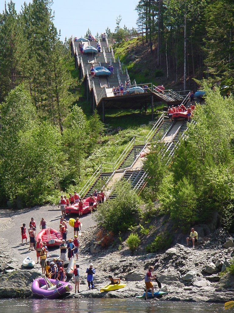
1. WebbÂs Dead River Campground & Shuttle Service: Shuttles to the Dead put in, campground with showers. To book a site at Webb's campground or shuttle call River Drivers to make the reservations. That phone number is: 207-663-4475. The cost is $8.00 per person, per night, plus 7% State tax.
2. AppletonÂs restaurant: Pizza, subs, ice cream, breakfast (207) 663-2114 .
3. River Drivers: Rafting, etc 207-663-4475.
4. Paddling shop: Dead River Outfitters
5. BerryÂs General Store: Gas, Beer, food, supplies, pizza, subs
6. The Ball field campground: Primitive campsites, porta-poties, no showers. Take out for Lower Kennebec.
7. Crab Apple Camping Rafting, hot tub, bar, food.
8. Public Picnic area: also used as Lower Kennebec take out.
9. The Marshall Hotel (Hotel Cocktails): Food, bar, horse shoes, pool table.
10. Dead River takeout.
11. Majic Falls Rafting: Raft trips, camping
12. Three Rivers Whitewater & Kelly Brook campground
13. Northern Outdoors Camping, Rafting, restaurant, hot tub, bar, entertainment
14. North Country Rivers Rafting, etc.
15. Professional River Runners: Rafting, etc.
16. New England Outdoor Center: Rafting, paddling shop, etc.
17. Indian Pond campground
Not on map:
Moxie Gore cabins: : $30 per night
Moxie Outdoor Outfitters: 866-663-2646 Large cabins $75 per night
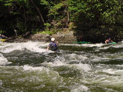
Easy big water rapids with lots of surfing opportunities. Ball Buster wave can only be surfed by long boats. Disappearing wave is a little further downstream. This wave pulses on a gradual cycle from being a great wave to just a flat spot in the river.
Big waves with some rocks and holes on river left. Best run right of center then cut across to river left just below a large hole. Catch the eddy for some surfing at the base of the rapid.
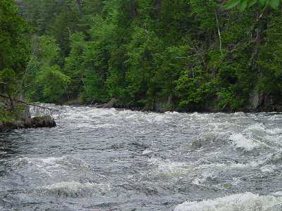
Largest waves on the Kennebec. 6-8 foot waves. Some people attempt to surf Big Momma. Best approach is from an eddy on river right just above the wave. Long eddy on river left allows you to feed back in but the wave is harder to catch from this side. At 3200cfs this turns into a large hole that can be punched on the left or threaded on the right.
Long series of waves with much turbulence. A swim here will be about 3/4 of a mile to Cathedral Eddy. This section is similar to the waves and turbulence found in the Grand Canyon.
Big turbulent rapid similar to Grand Canyon rapids. Run left for the drop into Magic hole. Left of center (The Highway) to avoid Magic and Maytag hole on river right. Caution do not run Maytag unless levels are above 8500 cfs. Magic hole becomes nasty at levels below 3400 cfs.
Jul 6, 2003
A homeland sucurity project built to keep suicidal kayakers from blowing up Harris Station.