Rio de la Plata
Dam Section(Canon de la Plata)
| Difficulty | V+ |
| Length | 5 mi |
| Avg Gradient | n/a |
| Gauge | Rio De La Plata at Comerio, Pr |
| Flow Rate as of 13 hours | 21 cfsbelow recommended |
| Reach Info Last Updated | November 15, 2005 |
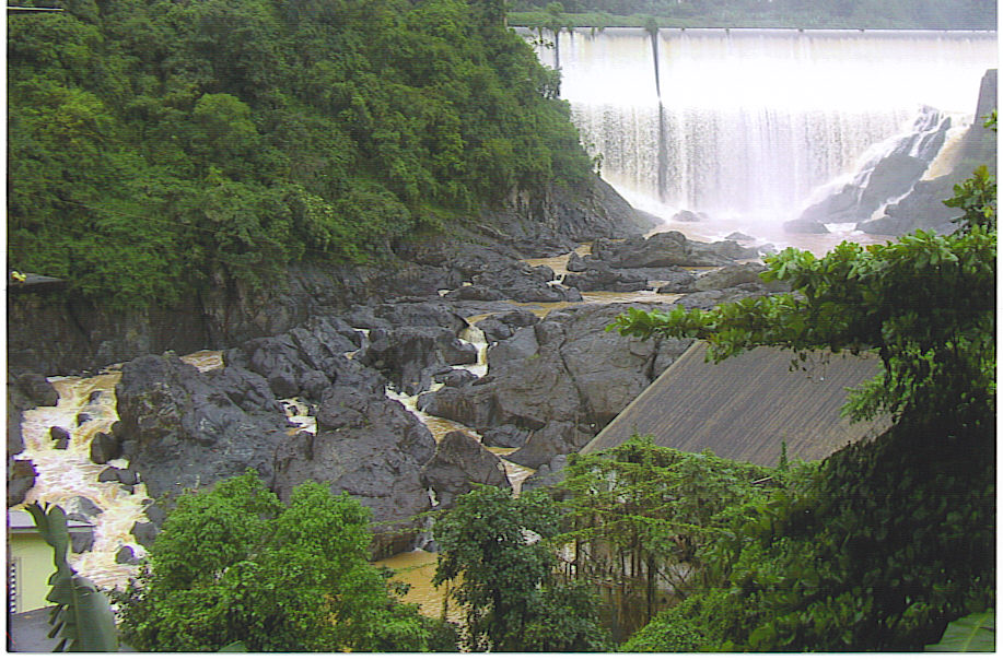
The Dams section of the Rio de la Plate is a short, steep, wild, class V run that contains two big falls, and for the island is a relatively large river. The entire run is only about five miles long and everything is easily scouted due to the road that parallels the river. The put in is just below the first dam downstream of the town of Comerio. There are several houses perched high above the river and next to the road including a small bar from which you can scout the first several rapids. Hike down the bank behind the houses and head upstream to put in under the dam. The first rapid starts with a bang. After a couple easier ones you enter the lake behind the second dam. ItÂs a short paddle to portage the dam on the left. Here the river is a wide boulder garden with several lines possible. Shortly after the dam the river starts to tighten up as you enter a canyon. With in the canyon lie the two big ones. Each falls are between thirty and forty feet high. The first falls is more vertical with the second being more of a slide with lines possible on the right or left. After the last falls the canyon starts to open up again with some easier boulder garden rapids until the river flattens out and you reach the route three bridge. If this seams a little intense you can run the class III(IV) upper section.
No river features have been added