Nickajack Creek
East-West Connector to Bankhead Highway
| Difficulty | II-III |
| Length | 5.6 mi |
| Avg Gradient | 20 fpm |
| Gauge | Nickajack Creek at Us 78/278, Near Mableton, Ga |
| Flow Rate as of 1 hour | 46 cfsbelow recommended |
| Reach Info Last Updated | February 14, 2024 |
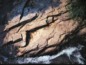
Nickajack Creek, like all fall-line streams, drops over punctuated drops and rock ledges. Unfortunately, the water quality is poor and the everpresent streamside sewer line occasionally overflows. In recent years, the increasing encroachment of metro Atlanta has paved much of the watershed. For boaters this has a remarkable benefit of producing floatable water levels immediately after big thunderstorms. Unlike Sweetwater Creek, this little stream does not crash through big formidable waterfalls, but the rapids are entertaining. There are some problematic strainers.
Oct 12, 2009
I paddled this last week. About a 1.5 mile run with two pretty good class III rapids that can be hike and hucked multiple times because the hike is only about .5 miles. The only wood that was a problem, other than that in my pants, was a log around the corner after the covered bridge. Be careful because it is around a blind corner. We didn't see it until we were about 15' from it.
May 17, 2009
I hiked from the east west connector down to about a mile past the Concord Woolen Mill ruins. The run is somewhat continuous class II with two class III rapids. One of the class III's is directly under the silver comet trail bridge and the other is around the bend downstream of the covered bridge. It's all bedrock ledges and slides. The level was 338 cfs on the gauge and it looked to be a good medium low level. There were a few riverwide strainers. Probably three or four in the two miles or so that I hiked. On the topo it looks like it flattens out past the mill. I think the thing to do is to run down to the mill and hike back up.