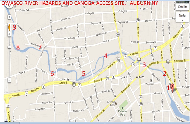
Owasco River (Outlet)
Canoga Rd to Turnpike Rd
| Difficulty | II(III) |
| Length | 3.1 mi |
| Avg Gradient | n/a |
| Gauge | Owasco Outlet at Genesee St., Auburn Ny |
| Flow Rate as of 53 minutes | 238 cfsbelow recommended |
| Reach Info Last Updated | June 7, 2016 |
The Owasco River originates at the North end of Owasco Lake. The river is initially navigable to the first dam but then flows through an industrialized section of Auburn where downstream flows are used and regulated by Auburn Hydro. The river becomes navigable again at Wadsworth Street, upstream of the suggested put-in at Canoga Road. The Turnpike Road takeout, 3 miles downstream, is also the beginning of a pleasant, 4.5 mile class 2 section through remote woodlands and valleys to the Village of Port Byron, from here, continuing downstream at class 1, the Owasco meanders to the Seneca River and a State Boat Launch site at Mosquito Point.
ACCESS:
Put in: Canoga Road bridge. Auburn does not currently provide public access to the Northern Navigable portion of the river that AW paddlers use, although they (?) support it in the Auburn Greenway Trail & Auburn Comp Plan . The property owner at the Canoga Road put-in ( all 4 corners) has been known to assert his authority by physically moving paddlers vehicles or challenging paddlers who do not contact him before accessing. Please park on the public right-of-way being sure not to block his driveways or just call his number (on little sign in front of old factory) and say you're paddling. Also there have been several citations issued to paddlers using this section because clarification of the Auburn City Code may be needed. Auburn Code 234-11-C
Take out: Turnpike Road bridge-current access is a herd path with parking on the shoulder suitable for 3-4 cars. Cayuga County possesses all 4 corners inclusive in a 400+ acre parcel acquired
...
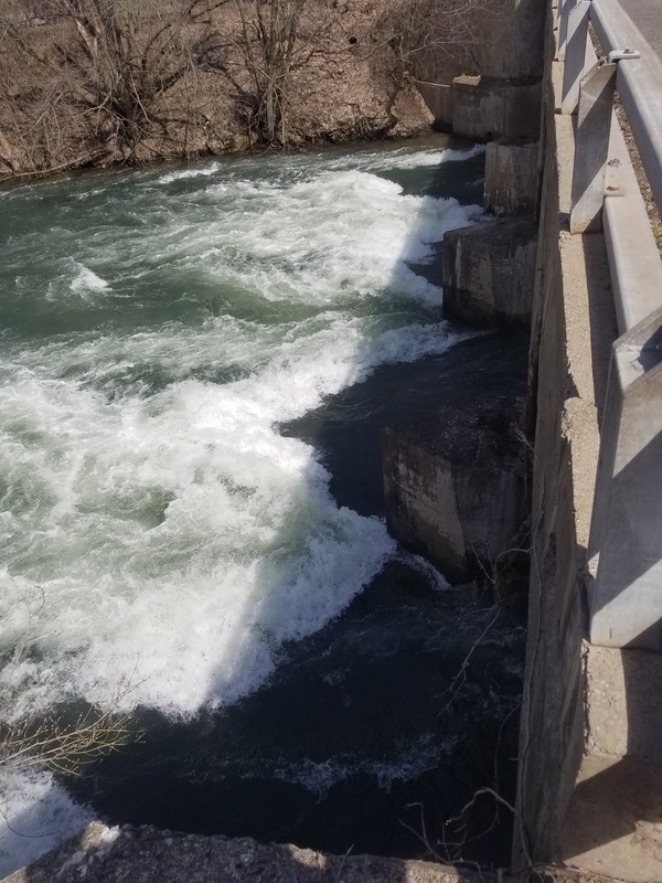
This 45 foot high dam for hydropower is not passable.
This area at Wadsworth Avenue is listed as a potential park in the Auburn comprehensive plan.
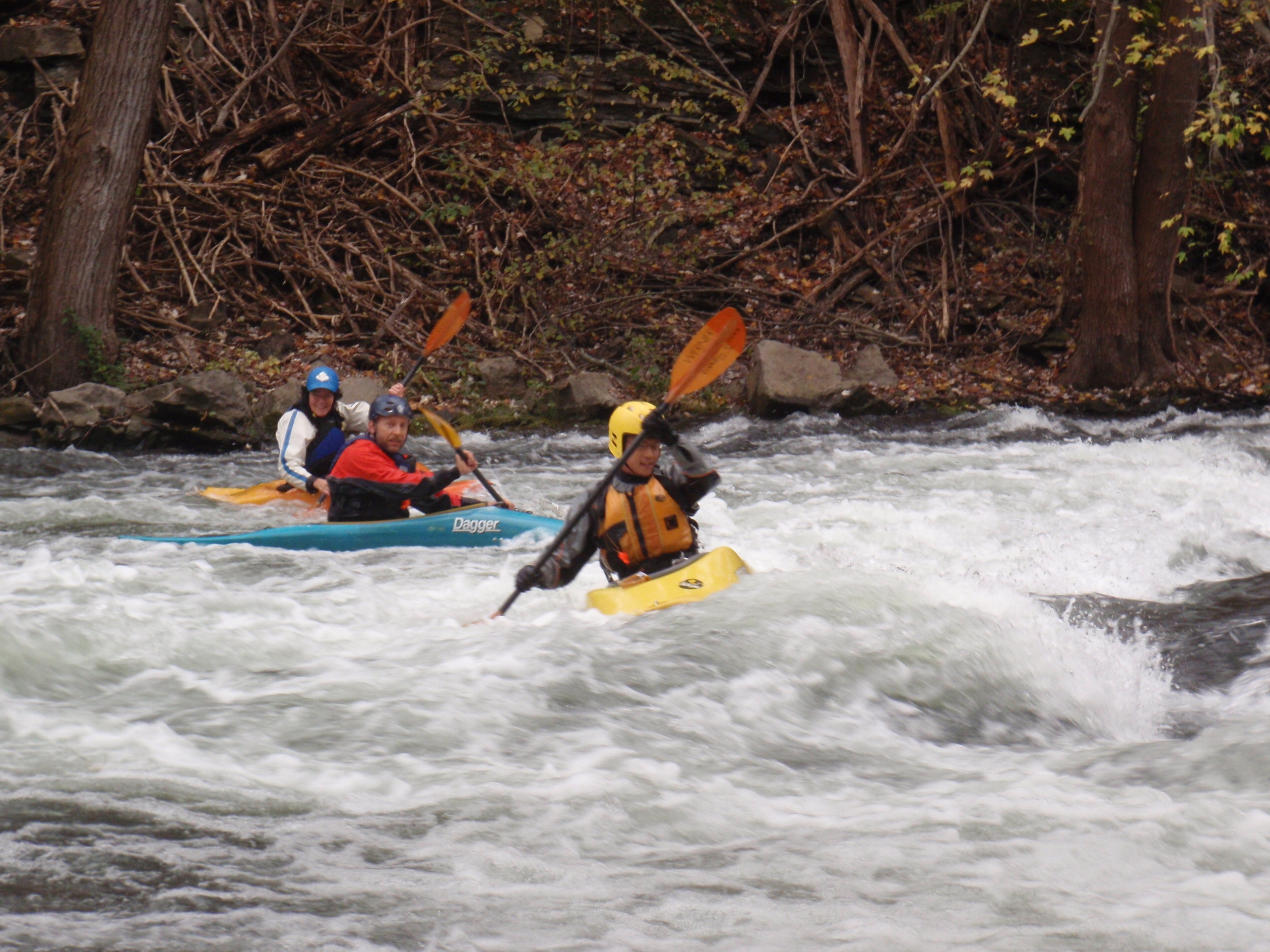
Ledge drop, just past the Canoga Rd Brige at the putin. This can be run almost anywhere, middle left is good for higher levels and beginners. There is an eddy river right past the bridge. There is also an eddy river right just below the drop and a surf wave. This can be scouted from the brige at the putin.
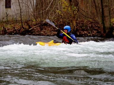
Low head dam, not retentive, paddle out, squirt out or roll out. Nice place to learn side surfing. Becomes a wave at 750-800 cfs, disappears at higher levels, becoming a ripple in the water.
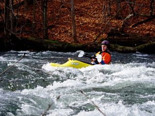
Owasco takes an almost 90 degree bend to the right. There are a series of nice surf waves, most of them have no eddy service.
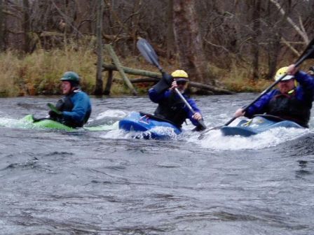
A pair of waves, 30 yards apart. The first one is river right, a 2-3 boat eddy is also river right. Second one is downstream, eddies river left and right, wide enough for 3-4 boats to surf at once. Nice place to learn to surf/front, back, hand, spins.
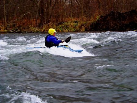
A nice surf wave/hole, reminds me of Black Hole on the Salmon River. The current is fast, it is steep, and needs to be caught on the fly. It is possible to paddle back up to at low levels, there is a micro eddy river right/center of the wave. The property owner mows the grass down to the edge of the water.
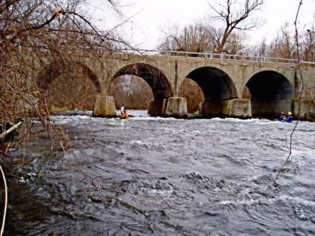
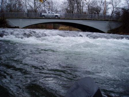
This can become full on class 3 for 50 yards before the bridge, ending with a class 3 drop just past the bridge. There are many waves and a couple of holes before the bridge at higher levels. All 4 tubes of the bridge are runnable. The far left tube sometimes has a surf wave under the bridge. There are surfable waves just past the bridge. The drop itself is past the bridge and is best run river left/center. This can be scouted from Division St to be sure all bridge tubes are clear of strainers.
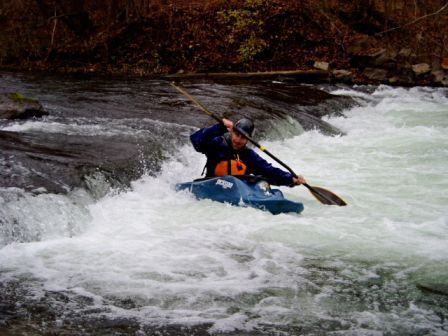
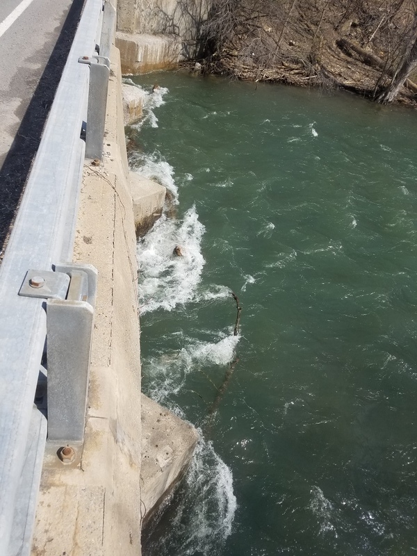
There is a low head dam just upstream of the bridge. There is a sneak route river left and the ledge can also be boofed river right. I don't recommend running the middle. It is very retentive. There is also a class 2 rapid just below the dam. The the take out is in the eddy on river left underneath the bridge.
Apr 10, 2017
Wood blocking all chutes on the other side of the bridge except for the run all the way to the left. Definitely needs a scout before running. 1250 cfs
Apr 10, 2017
A bunch of wood is making the only chute the opening all the way to the left. strainer right before the bridge on the left and big log on the left right after the bridge. Makes for a nice boogie. Just don't swim.1250cfs
Apr 10, 2017
Just a more current reminder... scouting division st bridge is a must. Just ran this run 2 days ago and all arches were blocked besides the far left. In addition there is a bad strainer on the left right before the bridge and a good sized log on the left after the bridge. Ran it at 1250 and the wood was easy to avoid but it would be a very scary situation if someone were to swim at that level at that spot. As far as the run as a whole there is a bunch of wood everywhere so beware!