Fall Creek
End of Gorge Trail to Parking Lot (0.7 miles)
| Difficulty | I-IV |
| Length | 0.7 mi |
| Avg Gradient | 21 fpm |
| Gauge | Bear Creek at Hannibal, Mo |
| Flow Rate as of 1 hour | 2 cfsbelow recommended |
| Reach Info Last Updated | April 2, 2019 |
This is a great creek (for this area) with a lot of potential. We have yet to catch it at high flow, but judging from the smooth bedrock bottom and drops, combined with various rock outcroppings and vertical (mini-)canyon walls, this should be an awesome run when the water comes up. At low flow it's mostly just sliding over rocks and can't really be run unless a significant rain event or snow melt occurs. Dropping over the biggest fall at the put in makes for a good time even when it's dry (if you don't mind the hike up just to grunge down that drop).
The section outlined here is publicly accessible by car only at the takeout. The entire length of this section is owned and maintained by the IL-DNR as part of the Fall Creek Rest Area just off of state HWY.57. If arriving by Interstate 172, take the Marblehead exit, turn right (south) onto Hwy.57, then immediately left onto Payson Rd which is the first blacktop road on your left. (If you cross a bridge on Hwy.57 you've passed over Fall Creek and gone too far.) Once you turn left (east) onto Payson Rd, you'll travel a short distance before seeing the entrance to Fall Creek Rest Area on your right. Enter and park at the parking lot.
Good news! There are restroom facilities here! However, the park has limited hours and there is no camping.
*NOTE: THERE IS VIDEO SURVEILLANCE HERE!!! We've not had any run-ins about boating here and we hope we never do. They've got a sign specifically prohibiting climbing or rappelling here (which is too bad because it would be a great place to go). We don't want to have a sign put up banning boating also, so mind your P's and Q's please! We don't have many public places like this around here, so we'd like to keep in the DNR's good graces.
Once parked and unloaded, head up a foot path that runs along the river-left bank of the creek. You will reach a wooden overlook from which you can see the last little drop and the opening to Fall Creek
...
Drainage area at our listed put-in is approximately 5.3 sq.mi. (as calculated via USGS StreamStats Beta software). As stated in the main description, this is a very small creek, which will take major snowmelt or heavy rains to bring this small a watershed to boatable flows. And, it means that flows will run out fairly quickly. (The 'window of opportunity' may be as little as an hour or two after a rain.)
The nearest gauge (on a relatively similar size creek) is in Missouri, only 10 miles to the southwest. Bear Creek has 31 square miles drainage at its gauge. Thus flow here (on Fall Creek) could be about 1/6th the reported flow from that gauge. Correlations are not assured, but it should give a decent indication of likelihood of boatable flows here. If you check out this run (or actually boat it), please post a trip report, stating reported flow (from Bear Creek gauge), and your impressions of Fall Creek (too low, low-boatable, medium-boatable, high-boatable, or scary high).
Oct 19, 2004
This was during the first KNOWN decent of Fall Creek in Adams County Illinois. If anyone knows otherwise please let me know. This was at low water, but still fun. More pics as they develop.
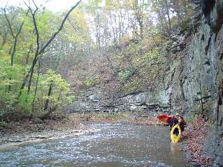
Hangin out in the low water below the #2 drop. Taken on the First KNOWN decent, let us know if somone has run it before.
Jan 1, 1900
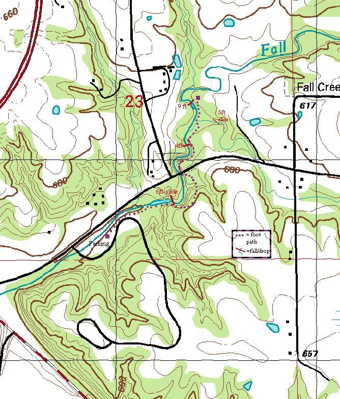
Purple dots are the trail, Red lines are the falls with the height of the falls/slides in red next to them.
Here is the area with major hws noted.
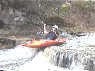
Not much water this day, but launching off the rock was still fun.
Goin under!
Under! if you look close.. you can acctually see the yellow of mark's eskimo showing through the water's surface just before corey comes up!
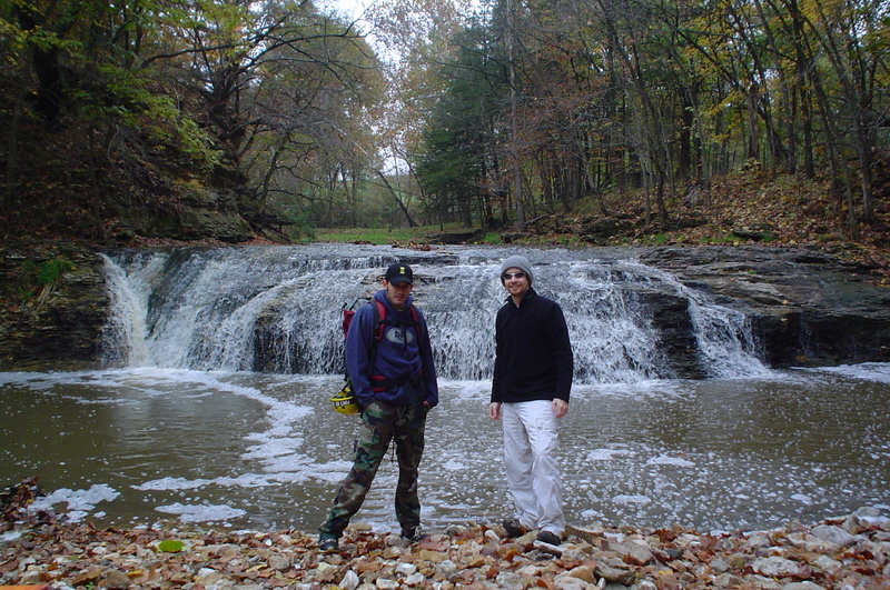
low water hike into the gorge to play on the rocks