Alameda Creek
Sunol to Niles Junction near Fremont(Niles Canyon)

| Difficulty | III |
| Length | 5 mi |
| Avg Gradient | 21 fpm |
| Gauge | Alameda C Nr Niles Ca |
| Flow Rate as of 47 minutes | 24 cfsbelow recommended |
| Reach Info Last Updated | November 6, 2023 |
A little backyard run for the Bay Area dweller. Perfect beginner run or enough to satiate those more experienced river folk who only have half a day and no patience to drive. Alameda Creek is a short but swift Class II/I trip that'll take about an hour and a half with a short lunch break.
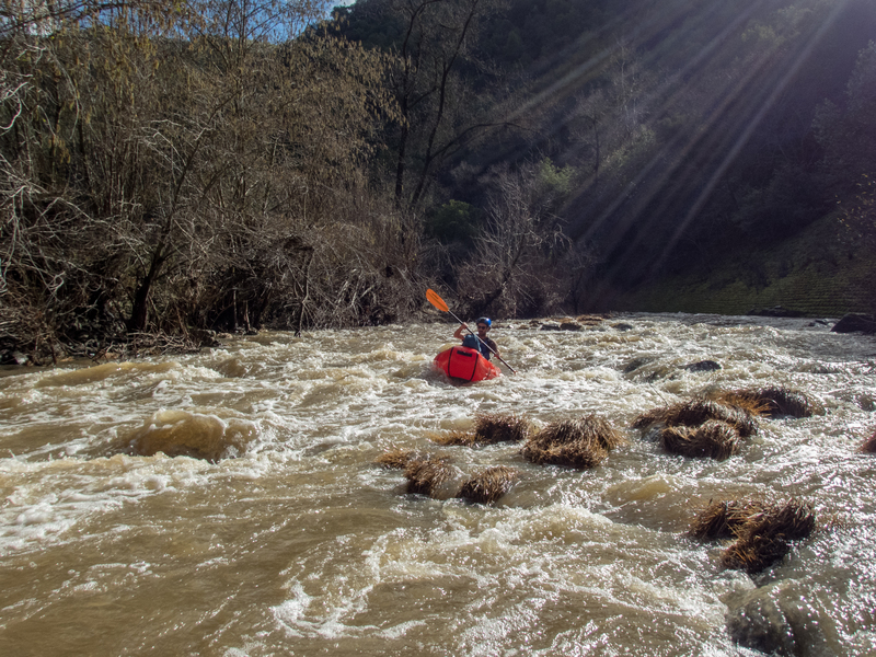
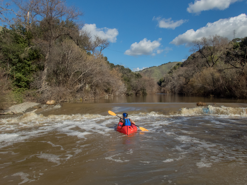
Running it around 474cfs a day after some rain made for several fun and narrow wave trains and only two limbo-under-branch situations. The two or three diversion dams were easy spillovers with no real suction danger at this level, in our opinion. The first makes for a fun little Class II shoot under the 84 bridge, though the second one sneaks up on you a bit. However it should be noted these dams have created scary swims for people in the past, so be aware.
Water was brisk and predictably muddy, but not smelly, as the somewhat urban environs would have you believe. Despite its proximity to the sprawl of SF/Oakland, the river offered up some nice views of the hills, with mallards, great blue herons, common and red-breasted mergansers, and a kingfisher. Poison oak was common along the banks, but it seemed easy to eddy out or find respite on the shore between patches, if need be.
We also put in maybe 0.5-1.0 mile downstream of the put in listed here, since since it looked a bit too brushy and parking/access looked questionable. We parked on the westbound side of 84/Niles Canyon Road where several cars were parked (graffiti artists, from what I could tell, since no one else was on the river) and quickly found a reasonable but not ideal spot to launch. Take out was super easy at Nile Staging Area. Shuttling with two cars is easy, taking a Lyft/Uber would also be quick and cheap. Apparently hitching/biking on this section of road isn't the safest though. Best self shuttle option is to walk up the trails from the Niles Staging Area and put-in wherever.
Paddlers can do periodic brush snipping to make passage easier.
Put-in: Finding a legal
...
This bridge signals that a low head dam is a quarter mile downstream.
Jan 22, 2019
Dup in the runout from the first diversion dam, under the second railroad bridge.